|
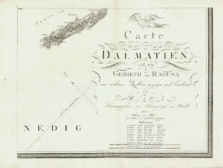
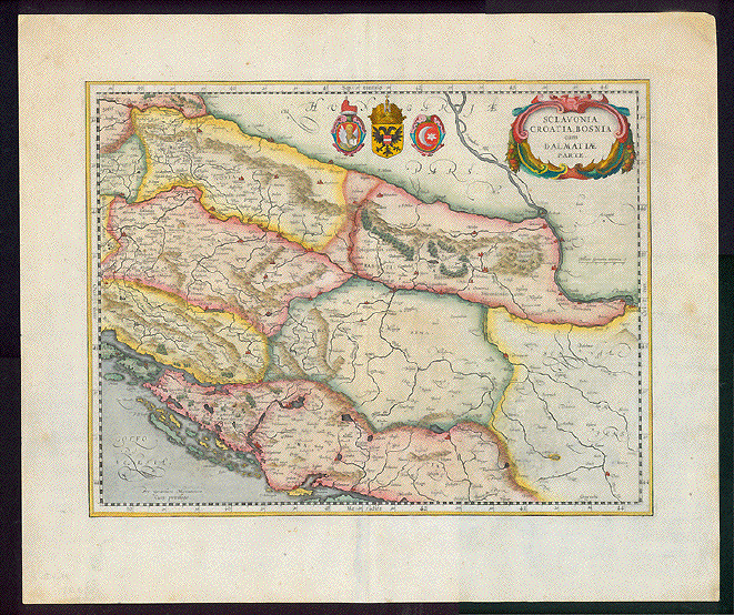
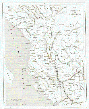
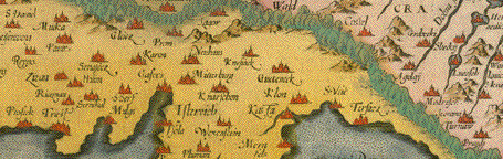
"Carte von Dalmatien und dem
Gebieth von Ragusa aus ächten Quellen gezogen und
bearbeitet von �"
Herausgegeben von Joseph
Schrevogel und Joseph Riedl 1810 Wien und Pest"
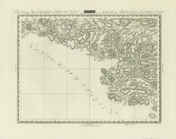
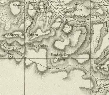
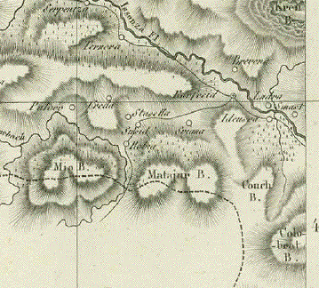
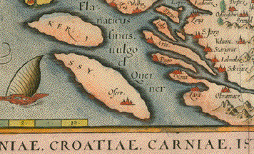
This oversize wall map measures
(when the eight individual sheets are assembled) 85,5 x 225
cm (ca. 33.7 x 88.6")
Map is surrounded by an
ornamental bordure.
Fragment:
To pour, right away, water into
the wine: We have only six of the eight sheets.
Sheets Nr. 3 and Nr. 7 are
missing. We have waited while trying several years hoping to
complete the map. But we were unsuccessful. We are sure that
there must be colleagues or private persons who happen to
have just these missing links, who would be willing to offer
us sheets 3 and 7.
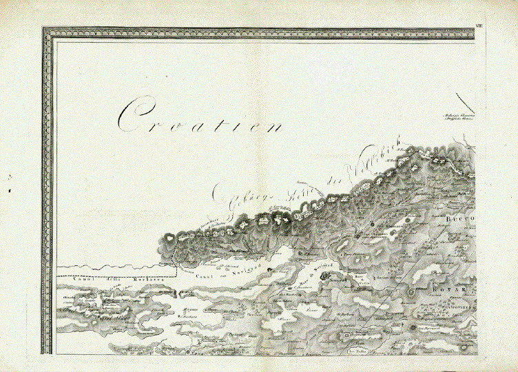
The numbering of sheets are
peculiar on this map: Normally sheet 1 to 4 would form the
upper row from left to right and sheets 5 to 8 would be
placed in the lower row.
Here sheet 1 is placed in the
lower right with title and print details. Above sheet 1 is
sheet 2. Sheet 3 (here missing), is in the lower row next to
sheet 1. Above it is sheet 4. Then sheet 5, and above it
sheet 6. Then sheet 7 (here missing), and above it in the
upper left corner sheet 8. All sheets bear Roman numbers.
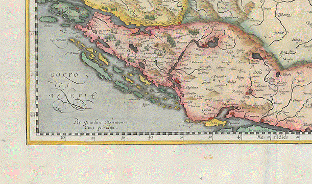
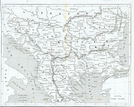
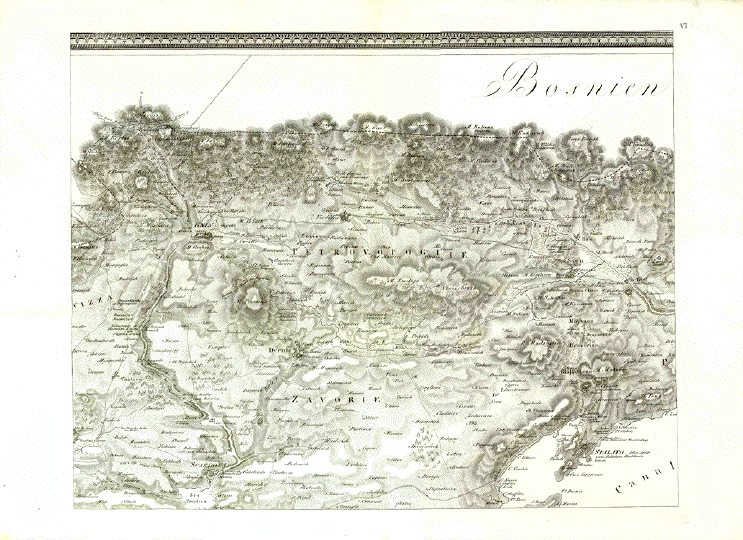
The map was cartographed, and
the geographical names of places, islands, mountains, etc.
this entire part of Dalmatia was part of the Habsburg
Empire. The Italians were heirs to the long lasting Venetian
rule in the area. The elites in Dalmatia spoke Italian and
felt Italian, although the Italian population amounted to
less than 3%. All this explains why this map was created in
Vienna and why the place names on it are in the Italian and
in the German languages.
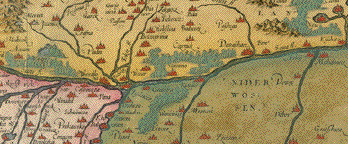
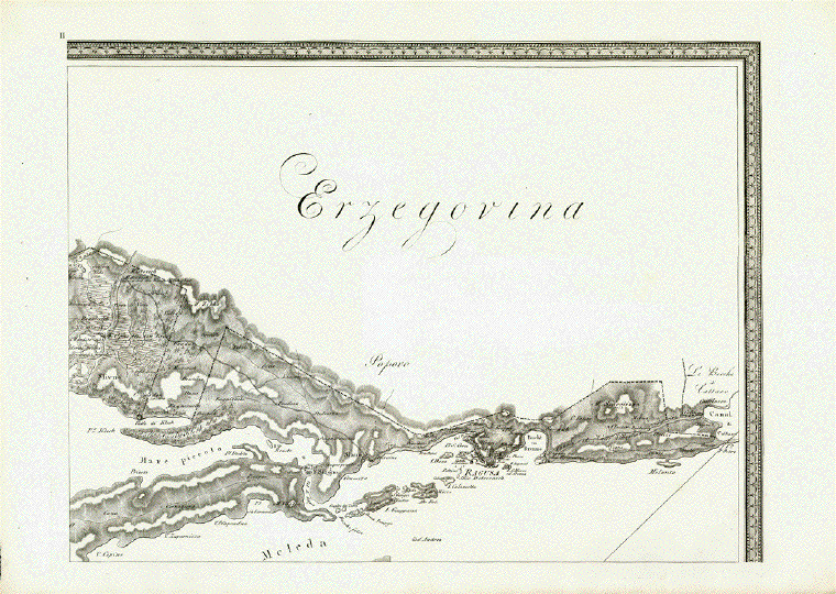
There is another specialty with
regard to this map: It shows the boundaries of the "Stato di
Ragusa" or the Republic of Ragusa (Dubrovnik). When this map
was published in 1810 the Republic of Ragusa had actually
vanished from existence. It actually ended officially in
1808, when Napoleon and his troops dissolved the city state
- after more than 500 years from 1358-1808! Ragusa
(Dubrovnik) was a Mediterranean Trade Capital, proud,
successful and wealthy, flourished especially in the 15th
and 16th centuries.
There are only few maps and
hardly any as pricise and well cartographed of the Republic
of Ragusa as this one.
All maps have a vertical
centerfold with very light toning along centerfold.
The outer edges of the maps have a natural uneveness of
handmade paper.
Some spotting and smudges in the margins. Heavy
paper.
Measurement of the entire map
(including the missing sheets):
85,5 x 225 cm (ca. 33.7 x
88.5")
The individual sheets measure
(margins not included): Ca. 43 x 55 cm (ca. 16.9 x
21.6")
Price for the six maps $
1800.00
Order Nr. CROATIA254091
RESERVED
|