twitter.com/philographikon2
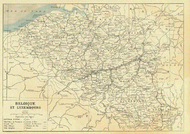
"Belgique et Luxembourg"
Detailed wood engraving map ca 1890. In the lower left is a map key
with the symbols for towns and villages as well as railroads and roads.
On the reverse side is unrelated print.Map image: 18 x 25 cm (7x 9.8")
$ 75.00
Order Nr. BELGIUM255216
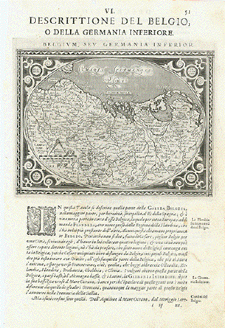
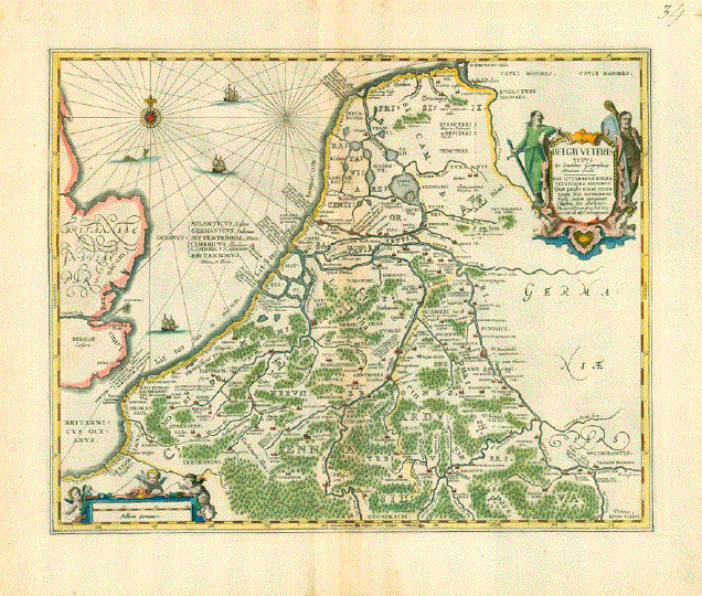
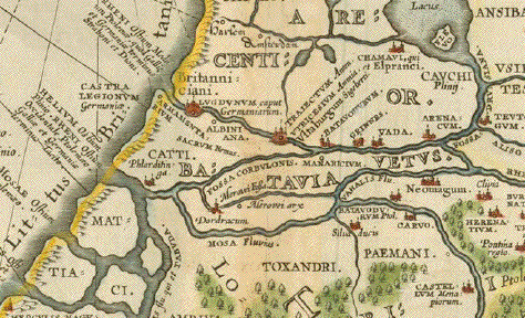
ăDescrittione del Belgio o della Germania Inferiore"
The Netherlands, Belgium, Luxembourg and parts of NW Germany in the shape of an egg.
Type of print: Copper etching
Artist: Girolamo Porro
Published in: ăGeografia cioe Descrittione Universale della Terra"
Publisher: Gio. Battista & Giorgio Galignani Fratelli
Edition: Italian edition
Editor: Giovanni Antonio Magini (1555-1617)
Text: Italian. Complete on front and reverse side
Published in: Venice
Date: 1598
Measurements:
Map size: Ca. 12,5 x 17 cm (ca. 4.9 x 6.7")
Page size: Ca. 28,5 x 19 cm (ca. 11.2 x 7.5")
Condition: Near perfect. Very minor traces of age.
Price: $ 280.00
Order Nr. BELGIUM238494
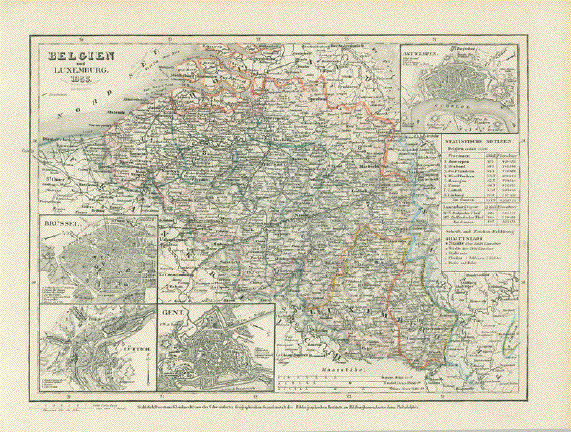
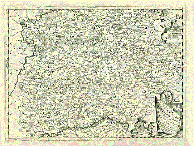
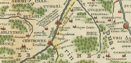
"Belgium und Luxemburg 1855"
Steel engraving map published by the Bibliographischen Instituts zu Hildburghausen, 1855.
In the lower left are details of Brussels,Luettichand Gent. In the upper left is a detailed plan
of Antwerp and the surrounding area. In the lower right is Luxemburg.
Original hand outline coloring.Hardly visiible vertical centerfold. Minor signs of age and use in margins.
Image: 18.5 x 24.5 cm ( 7.2x9.6")
$ 90.00
Order Nr. BELGIUM 254506
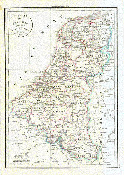
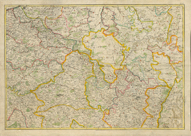
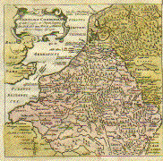
"Royaume des Pays - Bas Divise en ses 18 Provinces"
Copper engraving by F. Delamarche. Published 1832. Original hand outline coloring.
Horizontal centerfold. Spot in upper left corner - otherwise clean and in good condition.
41 x 29 cm ( 16.1 x 11.4 ")
$ 85.00
Order Nr. HOLLANDMAP242651