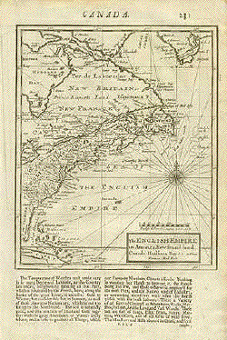
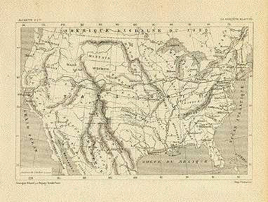
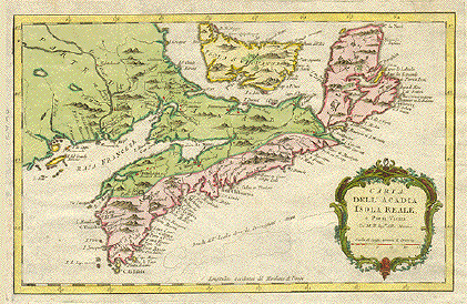
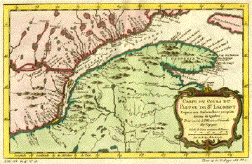
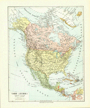
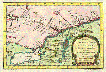
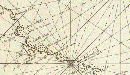
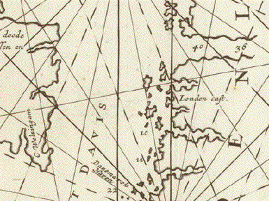
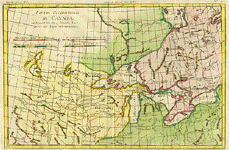
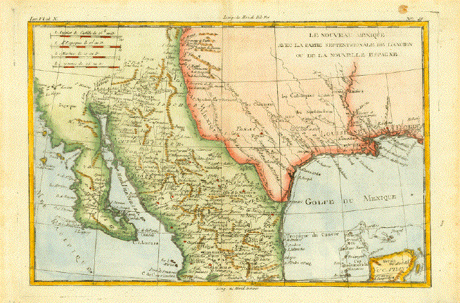
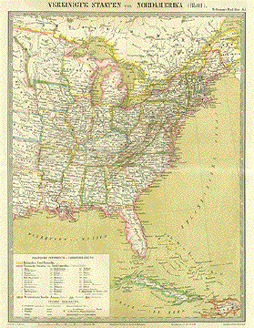
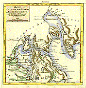
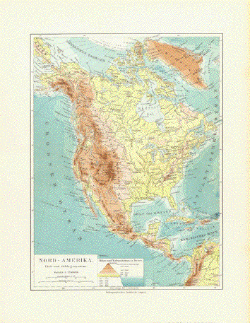
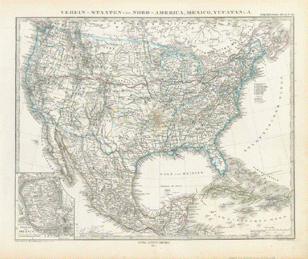
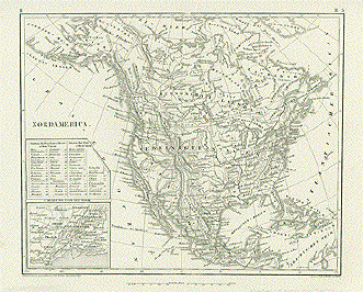
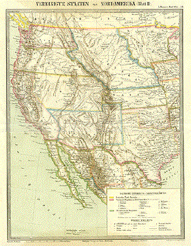
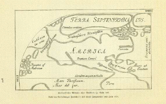
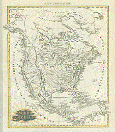
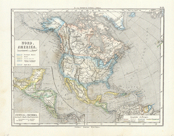
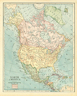
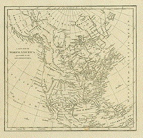
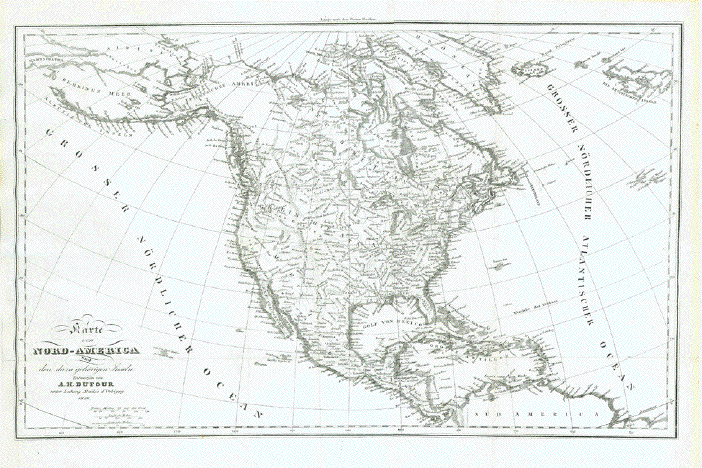
Antique Maps of North America

A selection of historical maps of North America that is sure to please you. Each map is illustrated and carefully described. Please contact us if you are looking for special maps.

Maps of Hawaii and the Pacific Islands

Ordering and Payment

"Nordamerica" Steel engraving by J.L. von Baehr in Halle after Ph. Weber in Carlsruhe, ca 1850.

Interesting map that shows where the various Indian tribes live as well as topographical details. In the lower left corner is a detailed plan of New York City and surrounding area.

Clean map in good condition.

21 x 25.5 cm ( 8.2 x 10 ")

$ 75.00

Order Nr. NORTHAMERICA2098


"Montreal And Its Environs". Wood engraving printed in color in New York ca 1880.

Detailed map of Montreal and surrounding area.

Vertical centerfold. Three small repaired tears on margin edges.

20 x 27.7 cm ( 7.8 x 10.9 " )

$ 60.00

Order Nr. NORTHAMERICA2096


Map of the Coast
from Charleston to Savannah,

Wood engraving by Rae Smith after J. Wells.
Printed in color. Dated 1866.

Map shows details of the Carolina Coast.
Lower inset shows details of the area from Charleston
to Savannah. Upper inset shows Albemarle, Roanoke
and Palmic Sounds.

One light spot in upper right area.
Minor spotting in margins.

23.6 x 17 cm (9.2 x 6.6 ")

$ 65.00

Order Nr. NORTHAMERICA2094


"Die Staaten N & S Carolina Georgia & Florida 1850". Steel etching from "Neuster Zeitungs Atlas. Alter und Neuer Erdkunde" by J. Meyer, ca 1855. Original outline coloring.

Map shows the Atlantic Coast as far north as Norfolk, Virgina and the Gulf of Mexico as far west as Pensacola, Florida. In the lower left corner is an inset of Anastasia Island with St. Augustine. On the right side are insets of the Gold region of the Carolinas. In the center the inset shows Newberne and surrounding area. The lower inset is Charleston and surrounding area.

The map is very clean with only a few very trivial spots in margins.

25.2 x 18.8 cm ( 9.9 x 7.4 ")

$ 90.00

Order Nr. NORTHAMERICA 2074


"Vereinigte Staaten von Nordamerika". Lithograph von E. Serth after Tr. Bromme for "Tr. Bromme's Hand Atlas", 1862. Original hand coloring.

Map shows the western part of the USA with major towns and cities as well as railroad lines and canals of the time. Notice that much of the West was still divided into territories.

Map has a horizontal fold. Light brown stain in upper and lower margins reaching slightly into map image. Condition is Better than Good.

37.5 x 28.5 cm (14.7 x 11.2 ")

$ 130.00

Order Nr. NORTHAMERICA2051 RESERVED M


"États-Unis par Th. Duvotenay". Steel engraving by Ch. Smith, published in Paris by Maison Basset ca 1850. Modern hand coloring.

A decorative map of the United States and southern Canada showing the various early territories and states of the USA.

Lower right corner has a bend. Otherwise the condition is Very Good.

22.4 x 30.6 cm ( 8.8 x 12 ")

$ 340.00

Order Nr. NORTHAMERICA2033


“Britisches Nordamerika". Canada. Steel engraving with original outline coloring. From “Zeitungs-Atlas fuer alte und neue Erdkunde". Published by J. Meyer. Hildburghausen, Amsterdam and New York. 1849. After a drawing by the Hudsons Bay-Company (Parry, Franklion, Beechey, Graab, J. Ross& Back. Commander of the expedition: Captain Radefeld.

Map shows all of Canada, Greenland and the northern belt of the United States of America. Most of Alaska is seen. Interesting: South of Oregon the map states “mexico".

Generral age toning. Some traces of use, especially on margin edges.

21 x 26 cm (8.3 x 10.2")

$ 150.00

Order Nr. NORTHAMERICA2091


"Neuste Karte von Lower Canada (Unter Canada) Nach d. besten Quellen entworfen und gezeichnet." Steel engraving for "Meyer´s Handatlas" published by the Bibliographischen Instituts of Hildburghausen, 1844. Original hand outline coloring.

Detailed map with the St. Lawrence River flowing diagonally across the map. In the lower right is a detailed inset of Nova Scotia and New Brunswick with umbered key to the important towns. In the upper middle is Lake John.

Map has a few minor creases and light browning on margin edges.

30 x 37 cm ( 11.8 x 14.5 ")

$ 190.00

Order Nr. MORTHAMERICA2093


“Grossbritannien's saemmtliche Besitzungen mit Angabe ihrer Erwerbungszeit". Great Britain with all of its possessions with indication of the year of acquisition. Anonymous steel etching. 1846. Faint borderline coloring.

Insets: North America up to 1783. India ca. 1760.

Clean. Light crease in lower left margin corner.

Page size: 37 x 43.8 cm (14.6 x 17.2").

$ 180.00

Order Nr. BRITISHISLES1150


"Die Pacific Bahnen Nordamerika's." Wood engraving from A. Harlebens Verlag, ca 1880. Printed in color.

Map shows the early rail routes with the names of the rail companies on each route.

Map has folds to fit book size. A few light spots in margins. Small crease in lower map.

21.2 x 28.8 cm ( 8.3 x 11.3 ")

$ 45.00

Order Nr. NORTHAMERICA2092


"Campaigns of 1775-1776"

Wood engraving ca 1885.
Backside is printed.

14 x 9 cm ( 5.5 x 3.5 ")

$ 45.00

Order Nr. NORTHAMERICA2063


"Carte des États-Unis d'Amerique indiquant les États à esclaves et les États qui veulent séparar de l'Union"

Wood engraving from "Le Monde Illustré" ca 1880. Backside is printed.

11.7 x 22 cm ( 4.6 x 8.6 ")

$ 50.00

Order Nr. NORTHAMERICA2065


"Hawaian Islands" Wood engraving ca 1860.

Detailed map of the Hawaian Islans with major settlements shown. In the lower left is an inset with kauai, Lehua, Nihau and Kaula.

On the backside is a map of China.

10.2 x 18.3 cm ( 4 x 7.2 ")

$ 55.00

Order Nr. NORTHAMERICA2090


Niagra Falls" Wood engraving printed in color in New York ca 1880.

Very detailed plan of the area surrounding Niagra Falls.

Map has vertical centerfold and light age toning in margins.

20.5 x 28.3 cm ( 8 x 11.1 ")

$ 60.00

Order Nr. NORTHAMERICA2097


"Quebec And Its Environs" Wood engraving printed in color in New York ca 1880.

Very detailed area map of Quebec showing some of the many islands in the St. Lawsrence River.

Map has vertical centerfold. Two small repaired tears on lower margin edge.

18.5 x 27.7 cm ( 7.2 x 10.8 ")

$ 60.00

Order Nr. NORTHAMERICA2095


"Nord Amerika" copper engraving ca 1780. A bit of original hand coloring.

Map shows many topographical details, especially mountain ranges and rivers.

Left margin has been widened because part of Alaska reaches over yellow borderline. Bottom margin has been widened. Map has a vertical and horizontal fold to fit book size.

26.2 x 21.2 cm ( 10.3 x 8.3 ")

$120.00

Order Nr. NORTHAMERICA2084


"Carte politique de l'Amerique septentrionale." Copper engraving ca 1750.

Interesting historical politcal map of North america showing the political divisions of the time.

Map has vertical centerfold. Light browning at bottom of map on fold line. A few small scattered spots.

19.3 x 23 cm ( 7.5 x 9 ")

$ 95.00

Order Nr. NORTHAMERICA2085


"North West America" Wood engraving printed in color ca 1870.

Interesting map of the west coast of North America reaching as far south as Salt Lake City in the lower left and Sioux City in the lower right.

Horizontal centerfold. Narrow upper and lower margins.

32.7 x 23.8 cm ( 12.8 x 9.4 ")

$ 90.00

Order Nr. NORTHAMERICA2089


"Vereinigte Staaten von Nord-Amerika und Mexico." Steel engraving ca 1880. Original hand outline coloring.

Map has vertical centerfold and a few scattered spots.

20.3 x 26 cm ( 7.9 x 10.2 ")

$ 50.00

Order Nr. NORTHAMERICA2088


"Carte de la Californie det des Pays Nord-Ouest separés de L'Asie par le Détroit d'Anian". Copper etching by Robert de Vaugondy , dated 1772.

Map shows the Pacific coastline from Escondido, California in the north to The southern tip of Baja California. The inset at the top is a smaller version reaching to the North Pole and showing more of the inland of the continent.

Map has folds to fit book size. Tiny repaired tear on bottom margin edge. Very light stain in upper part of map. Overall condition is Better than just Good.

29.2 x 36.2 cm ( 11.4 x 14.2 ")

$ 580.00

Order Nr. NORTHAMERICA2055


Arkansas, Mississippi, Loisiana and Alabama

"Die Staaten von Arkansas, Mississippi, Louisiana & Alabama 1850". Steel engraving from the Bibliographischen Institut in Hildburghausen, ca 1855. Original hand outline coloring.

Map shows the states of Arkansas, Louisiana, Mississippi and Alabama. The circular inset is of New Orleans and the surrounding area.

The map has some light, scattered spotting. There is minor smudging in margins. Overall condition is Better than Good.

19.8 x 26.7 cm ( 7.7 x 10.5 ")

$ 80.00

Order Nr. NORTHAMERICA2026


"Carte De L'Ille De Vancouver Du Groupe San Juan et de la côte adjacente"

Wood engraving from "Le Monde Illustré" ca 1880.
Backside is printed. Includes text about Vancouver Island.

Map reaches south into the Washington Territory to Nisqually (location of Seattle).
In the upper left is the Queen Charlotte Straits and Fitzhugh Bay.The Strait of Juan de Fuca
and the Islands of Pugent Sound are shown in detail.

Print has a few hardly noticeable spots. Light age toning. Narrow lower margin.

21.6 x 22 cm ( 8.5 x 8.6 ")

$ 130.00

Order Nr. NORTHAMERICA2066


Canada

The English Empire in America,
Newfound-land. Canada. Hudsons Bay

Copper etching by Hermann Moll (1678 - 1732)
Published ca 1710.

Map shows Canada as far north as Davis Strait,
Mill Island, and Nottingham Island in Hudsons Bay.
In the lower left is Cuba and surrounding islands.

Text below map image and on backside is in
English. Map image is clean and strong. Light
browning and fraying of margin edges. Overall
light age toning. General condition is Good.

Map image: 21.3 x 17.7 cm ( 8.3 x 6.9 ")
Page size:31.5 x 20.5 cm ( 12.4 x 8 ")

$ 330.00

Order Nr. NORTHAMERICA2041


"Die Staaten von Missouri Illinois, Indiana, Ohio Kentucky & Tennesee 1849" Steel etching by Joh. David after Arrowsmith, Brué and Lapie from "Neuster Zeitungs Atlas. Alter und Neuer Erdkunde" by J. Meyer, ca 1855. Original outline coloring.

The states of Illinois and Indiana are in the center of this map. The circle inset on the left shows Cinncinnati and surrounding area. In the lower left is an inset showing Nashville and surrounding towns. The inset in the lower right is a detail of the area Lexington, Kentucky, Georget and Franket.

Map has reinforced horizontal folds. Up and lower margin edge have been reinforced. Some scattered spotting and age-toning.

26.5 x 19.7 cm ( 10.4 x 7.7 ")

$ 90.00

Order Nr. NORTHAMERICA2062


"Plan de l'Entree de Nootka". Copper engraving by Bernard for Captain Cook's travel report, 1785. This map is from the first French edition.

Map shows in careful topographical detail the entrance to Nootka Sound on the coast of British Columbia.

A horizontal and a vertical fold to fit original book size. Repaired tear in left margin reaching ca 2.5 cm into map. Visible on scan.

26.8 x 21 cm ( 10.5 x 8.2 ")

$ 140.00

Order Nr. NORTHAMERICA2079


"Plan du Harvre de Samganoodha dans l'Isle de Oonalaska". Copper engraving by Bernard for Captain Cook's travel report, 1785. This map is from the first French edition.

This print shows the island's harbor in great topographical detail.

19.2 x 16.8 cm ( 7.5 x 6.6 ")

$ 140.00

Order Nr. NORTHAMERICA2080


"Carte de la Riviere De Cook, dans la partie N.O.de L'Amerique". Copper engraving by Bernard for Captain Cook's travel report, 1785. This map is from the first French edition.

This map was drawn on Cook's third voyage in 1776-1780. Dotted lines show the route taken by Cook's ships along the Alaskan coast and then in to Prince William Sound whose entrance is on the right side of the map. The map is topographically very detailed. On the left side is the Bayde de la fumee and Cape de la Pentecote.

Map has vertical fold to fit book size. Very minimal spotting.

23.3 x 30.1 cm ( 9.1 x 11.8 ")

$ 290.00

Order Nr. NORTHAMERICA2076


"Vues des Terres de la Côte Occidentale de L'Amerique, à L'Ouest de a Riviere de Cook". Copper engraving by Bernard for Captain Cook's travel report, 1785. This print is from the first French edition.

This print shows the landmarks along Cook's River. some of the landmarks are: Cap à Pic Mountain, Isle de la Colline, Tete Halibut, Detroit de Schumagin and Pointe de Tours.

Print has two vertical folds to fit original book size. Light creasing on right side of image. Minor scattered spotting.

23 x 46 cm ( 9 x 18.1 ")

$ 135.00

Order Nr. NORTHAMERICA2078


"Vues de la Côte Occidentale d'Amerique" Copper engraving by Bernard for Captain Cook's travel report, 1785. This print is from the first French edition.

This print shows some of the prominent landmarks along the Northwest Coast of North America. Some of the landmarks shown are: Mount Edgecoumbe. Isle de Kaye, Mount St. Elie and the entrance to Prince William Sound.

Print has 3 vertical folds to fit original book size. . Very light creasinbg on two left folds. A few very minimal spots.

23.5 x 43.5 cm ( 9.2 x 17.1 ")

$ 150.00

Order Nr. NORTHAMERICA2077


"Descrittione del potentissimo imperio della Tartaria". Copper etching from Giovanni Magini (1555-1617). Printed in Venice 1598 in Ptolemy's "Geographia". Modern hand coloring.

A pretty little map of Northeast Asia, Siberia,China, Japan, Northwest America with California vaguely defined and an amazing anticipation of the western American coastline. The map reaches north to the Polar Circle and is adorned with two decorative cartouches and a Tartarian tent. This map might be of special interest to West-Coast Americans, since it shows - however vaguely - the western shores of America in the 16th century. Text in Italian describing Tartaria.

Map image is clean. Scattered light spotting in margins. Fingering in lower right margin. Overall condition is Almost Very good.

Image size: 12.5 x 17.2 cm ( 4.9 x 6.8 ")
Page size: 27.7 x 20.3 cm ( 10.9 x 8 ")

$ 580.00

Order Nr. ASIATARTARIA1737


"Isthmus of Chignecto". Wood engraving from "The Earth and its Inhabitants, Vol. 1, British North America." published in 1890.

In the lower left are the Bay of Chignecto and Bay of Shepody. In the upper left is Green Bay with Port Elgin. In the lower right is the town of Oxford and the Black River.

Map has print on backside.

8.2 x 11 cm ( 3.2 x 4.3 ")

$ 45.00

Order Nr. NORTHAMERICA2071


"Lake of Brador" Wood engraving from "The Earth and its Inhabitants, Vol. 1, British North America." published in 1890.

At the top center of the map is Boulard Island. At the bottom left is part of Madame Island and Port des Habitants. On the right side is the Bay of Gabarus. Whycocomagh is on the left side. At the bottom of the map are shading indicators for the elevations shown.

Backside of map is printed.

9.5 x 9.7 cm ( 3.7 x 3.8 ")

$ 45.00

Order Nr. NORTHAM2069


"Mines Basin and Land of the Acadians". Wood engraving from "The Earth and its Inhabitants, Vol. 1, British North America." published in 1890.

At the top of the map is Mount Cobequid. In the upper left is Mines Channel. Mahone-by is at the bottom center. Windsor is in the center near the Kennetcook River.

Backside of map is printed.

8.7 x 10.7 cm ( 3.4 x 4.2 ")

$ 45.00

Order Nr. NORTHAMERICA 2072


"Shippegan Peninsula and Island". Wood engraving from "The Earth and its Inhabitants, Vol. 1, British North America." published in 1890.

At the top of the map is Miscou island with Point Wilson. In the lower left is Tracadie.

Backside is printed.

9.9 x 10.7 cm ( 3.9 x 4.2 ")

$ 45.00

Order Nr. NORTHAMERICA 2070


"Thousand Islands". Wood engraving from "The Earth and its Inhabitants, Vol. 1, British North America." published in 1890.

In the upper left corner is Loughbore Lake and in the lower left; Wolf Island between Cape Vincent and Kingston.

Backside is printed.

8.9 x 10.8 cm ( 3.5 x 4.2 ")

$ 45.00

Order Nr. NORTHAMERICA 2068


"Lake St. Peter". Wood engraving from "The Earth and its Inhabitants, Vol. 1, British North America." published in 1890.

Lake St. Peter is easily seen in the center of the map. In the upper right is Trois Rivieres and Doucet. In the lower left is Sorel and Berthier.

Backside is printed with a map showing the sources of the Ottowa and Gatineau.

$ 45.00

Order Nr. NORTHAMERICA 2067


Return to Page 1 - Maps of North America

Maps of Hawaii and the Pacific Islands

Maps of the World

Maps of Mexico

Views of Mexico

Views of Puerto Rico

Views of Eastern Time Zone - USA

To order by e-mail

Methods of Payment

Terms of Sale - Lieferbedingungen

Return to Home Page

We have a large selection of old prints (town and city views) of North America.
Please contact us with your particular interest areas.