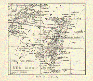
"Karte von Formosa"
Wood engraving ca 1895. Reverse
side is printed.
Overall light age toning.
12.7 x 14 cm ( 5 x 5.5 ")
$ 50.00
Order Nr. TAIWANMAP240818
Antique Maps of Taiwan
Terms of Sale - Lieferbedingungen
Sale! Discount!
30% Discount on All maps with a TAIWANMAP number on this page!
Take 30% off the listed price. !
Visit us at the following sites:
https://lovelyantiqueprints.com
twitter.com/philographikon2
|
"Karte von Formosa" Wood engraving ca 1895. Reverse
side is printed. 12.7 x 14 cm ( 5 x 5.5 ") $ 50.00 Order Nr. TAIWANMAP240818 |
|
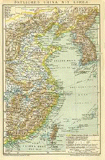
"Oestliches China Mit Korea". Wood engraving printed in color. From F.A. Brockhaus' Geogr.-artist Anstalt in Leipzig. Dated 1896. Map reaches westward to the Shansi and Hunan provinces. In the lower left is Macao and Hong Kong and towards the lower center is Taiwan. South of Korea are a few Japanese islands. Left margin is very narrow. Map is clean and the overall condition is Much Better than Good. 21.8 x 14.2 cm ( 8.5 x 5.6 ") $ 85.00 Order Nr. CHINA1744 |
|
Terms of Sale - Lieferbedingungen Copyright © Rainer Rauhut
|