|
Alte Landkarten von Deutschland (Seite 5) Antique Maps of Germany (Page 5) This is a selection of our historical maps of Germany. There are several pages more. Click the link at the bottom of the page to see more. If you are looking for a particular map please contact us. If you want to know if a certain town or city is on one of our maps, please ask. Sale! Discount! 30% Discount on All maps with a DEUTSCHLAND number on this page! Take 30% off the listed price. ! Visit us at the following sites: https://lovelyantiqueprints.com twitter.com/philographikon2 We accept reasonable offers. |
|
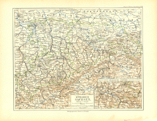
"Koenigreich Sachsen" Very detailed map published
1892 by the Bibliographisches Institut in Leipzig. Image: 21 x 26.5 cm ( 18.2 x 10.4") $ 35.00 minus 30% Discount = $24.50 Order Nr. DEUTSCHLAND255993 |
|
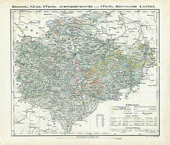
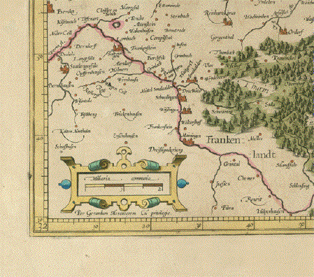
"Herzogl. Saechs: Fuerstl. Schwarzburgsche und Fuerstl. Reussische Laender." Steel engraving by A. Tschierschky for Flemming ca 1860. A bit of original outline coloring. In the center of this detailed map is Renda and Stadt Ilin. The map extends as far north as Nordhausen and Schraplau and as far south as Ebern and Staffelstein. On the left is Waldkuppel and Geisn. In the upper right is Leipzig. Plauen is right above the interesting cartouche. The highest mountains are listed in the cartouche. Map has some light fraying on margin edges and a few spots in margins. Two tiny repaired tears on lower margin edge. 31 x 36.5 cm ( 12.2 x 14.3 ") $ 90.00 Order Nr. D1412 |
|
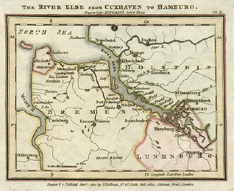
"The River Elbe from Cuxhaven to Hamburg". Copper etching by J. Luffman. Dated 1801. Published in London. Original hand coloring. This dregional map shows the course of the river Elbe as far as Hamburg. On the left side is part of the Weser river with Oldenburg in the lower left corner. At the bottom in the center is Kloster Zeven. Map image is very clean. There is a spot near upper margin edge. Fraying and small holes from binding on upper edge. General condition is Almost Very good. 11.5 x 15.5 cm (4.5 x 6.1 ") $ 115.00 Order Nr. D1267 |
|
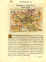
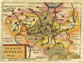
"Brandenburgens Marcha. Marca Antica.
Marca Nuoua". Copper etching by
Giovanni Botero (1540-1617). Published in Berlin is in the middle of this interesting
little map. In the north is the lower part of Stettin Bay to
be seen. In the very northeast is part Overall light toning and fraying on edge of upper margin. One small worm hole in text. Light water stain in upper margin that reaches a bit into the image. Overall condition is Almost Very Good. Page size: 20.7 x 15.3 cm ( 8.1 x 6 ") $ 150.00 Order Nr. D1216 |
|
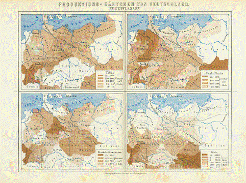
"Produktionskaertchen von
Deutschland" Interesting map showing the
production areas of tobacco, hemp, flax, beet sugar and
wine Map image: 15 x 20 cm ( 5.9 x 7.8") $ 25.00 minus 30% Discount = $ 17.50 Order Nr. DEUTSCHLAND256650 |
|
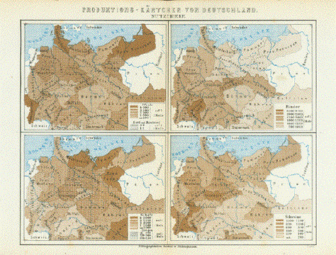
"Produktionskaertschen von
Deutschland" Interesting map showing where
there are large numbers of horses, cattle, sheep and
pigs Map image: 15 x 20 cm ( 5.9 x 7.8") $ 25.00 minus 30% Discount = $ 17.50 Order Nr. DEUTSCHLAND256651 |
|
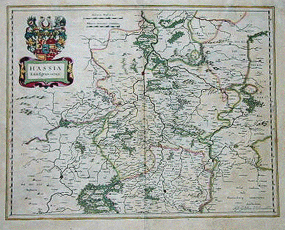
"Hassis Landgraviatus" .Copper etching by Wilhelm Janzoon Blaeu. Published in Amsterdam, ca 1630. Original hand coloring. This detailed map shows Hesse from Fulda in the south to Kassel in the north. It reaches from Marburg in the west to Eisenach in the east. Map has some overall age toning and browning along the centerfold.In the upper and lower margins are repairs of small missing pieces along the centerfold. In the upper margin are two repaired tears that reach into the image, (ca 7cm long). The lower margin edge is a bit frayed and the corners have been rounded. The upper right margin corner has a repair. General condition of the map is Almost Good. 39 x 49.6 cm ( 15.4 x 19.5 ") $ 380.00 Order Nr. D1290 |
|
|
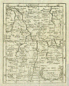
"Les deux Cercles du Haut et Bas Rhin" Copper etching for the Accademy
of Sciences Map has folds to fit book size
and 17.5 x 13.5 cm ( 6.8 x 5.3 ") $ 50.00 Order Nr. D1331 |
|
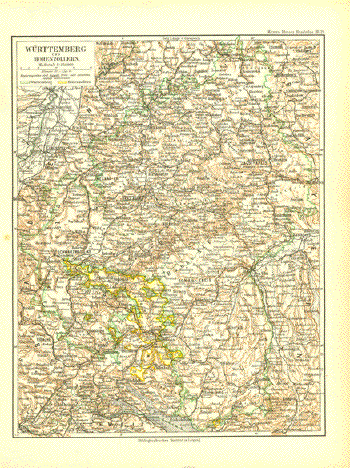
"Wuertemberg und Hohenzollern" Very detailed map published
1892 by the Bibliographisches Institut in Leipzig. Image: 27 x 21 cm ( 10.6 x 8.2") $ 35.00 minus 30% Discount = $24,50 Order Nr. DEUTSCHLAND255994 |
|
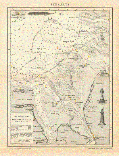
"Seekarte" Very interesting and detailed
map showing the depths, light house, fog warnings and other
signals. The map was published 1895. Horizontal centerfold. Light age toning. 27 x 20.5 cm ( 10.6 x 8 ") $ 40.00 Order Nr. DEUTSCHLAND244683 |
|
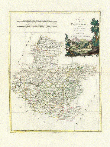
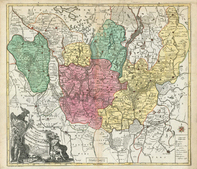
"Il Circolo di Franconia diviso ne suoi Stati" Karte zeigt Mainlauf und alle darum herum gelegene Gebiete Unter-, Mittel- und Oberfrankens Type of print: Copper etching Color: Original outline hand coloring. Cartouche is originally hand-colored Author: Antonio Zatta Published: Venice, dated 1780 Condition: Very good. Clean. Wide margins 40 x 30,7 cm (ca. 15.7 x 12") $ 130.00 Order Nr. DEUTSCHLAND239128 |
|
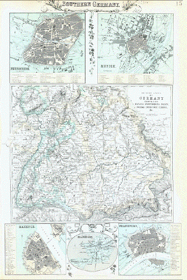
"Southern Germany" Southern States of Germany comprising Bavaria, Wurtemberg, Baden, Nassau, Darmstadt, Coburg. Map has several city plans: Nuremberg Nuernberg), Munich (Muenchen), Mayence (Mainz), State of Frankfort (on the Main) and Frankfort (Frankfurt am Main) Type of print: Line lithograph printed in several colors (mostly green and beige) Engraver. John Bartholomew jr. (1831-1893) an Edinburgh based cartographer. He was known for the finest of cartographical work done in Great Britain. Published: By Fullarton & Co. London, Edinburgh and Dablin ca. 1870 Condition: A few repaired margin tears. Upper margin narrow. Reverse side has no print Page size: 47 x 31 cm (ca. 18.5 X 12.2") $ 120.00 ORDER NR. DEUTSCHLAND238823 |
|
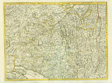
"Partie Meridionale de la Souabe" Copper engraving by Guillaume De Lisle (1675 - 1726). Dated 1704. Original hand coloring. Very detailed map with biberach on the Riss in the center. In the lower left is part of Lake Constance ( Bodensee) and in the upper left is Waltenbuch and Tubingen. In the upper right is Tierhaupten and Friedberg. In the lower right isVils and Pflach in Austria. Map has on repair on centerfold at the bottom with light creasing in the area. Otherwise the map is in good condition. Clear imprint on strong paper. 48 x 63 cm ( 18.8 x 24.8 ") $ 280.00 Order Nr. DEUTSCHLAND234783 |
|
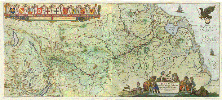
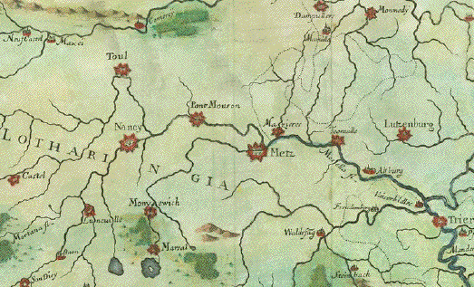
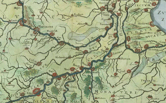
"Rhenus Fluviorum Europae Celeberrimus, cum Mosa, Mosella, et reliquis, in Illum se exonerantibus fluminibus". West-oriented course of the river Rhine. Copper etching by Conte de Galeazzo, Gabriel Gualdo Priorato, ca 1670. Modern hand coloring. In the upper left are the following coats-of-arms: Heluetii, Alsatia, Palatin Rheni, Archiep. Mogun, Archiep Trevir, Archiep. Colon, Clevia, Geldria, Vltraiectum, Hollandia. Map was photographed with matting (passepartout). The map has hardly visible 7 vertical and 1 horizontal folds to fit book size. It is printed from two plates matched at centerfold. Left fold near Bodensee (Lake Constance) has older repairs (backed up with paper) in lower part . All margins have been widened. Some creasing. Few small spots visible from backside. 40 x 90 cm ( 15.7 x 35.4 ") $ 820.00 Order Nr. DEUTSCHLAND1305 |
|
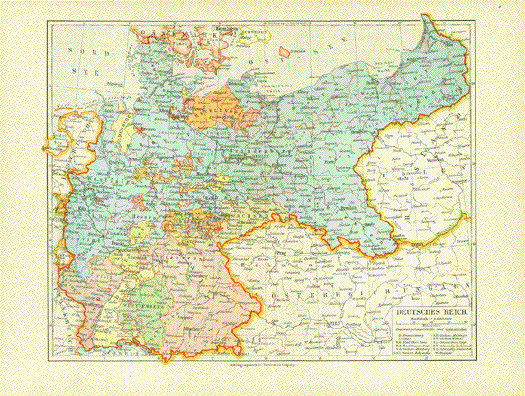
"Deutsches Reich" Map published 1906 in Leipzig. Vertical centerfold. Map image: 21 x 26.5 cm ( 8.2 x 10.4 ") $ 25.00 minus 30% Discount = $ 17.50 Order Nr. DEUTSCHLAND256811 |
|
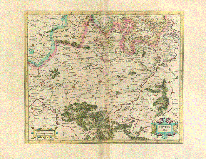
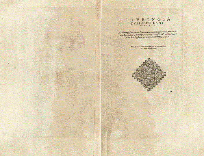
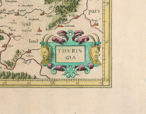
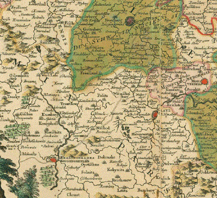
"Thuringia" Kupferstichkarte von Gerard Mercator (1512-1594) Copper etching by Gerard Mercator (1612-1594) Altkoloriert Original hand coloring Duisburg, ca. 1600 Leiche generelle Altersbräunung. Breite Margen. Sehr attraktives Altkolorit. Auf der Rückseite ist der Titel der Karte ausführlicher gedruckt. Erwähnt sind Grafschaft Gleichen, Kranichfeld und das Bistum Merseburg Mini Reperatur unten. Light general age toning. Wide
margins. Very pleasant original hand coloring. The vertical centerfold shows browning. See image. Normal signs of age and use. Small repair on lower margin edge. Map image: 34,5 x 41,2 cm (ca. 13.6 x 16.2") $ 230.00 Order Nr. DEUTSCHLAND250823 |
|
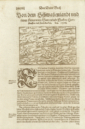
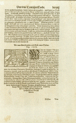
"von dem Schwaben land unnd seinen fuernemen Stätten unnd flecken / herrschafften und Fruchtbarkeit" At the top of this south oriented map are Ansbach, Augsburg, Memmingen, Zuerich, Basel Strasbourg,
Speyer, Worms, Mainz and the run of the river Published in "Cosmographia" by Sebastian Muenster (1488-1552) German edition. Basel, 1553 Above and below map and on reverse side title and text in German Reverse side has woodcut about gold and silver production. General age toning. a few foxing spots. Basically very good condition. Map: 9 x 13,4 cm (ca. 3.5 x 5.3") Reverse side image of gold and silver production: 7,7 x 13 cm (ca. 3 x 5.1") Page size: 30,5 x 20 cm (ca. 12 x 7.9") $ 130.00 Order Nr. DEUTSCHLAND250409 |
|
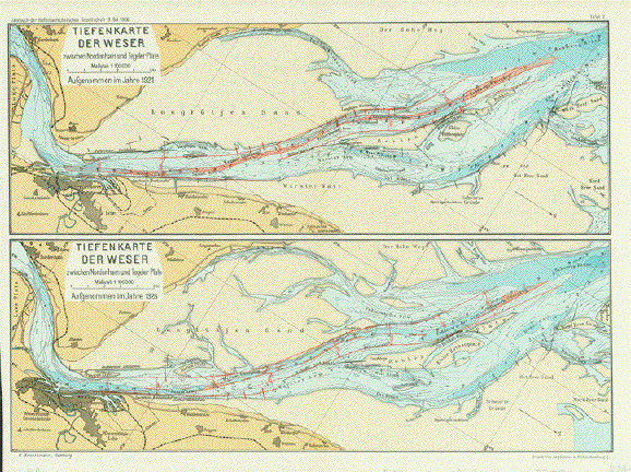
"Tiefenkarte der Weser zwischen Nordenham und Tegeler Plate" Farbdruck der Hafenbautechnischen Gesellschaft von 1926 Erstellt von R. Brennemann Zwei übereinanderangeordnete Tiefenkarten der Weser. Bremerhaven prominent. von den Jahren 1921 und 1926 zum Vergleich. Guter Erhaltzungszustand. ******** "Tiefenkarte der Weser zwischen Nordenham und Tegeler Plate" Map by R. Brennemann printed in color by the Hafenbautechnischen Gesellschaft von 1926. The two maps show a comparison between 1921 and 1926 of the depths of the Weser River. Good condition. Jede Karte/ each map 12,5 x 36 cm(4.9 x 14.1") $ 90,00 Order Nr. DEUTSCHLAND250865 |
|
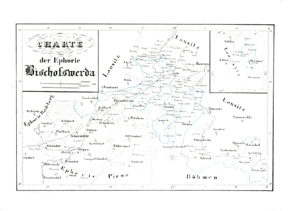
"Charte der Ephorie Bischofswerda" Lithograph of Bischofswerda and the surrounding area. In the upper right is an inset showing Bischdorf and Loebau. Original outline hand coloring. Published in Leipzig, 1830. Lithograph. Very good condition. Map image: 20 x 30.5 cm ( 7.8 x 12 ")" $ 90.00 Order Nr. DEUTSCHLAND250429 |
|
Sale! Discount! 30% Discount on All maps with a DEUTSCHLAND number on this page! Take 30% off the listed price. ! Visit us at the following sites: https://lovelyantiqueprints.com twitter.com/philographikon2 We accept reasonable offers. |
|
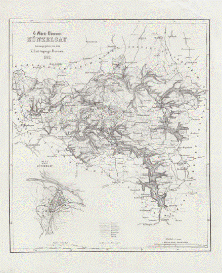
"K. Württ. Oberamt Künzelsau" Detaillierte topographische Karte des ehemaligen Oberamtes Künzelsau. Lithographie von F. Bohnert Herausgeber: Königlich statistisches topographisches Bureau Stuttgart, 1882 Die Karte zeigt mit grossem
Detail das Gebiet zwischen Krautheim im Norden, Die Karte war mehrfach gefaltet, um an das Heftformat, in dem sie veröffentlich wurde, angepasst zu sein. Erhaltungszustand: Sehr gut 39 x 34 cm (15.3 x 13.4") $ 140.00 Order Nr. DEUTSCHLAND250413 |
|
|
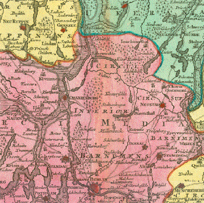
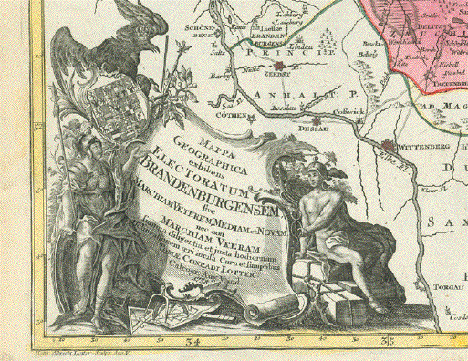
"Mappa Geographica exhibens Electoratum Brandenburgensem sive Marchiam Veterem, Mediam et Novam, nec non Marchiam Ukeram". Kurfürstentum Brandenburg.
Im Zentrum der Karte die deutsche Hauptstadt Berlin. Altkolorierte Kupferstichkarte
bei Matthias Albrecht Lotter (1741-1810) Zustandsbeschreibung: Obere
Marge hat einige kleine Wurmlöcher, keines davon
innerhalb der Karte. Map image; 51 x 57,2 cm (20,7x22.5") $ 540.00 Order Nr. DEUTSCHLAND253993 |
|
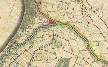
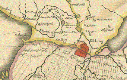
"Tractuum Borussiae, circa
Gedanum et Elgingam ab incolis Werder appellaticum Copper engraving
after Olao
Joannis Gotho by Ioannes Jansonius 1647. Original hand
coloring. Map has overall pleasant age
toning. Some light scattered spotting. Map image 41 x 48 cm ( 16.1 x 18.8 ") $ 620.00 Order Nr. POLAND249958 |
|
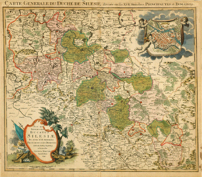
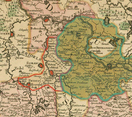
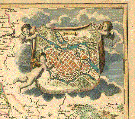
"Carte Generale Du Duche de
Silesie divisee en ses XVII Moindres Principautes et
Domaines" Copper engraving map of Silesia
by Covens and Mortier. Original hand coloring with Map shows Silesia with a decorative inset of Breslau in the upper right corner. The map has overall natural age
toning. Some spotting in margins. Map image: 47.5 x 56.5 cm ( 18.7 x 22.2 ") Order Nr. DEUTSCHLAND252579 SOLD |
|
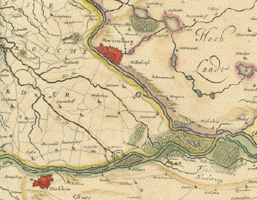
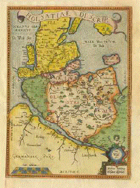
"Holsatiae Descriptio". Copper etching by Marco Iordano Holsato from the atlas "Theatrum Orbis Terrarum" by Abraham Ortelius. Antwerp, modern hand coloring. Differs from the preceding map through title ribbon. Also reaching a trifle further north. Title cartouche lower left replaced by mileage cartouche, which was moved from the right to the left. Author^s name in its stead. Verso no text. Antwerp 1603. This is basically a map of Schleswig-Holstein , the north end of Germany. Neighboring southern Jutland (Denmark) with islandsAlsen and Laland are featured as well as Sylt and Femarn in ruddy fashion typical for the 16th century. Parts of Lower Saxony south of the Elbe river and hints of Mecklenburg are bordering. Map has some very light scattered spotting in margins. Left margin has been added. Map is not printed exactly straight on paper. A few light scattered creases that are hardly visible. Overall condition is Better than Good. 33.5 x 24.2 cm ( 13.1 x 9.5 ") $ 320.00 Order Nr. D1303 |
|
Sale! Discount! 30% Discount on All maps with a DEUTSCHLAND number on this page! Take 30% off the listed price. ! Visit us at the following sites: https://lovelyantiqueprints.com twitter.com/philographikon2 We accept reasonable offers. |
|
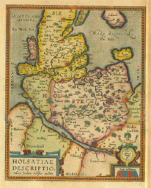
"Holsatiae Descriptio". Copper etching by Marco Iordano Holsato from the atlas "Theatrum Orbis Terrarum" by Abraham Ortelius. Antwerp, 1584. Modern hand coloring. This is basically a map of Schleswig-Holstein , the north end of Germany. Neighboring southern Jutland (Denmark) with islands Alsen and Laland are featured as well as Sylt and Femarn in ruddy fashion typical for the 16th century. Parts of Lower Saxony south of the Elbe river and hints of Mecklenburg are bordering. Verso: Text in Latin. Map has overall age toning with light, scattered spotting in margins. Wide margins except on right side. Overall condition is otherwise Almost Very Good. 30.5 x 24 cm ( 12 x 9.4 ") Order Nr. D1298 SOLD |
|
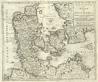
"Carta Nuova del Regno di Danimarca........". Copper etching by Issac Tirion (1705-1765). Published ca 1750. Map shows Denmark and surrounding area with fine detail of cities, towns, rivers, lakes and islands, even the fishing frounds are shown. Map has folds to fit book size.Strong, clear impression. Part of binding margin added inlower right corner. Paper replaced in lower left corner. Tiny repaired tears on upper margin edge. Condition is otherwise Good. 28.4 x 33 cm ( 11.1 x 12.9 ") $ 265.00 Order Nr. SCANDINAVIA1491 |
|
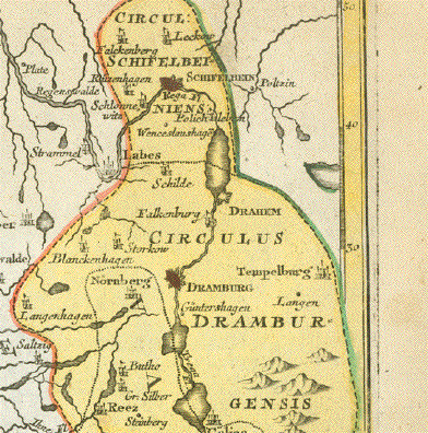
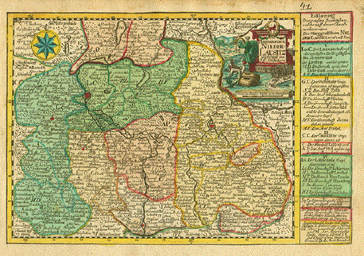
"Das Marggrafthum Niederlausitz". Copper etching by Johann Christian Schreibern (1676-1746). His atlas was published after his death ca. 1750 in Leipzig. Original hand coloring. To the left of the title cartouche is the Oder river flowing into the map by Reipzig. It flows under the cartouche and to the right and exits by Netka. Flowing into the Oder from the south along the right of the map is the Bober river. In the center of the map is Peitz on the Spree river. In the upper left is Treppin and Mittenwalde. In the lower left corner is Treblitz and Dobra. On the right side is information about the area. Map has overall toning and some light spots in margins. Along upper margin edge is browning. Hand-written number in upper right margin corner.General condition is Good. 16 x 24 cm ( 6.3 x 9.4 ") $ 140.00 Order Nr. D1269 |
|
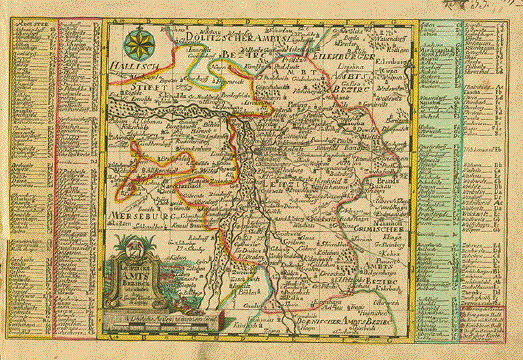
"Leipziger Amts Bezirk" . Copper etching by Johann Christian Schreibern (1676-1746). His atlas was published after his death ca. 1750 in Leipzig. Original hand coloring. Leipzig is right in the center of this map that reaches from Schorlau in the north to Zöpen and Geslowitz in the south. The Elster river and its tributaries are on the left side of the map. In the upper right is Eilenberg. On both sides is a list of towns and cities found on the map. Map has overall age toning with some light scattered spotting and smudging in margins. In the upper write corner is a hand-written number that was changed. Left margin is narrow. Condition is Good. 16.2 x 25 cm ( 6.3 x 9.8 ") $ 140.00 Order Nr. DEUTSCHLAND1270 |
|
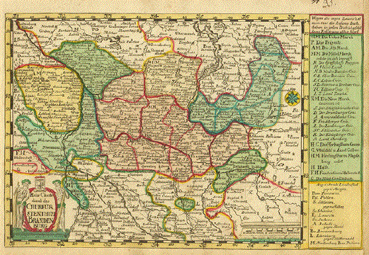
"Churfürstenthum Brandenburg". Copper etching by Johann Christian Schreibern (1676-1746). His atlas was published after his death ca. 1750 in Leipzig. Original hand coloring. Berlin is directly in the center of this Brandenburg map. Above the title cartouche is Halberstadt and Quedlingburg. The Elb river flows out of the upper left corner. The Oder flows into the map in the lower left corner and north to Stettin, Usedom, and Anklam at the top of the map. Map has overal age toning with browning along margin edges. Right margin has been added. Some light scattered spots in margins and a hand-written number in upper right corner. General condition is Good. 17 x 25.6 cm ( 6.7 x 10 ") $ 140.00 Order Nr. DEUTSCHLAND1271 |
|
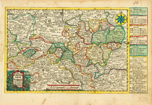
"Das Fürstenthum Anhalt". Copper etching by Johann Christian Schreibern (1676-1746). His atlas was published after his death ca. 1750 in Leipzig. Original hand coloring. In the center of this Anhalt map is Berenburg on the Saal river. At the top in the center is Magdeburg on the Elbe river and at the bottom center is Halle on the Saal river. On the right center is Wittenberg and on the left center is Halberstadt for orientation. On the right side is map description. Map has scattered spots in margins and staining on edges. Overall age toning. Hand-written number in upper right margin. Condition is Good. 15 x 24.7 cm ( 5.9 x 9.7 ") $ 140.00 Order Nr. DEUTSCHLAND1297 |
|
Sale! Discount! 30% Discount on All maps with a DEUTSCHLAND number on this page! Take 30% off the listed price. ! Visit us at the following sites: https://lovelyantiqueprints.com twitter.com/philographikon2 We accept reasonable offers. |
More Maps of Germany (Page 6) - Mehr Landkarten von Deutschland (Seite 6)
|
© Rainer Rauhut
|