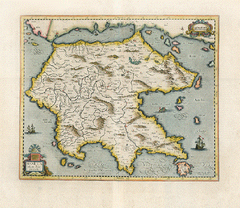
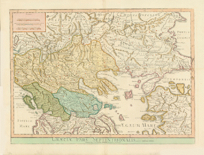
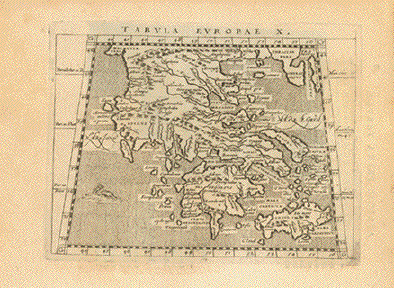
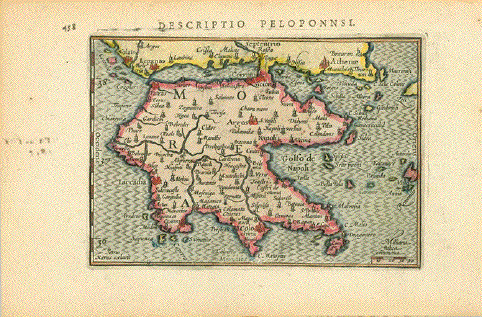
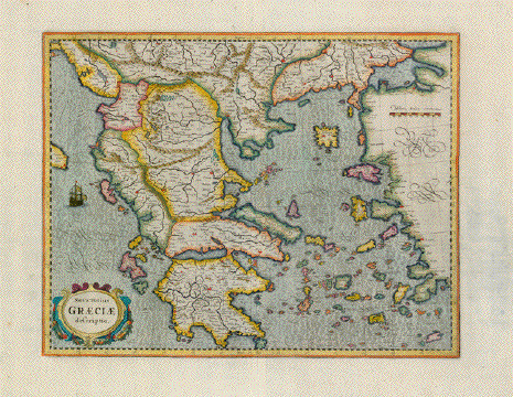
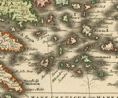
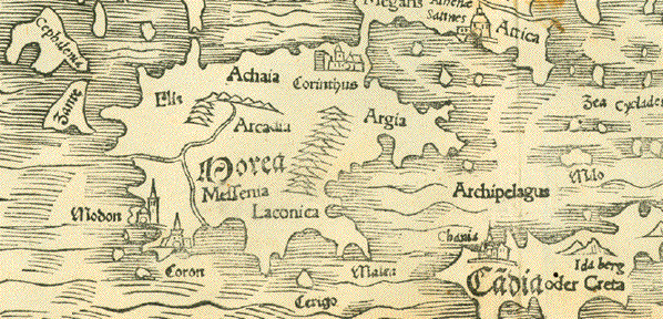
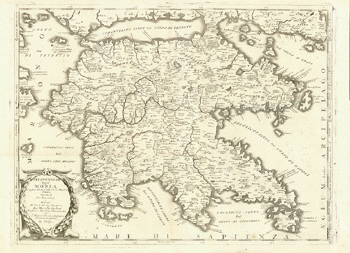
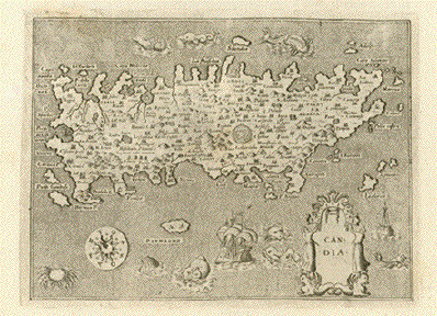
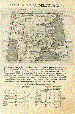
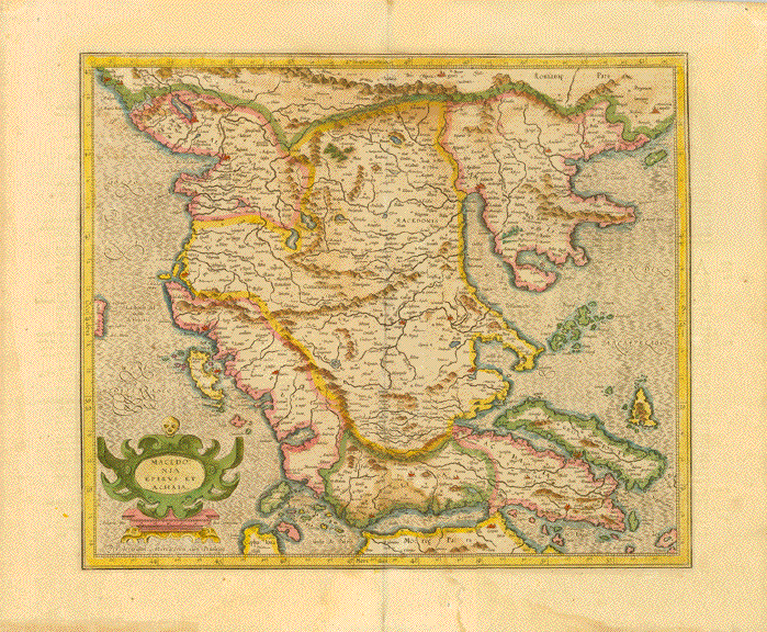
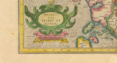
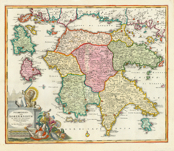
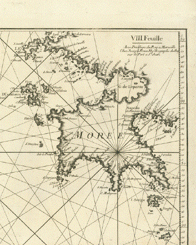
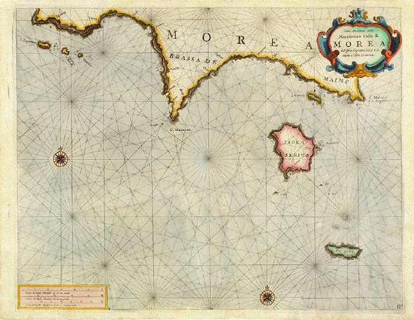
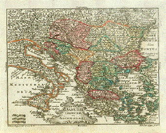
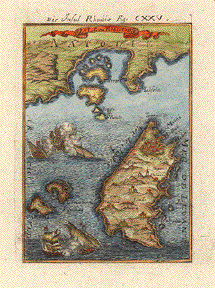
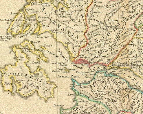
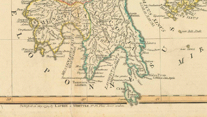
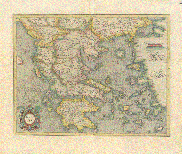
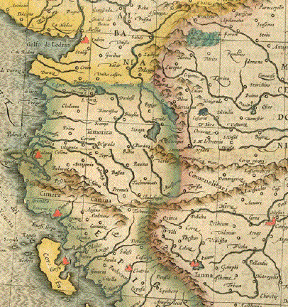
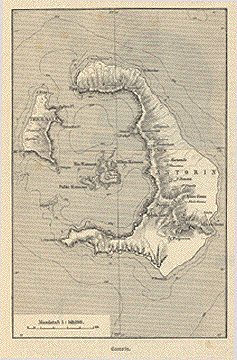
Antique Maps of Greece

View this selection of fine, historical maps of Greece. Maps showing the Mediterranean area with Greece are on our page: Maps of the Mediterranean. If you are looking for a particular map, please contact us.

Ordering and Payment

Lieferbedingungen

Sale! Discount!

30% Discount on All maps with a GREECEMAP number on this page!

Take 30% off the listed price. !

"Griechenland die Ionischen Inseln und Candia 1854". Steel etching from "Neuster Zeitungs Atlas. Alter und Neuer Erdkunde" by J. Meyer, ca 1855. Original outline coloring.

Very detailed Greek map featuring the Ionean Islands with Crete. On the left side is an inset of Corfu.

Very light overall age toning and light browning of margin edges. Light crease in lower left margin corner.

20.2 x 25.7 cm ( 7.9 x 10.1 ")

$ 75.00

Order Nr. GREECEMAP1286


"Griechenland und Die Ionischen Inseln". Steel engraving by A. Theinert for C. Flemming in Glogau. Published va 1860. Some original outline coloring.

Very detailed map of Greece with its many islands.

Map image is very clean. Light browning on margin edges,

32.5 x 42 cm ( 12.7 x 16.5 ")

$ 130.00

Order Nr. GREECEMAP1287


"La Grece Et Les Pays Plus Septtrionaux Jusqu'au Danube Pour L´Histoire Ancienne de Mr. Rollin". Copper etching by Jean Baptiste Bourguignon D'Anville ( 1697-1782), published 1740. Modern hand coloring.

An attractive map of Greece with its many islands. Notice part of the "heel" of Italy on the left side. In the lower right is Turkey with the ancient names of the western coast. In the north the Danube River. In the upper right is part of the Black Sea.

Map has very wide side margins (11 cm). Upper and lower margins are normal (ca 4,5 cm). Map has overall light toning. Light creases in upper left margin and minimal scattered spotting in margins far from map image. Overall condition is Almost Very Good.

24.8 x 21.2 cm ( 9.5 x 8.3 ")

$ 180.00

Order Nr. GREECEMAP1235


"Descrittione Dell'Isola di Rhodi". Copper etching from "L'Isole piu Famose del Mondo" (The most famous islands of the world by Thomas Porcacchi (1530 - 1585) and engraved by Girolamo Porro. The first edition of this work was published in Venice in 1572. This is from the second edition, 1620.

Rhodes is somewhat northeast oriented on this map. Notice the many sea monsters and Classical cartouche. This map is an enlargement from the page above. An extra page of text is included.

Map is a strong impression and clean. Pages have general light toning and some spotting in text and margins. Condition is Almost Very Good.

Map size. 10.2 x 14.2 cm ( 4 x 5.6 ")
Page size: 27.7 x 19.7 cm ( 10.9 x 7.8 " )

$ 280.00

Order Nr. GREECEMAP1223


ãGraeciae Pars Septentrionalis". Copper etching by Guillemo Delisle. Very attractive modern hand coloring over original borderline coloring. Puiblished by Laurie & Whittle. London, 1794.

This very attractive map centers in detail on Northern Greece, Albania, Macedonia, Northern Turkey, Romania, Bulgaria, reaching over to ãConstantinople" and the Black Sea. Since all topographical names are historical names this has to be considered a historical map. There is a mileage chart in upper left corner.

Map is very clean. One repaired tear into pink bordure on left, two little repaired tears in lower margin edge. Repair in lower margin on centerfold. Normal signs of age and use for a map this age.

45.8 x 63.0 cm (18.0 x 24.8")

$ 520.00

Order Nr. GREECEMAP255277


"Map of the Northern Shores of the Aegean with the Roman Roads"

Steel engraving map by w. Hughes. Published 1854.

Map image: 17 x 24.5 cm ( 6.6 x 9.6")

$ 80.00

Order Nr. GREECEMAP253249


"Candia and the Archipelago with the Adjacent Coasts"

Copper engraving map by Aaron Arrowsmith. Published in London 1828.

Original hand outline coloring. In the upper right is prt of the Sea of Marmara.
The Turkish coast on the right side extends as far south as the Greek island of Rhodes.
In the upper left is part of Macedonia and Thessalia.

The map is very clean. Above the title is very light imprint from the opposite page in the atlas.

Map image; 28 x 22 cm ( 11 x 8.6")

$120.00

Order Nr. GREEKMAP255129


"Die Landschaft Livadien einst Hellas oder das eigentliche Griechenland"

Copper engraving by Franz von Reilly ca 1790.
Original coloring when published.
Good condition.

Image: 22 x 34 cm ( 8.6 x 13.3")

$100.00

Order Nr. GREECEMAP255030


"Viaggi D'Ulisse e gli Argonauti"

VoyageS of Ulysses and the Argonauts

Text lower left: Geografia Primitive de Greci second Esiodo ed Omer (Early map of Greece according to Isidor and Homer.

Greece and Ulysse's voyage . Originally hand-colored traces of voyage.

Map's focus is Greece and the island hopping described in Homer's Odyssee

On the far left we find the Straight of Gibraltar and the ãFortunate Islands" = The Canary Islands (here with their Italian name: Isole de Felice. At bottom: North Africa. On the right: The Near East, the Black Sea and much unknown land up north.

Copper etching

Published in ãAtlante di Geografia Universale É per servire al Corso di Geografia Universale"

Author. Francesco Constantino Marmocchi (1805-1858)

Florence, 1840

Very good condition. Very wide margins. Lower right margin corner has yellow stain
well away from image.. Small black spot at bottom

Image Diameter: 24 cm (ca. 9.4")

Sheet: 42 x 50 cm (ca. 16.5 x 19.7")

Order Nr. GREECEMAP255104SOLD


"La Macedonie La Thessalie L'Epire"

Copper engraving map by Jaques Benigne Bossuet (1627-1704).
Published in Paris by Chez Arkstree et Merkusm 1742.51.
From "L'Histoire Universelle despuis la commencement du monde,
jusqu a present, traduit de l'anglois d une societe de gens de letrtres"

Very attractive hand coloring. Two original vertical folds to fit book size.
Very minor signs of age and use in margins.

Map image: 20 x 31.5cm (7.8 x 12.4 ")

$ 220.00

Order Nr. GREECEMAP252929


"Grecia Antigua"

Rare copper engraving map by Joshua Archer (1792-1863)
Published by the Society for Promoting Christian Knowledge in 1847.
Very attractive original hand coloring. Ancient names of towns and topography.
Light natural age toning in margins. In lower left corner is a brown spot.

Map image: 14 x 9 cm ( 5.5 x3.5")

$ 185.00

Order Nr. GREECEMAP255132


"Hellas"

Rare copper engraving map by Joshua Archer (1792-1863)
Published by the Society for Promoting Christian Knowledge in 1847.
Very attractive original hand coloring.

Map has light natural age toning in margins. The upper margin edge is browned.

Map image; 9 x 14.2 cm ( 3.5 x 5.6")

$ 185.00

Order Nr. GREEKMAP255134


"Tabula Europae X"

Copper etching by Girolamo Porro ( 1520.1604 ) after Claudius Ptolemy.
Edited by Giovanni Antonio Magini ( 1555-1617 )

Variation of Porro's Map. Published by Peter Keschedt, Cologne, 1597.

Verso: Latin text for the map "Africae Prima Tabula"

Map has age toning. Strong impression. Watermark.

Size within plate marks: 13.6 x 17.6 cm ( 5.4 x 6.9 ")

$ 360.00

Order Nr. GREECEMAP249802


"Insula Creta hodie Candia in sita IV Territoria Divisa cum adiacentibus Aegei Maris Insulis ac praefertim nuperrime ex abysso pelagi emergente Nova Santurini Insula É"

The Island of Kreta and many of the Aegean islands.

Copper engraving. Published by Johann Baptist Homann (1664-1724)

Nuremberg, 1723

The island of Kreta has delicate original hand coloring, the islands, too, except as borderline coloring.

The cartouche enriched with Neptune, Mercury and an Ottoman lady, a putto and a rich staffage of Greek grapes symbolizing the Greek tradition of wine making. Crete covers the bottom half of the map, the sheer size allowing for great and precise geographical detail

Map is in good condition with a few light spots.. Only very minor traces of age and use.

48 x 57,5

$ 650,00

OrderNr. GREECEMAP249640


"Griechenland"

Detailed map of Greece published 1892.

Vertical centerfold.

21 x 26.5 cm ( 8.2 x 10.4 ")

$ 55.00

Order Nr. GREECEMAP249143


. - "Acquisitiones Phyrrhi Epirotarum Regis situ in Plutarch"

This map shows (as is described by Plutarch) the colonization of Southern Italy
including Sicily by the Gree in the 8th century B.C. The Italian part of the
Greek expansion was called ãMagna Graecia". For many centuries, well into
Christian time the Greek language and the Greek culture was much alive
in the region.  ãRomanizing"  happened late and slowly. Even in our time there are some
"anguage islands" in Apulia and in Calabria, where Greek is still commonly spoken.

Copper etching after Hermann Moll (ca. 1654-1732)

Published in ãGeographia Classica Emendata, ex Graecorum LatinorumqueÉ"

By William Stukeley (1687-1765)

London, ca. 1725

Light general age toning. Some minor traces of age and use in margins. Center fold.

15,3 x 22,5 cm (ca. 6 x 8.8")

$ 125.00 (Please see discount at top of this page. Here 30% = $ 87.00)

Order Nr. GREECEMAP254730


"Descriptio Peloponnsi"

Copper engraving map by Peter Bertius (1565-1629).
Published in Amsterdam by Jodocus Hondius ca 1603

From "Tabularum Geographicarum contractarum".

Hand coloring. Natural age toning. Some ink writing on rverse side visible on fron side.

Map image: 8.5 x 12.5 cm (3.3 x 4.9")

Order Nr. GREECE253278SOLD


"Die Insel Nisaro and Piscopia"

Copper engraving by Alain Mallet, ca 1686.

This map has the older names of the islands Nisyros, Tilos, Kos and Kefalos.

In the upper right is part of Natolia ( Turkey), Decorative ships adorn the lower part of the image.

Good condition. In the left margin is some orignal inking near the upper par of the image.

Image size; 14.5 x 10 cm ( 5.7 x 3.9 ")

$ 190.00

Order Nr. GREECEMAP248932


"Nova Totius Graeciae descriptio"

Attractively hand-colored copper etching by Gerad Mercator. Published by Hondius-Janssonius. Amsterdam, ca. 1630

Map shows all of Greece including the islands and the Turkish coastline north of 35°.

Renaissance title cartouche. Very wide margins. Verso: Accompanying text in the English language.

Very minor traces of age and use.

36.3 x 46.8 cm (14.3 x 18.4")

$ 720.00

Order Nr. GREECEMAP235102


"Griechenland" Steel engraving by J.L. von Baehr after G. Heck, ca 1850.

A detailed map of Greece showing the topography of the land in detail. In the lower left is an inset of the Cyclades Islands,

Map is very clean and in Very good condition.

20.2 x 25.3 cm (7.9 x 9.9 ")

$ 70.00

Order Nr. GREECEMAP1239


"Theatrum Belli Sive Novissima Tabula Qua Maxima Pars Danubii et Praesertim Hungaria
Cum Aliis Adiacentibus Regnis, Nec Non Graecia, Morea, El Archipelagi Insulae Accurate"

Copper engraving by Matthaeus Seutter published in Augsburg between 1730.- 1760.

Orignal hand coloring. Strong paper.

Map has light browning on centerfold. Spot in upper left margin and a few light scattered spots.
Small repair on lower centerfold.

Map image: 49.5 x 57.5 cm ( 19.4 x 22.6 ")

Order Nr. HUNGARYMAP249701SOLD


ãMorea olim Peloponnesus"

Type of engraving: Hand-colored copper etching

Author: Gerardus Mercator (1512-1594)

Publisher: Gerard Mercator and Jodocus Hondius (1563-1612)
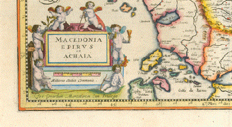
Published in: ãGerardi Mercatoris et I. Hondii - Janssonii Atlas or a Geographicke Description

of the Regions, Countries and Kingdomes of the World ...."

Amsterdam, 1636-1641

Verso: Text in the English language

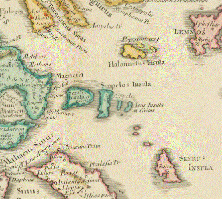
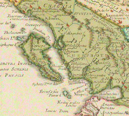
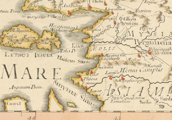
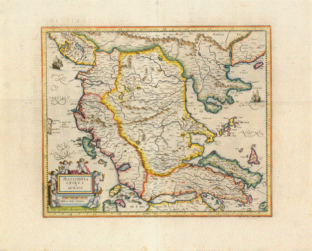
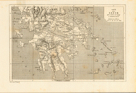
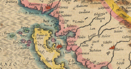
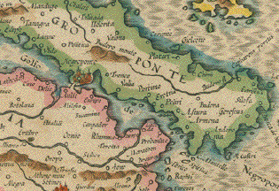
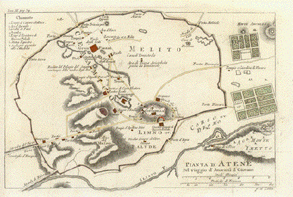
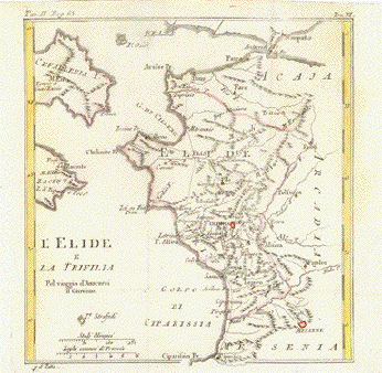
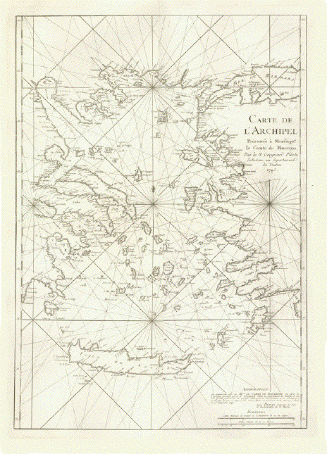
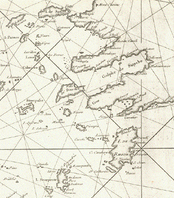
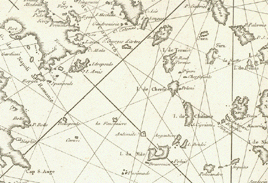
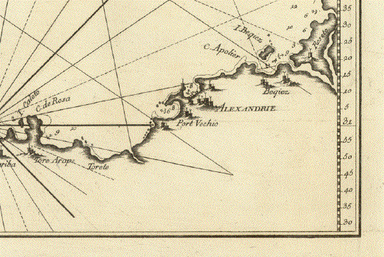
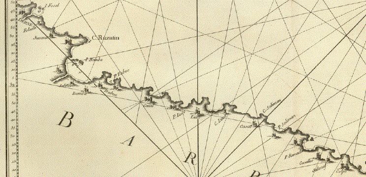
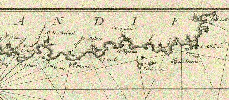
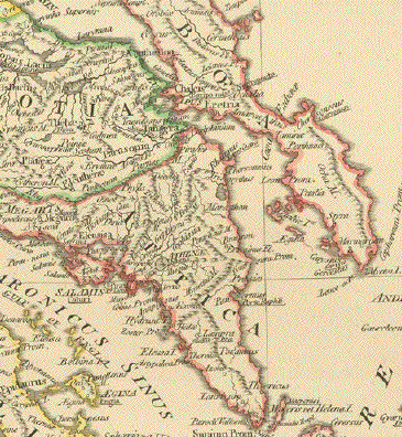
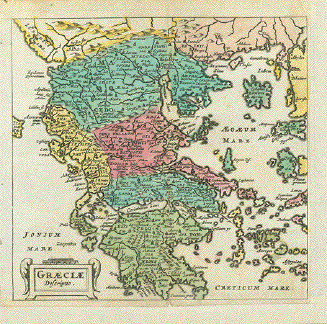
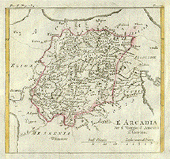
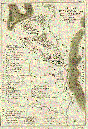
A very detailed and attractive map of the Peloponnes, created by the famous cartographer Gerard Mercator, whose maps were, after his death, published by the equally importatnt cartographer and publisher Jodocus Hondius. After his death Johannes Janssonius continued publishing the maps in what is referred to as Mercator-Hondius-Janssonies atlas. This atlas was continuously enlarged. This particular map was published in 
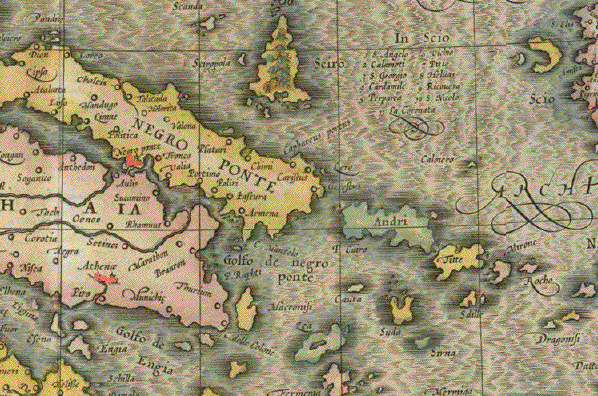
1636. It is the second state of this map, embellished with an additional mileage cartouche and sailships and a sea monster.

Mercator noted in the lower right corner of this map and marked on the island of Cerigo: Il templo dove fu rapta Helena da Paris!

Condition: Light general age toning. Very attractive hand-coloring. Very wide margins are lightly spotty. In general: good condition.

33,3 x 41,1 cm (ca. 13.1 x 16.2")

$ 650.00

Order Nr. GREECEMAP237472


"Thracia Antiqua" Copper engraving by R.W. Seale for the atlas "Notitiae Orbis Antiqui" published 1705 for the first time and published in London and Amsterdam in later editions. Original hand outline coloring.

Detailed map of Thracia with its ancient names. At the top is a bit of the Danube River.

Map has two vertical folds. Crease in left margin reaching in map image.

20.2 x 30.4 cm ( 7.9 x 11.9 ")

$ 220.00

Order Nr. GREECEMAP1290


"New Griechen lande mit andern anstossenden laendern wie es zu unsern zeiten beschriben ist"

Woodcut. Published in "Cosmographia" by Seabastian Muenster (1488-1552)

Basel, 1553

Shows Greece to the East Balkan, the Black Sea, Constantinople (Istambul), West Anatolia, the immense world of Greek islands south to Crete.

Early map of Greece and Western Turkey

Light general age toning. Lower margin more intensely toned. Lower left margin partially with reeforcement.

Map: 25,5 x 34,4 cm (ca. 10 x 13.5")

Order Nr. GREECE252936 SOLD


"Peloponneso hoggidì Morea Conquistata dall'armi della Serenis. Repub. di Venezia / descritta da Gio. Laurenberg ; e dedicata all' Eccell. del Sigr. Cavaliere Fra Marcello SacchettiÉ"

Type of print: Copper etching

Author (after the description of): Johannes Wilhelm Lauremberg (1590-1658)

Published in: Atlante Veneto. Vol. II Corso Geografico Universale

Author: Vincenzo Maria Coronelli (1650-1718)

Published: Venice (Venezia / Venedig), 1692

Rare!

Condition: Very Good

45,5 x 60 cm (ca. 17.9 x 23.6")

$ 950.00

Order Nr. GREECEMAP238919


East-Roman Empire - Greece - East Balkan - Turkey - Cyprus - Asia Minor - Palestine - North Africa, Egypt - Libya - Medirearranean Sea.

"Orbis Romani Pars Orientalis Auspiciis Serenissimi Principis Ludovici Philippi Aurelianorum Ducis Publici Juris Facta"

Copper etching by D'Anville. But this map was actually printed and published by Weigel and Schneider in Nuremberg.

With original borderline hand coloring

Nuremberg, 1782

Historic map of the East-Roman Empire with its Capital, here described as "Byzantinum ubi postea Constantinopolis". Place names of all sorts are in the Latin language all around the Mediterranean Sea.

On the center of this map we look at Cyprus and Turkey.

Map was larger than the atlas it was published in. Therefore the map has several horizontal and vertical folds.. It has general age toning and normal signs of age and use. But it is in good condition.

86 x 54,3 cm (ca. 33.9 x 21.4")

$ 320.00 (Look for discount at top of this page)

Order Nr. TURKEYMAP252410


"Le Cicladi Per il Viaggio d'Anacarsi il Giovine"

Copper engraving by Anville, 1793. Original hand outline coloring. Map has folds to fit original book size.

18.5 x 18 cm ( 7.2 x 7 ")

Order Nr. GREECEMAP245781SOLD


"Creta Iovis magni, medio iacet insula ponto"

Hand-colored copper etching from the Atlas: "Theatrum Orbis Terrarum" by Abraham Ortelius.

This historic map of the island Crete was publsihed in Antwerp, 1584

Map shows also as insets: Corsica, Sardinia and a group of islands in the Ionian Sea: Kerkyra, Paxi, Lefkada, Kefallonia, Ithaki, Zakynthos.

Map has wide margins. Verso: Text in Latin. Minor traces of age and use like general age toning and minor creasing along centerfold. Basically very good condition.

33.7 x 48.4 cm (13.3 x 19")

$ 720.00

Order Nr. GREECEMAP235138RESERVED


"Carte de la Grece por servir en voyage de M. Henri Belle"

Wood engraving ca 1880. Reverse sde is printed. A few light spots.

16 x 23 cm ( 6.2 x 9 ")

$ 45.00

Order Nr. GREECEMAP249818


"Passo Delle Termopyle al tempodell ´invasione di Serse nella Grecia"
"Per intelligenza del viaggio d´Anacarsi il Giovine"
"Del Signor Barbie Du Bocage"

Copper engraving by Antonio Zatta dated 1784. Hand coloring.

One can see the compass sign on the right side that this map is not northed. North is about 45 degrees to the right. The Termopyle Pass is on the left center of the Golf of Maliaco. On the left side center are Mount Eta and Tichio, In the upper left is Tracninia. In the upper right is Monte Otrisio. In the lower right is Tronio and Cnemide.

Map has folds to fit book size. Right and left magins have been widened.

31 x 20 cm ( 12.2 x 7.8 ")

$ 180.00

Order Nr. GREECEMAP237582


"Griechenland Noerdlicher Teil"

Map printed in color 1896 shows the northern part of Greece.
Vertical centerfold.

22 x 29 cm ( 8.6 x 11.4 ")

$ 30.00

Order Nr. GREECEMAP245780


"Griechenland Suedlicher Teil.

Map printed in color 1896 shows the southern part of Greece.
On the left side are detailed insets of Boeotia and the area around Athens.
In the lower center is an inset of Thermopylae. In the lower ight is a detailed plan of Olympia.

Vertical centerfold.

22.5 x 29 cm ( 8.7 x 11.4 ")

$ 30.00

Order Nr. GREECEMAP245779


"Balkan Halbinsel"

Detailed map of Gteece and the Balkan States published 1892. Horizontal centerfold.

25.5 x 21 cm ( 10 x 8.2 ")

$ 45.00

Order Nr. BALKANMAP249145


"Descrittione della Grecia con quella della Tracia Lei Congiunta, E Dell'Isole, Che La Circondano" Plate XXI (21)

Greece with Albania, Mecedonia, Romania, Dalmatia and the peninsula of Salento to the Golf of Taranto. Also clearly shown the islands of the Aegaian Sea and the West Coast of Turkey.

Type of print: Copper etching

Artist: Girolamo Porro

Published in: "Geografia cioe Descrittione Universale della Terra"

Publisher: Gio. Battista & Giorgio Galignani Fratelli

Edition: Italian edition

Editor: Giovanni Antonio Magini (1555-1617)

Text: Italian. Complete on front and reverse side

Published in: Venice

Date: 1598

Measurements:

Map size: Ca. 12,5 x 17 cm (ca. 4.9 x 6.7")

Page size: Ca. 28,5 x 19 cm (ca. 11.2 x 7.5")

Condition: Near perfect. Very minor traces of age.

$ 350.00

Order Nr. GREECEMAP236460


"Descrittione Dell'Isola Di Candida"

The Island of Crete

Type of print: Copper etching

By Thomaso Porcacchi

Published in: ""L' Isole piu famose del mondo descritte da Thomaso Porcacchi"

Text: Italian. On front and reverse side plus two separate pages
with text on both sides about Candia ( Crete )

Publishers: Paolo Galignani and Francesco Galignani

Published 1620 in Padua

Measurements:

Map size: Ca.10.2 x 14 cm ( 4 x 5.5 ")

Page size: Ca. 28 x 20 cm (ca. 11 x 7.8")

Some spotting and signs of age and use.

Price for the map and two extra pages of text;

Order Nr. GREECEMAP248458SOLD


"No Title" Copper engraving by Muenster after Pomponius Mela (lived in the 1st Century), published 1574.

Map is in the middle of a text page (in German). On the backside is text.

Light fraying on margin edges.

Image size: 12.5 x 14.5 cm ( 4.9 x 5.7 ")
Page size: 30.5 x 17 cm ( 12 x 6.6 ")

$ 240.00

Order Nr. GREECEMAP1283


"ãTavola Nona dell'Europa" . Reverse side: ãTavola Decima dell'Europa" (Griechenland)" Copper engraving ãGeografia cioe Descrittione Universale della Terra" by Gio. Battista & Giorgio Galignani Fratelli. Venice, 1598

First Italian edition edited by Giovanni Antonio Magini.

Early map of Europe with a map of Greece on the reverse side. ( See images below.) These maps are in the typical Ptolemy trapeze form. Many of the geographical names are old.

Page size: 28.7 x 18.6 cm ( 11.2 x 7.3 ")

Map size 12.5 x 17. 3 cm (4.9 x 6.8 ")

$ 360.00

Order Nr.EUROPEMAP236102

Reverse side:


Macedonia Epirus et Achaia

Corfu

Negroponte

Macedonia Epirus et Achaia

"Macedonia Epirus et Achaia"

Copper engraving by Gerard Mercator. Published by Hondius in the French edition of the atlas between 1613
and 1616. Pleasant hand coloring. On the reverse side is detailed historical text ( in French ) about the region shown on the map.

The centerfold has been reinforced. Water stains in lower margin. cattered sotting in margins.
Light browning in upper and lower map image.

Map image: 35 x 43 cm ( 13.7 x 16.9 ")

$ 440.00

Order Nr. GREECEMAP248953


"Danubius & Ister cum Domino Turcio in Europa et adjacentibus Regionibus..." Copper etching by Michael Kauffer for Christoph Weigel ( 1654-1725) in original hand coloring. Published in Nuremberg, ca. 1720.

This map features the Turkish domain in Europe. It shows the Danube River from its source in Germany on the left, to its mouth in the Black Sea on the right. The green area in the center shows Hungary, Slovenia, Bosnia-Herzogovina and Dalmatia. Not only does this map show the countries of the Danube, but also a large part of southern Europe surrounding the Mediterranean. In the northwest is Frankfurt am Main and in the northeast is part of the Dnieper river.The title is surrounded by four classical figures holding various symbols.

The overall condition of this map is Almost Very Good except for flight browningalong the centerfold.
Small repair in lower margin on centerfold.

33 x 40 cm ( 13 x 15.7 ")

Order Nr. GREECEMAP239873SOLD


"L'Archipel"

Steel engraving by Charles1853.

Map shows the many islands between Greece and Turkey.
Crete ( Candie ) is in the lower part of the map.

Map has folds to fit original book size.

22.5 x 17.5 cm ( 8.8 x 6.8 ")

$ 35.00

Order nr. GREECEMAP242534


"Graecia Extra Peleponnesum"

Steel engraving by J. Yeager. Published in Philadelphia by Carey and Lea, 1834.
Original hand outline coloring. Vertical centerfold.

17.8 x 24 cm ( 7 x 9.4 ")

$ 90.00

Order Nr. GREECEMAP239481


Turquie D'Europe par F. Delamarche 1828

"Turquie D'Europe par F. Delamarche 1828"

Copper engraving published 1832 by F. Delamarche. Original outline coloring.
Vertical centerfold. Very minor signs of age and use.

27.5 x 25.5 cm ( 10.8 x 10 ")

$ 55.00

Order Nr. GREECEMAP242174


"Peloponesus hodie Moreae Regnum in omnes suas Provincias Veteres et Hodiernas accurate divisum"

Type of print: Copper etching

Color: Very, very nice original hand coloring

Published by: Johann Baptist Homann (1664-1724)

Published: Nuremberg, 1723

Condition: Very Good. Pink color in centerfold slightly faded.

47,3 x 58,8 cm (ca. 18.6 x 23.1")

Order Nr. GREECEMAP238933SOLD


"Das alte Griechenland" (Old Greece)

Wood engraving ca 1875. On the reverse side is an image of the temple in Athens and an image of the ruins of the theater of Sparta with Tangetos.

Map is especially interesting for historians who look for the ancient names. The map shows all the old regions and major towns.

20 x 18.5 cm ( 7.8 x 7.2 ")

$ 20.00

Order Nr. GREECEMAP237575


Athens   Atene

"Pianta d'Atene

Copper engraving by Antonio Zatta ( 1757-1797 ) printed ca 1790.

Map has folds to fit original book size. Small crease in lower right margin corner.

18.5 x 27.5 cm ( 7.2 x 10.8 ")

$ 150.00

Order Nr. GREECEMAP247905


"L'Elide y la Trifilia"

Elide ( Elis ) is the area of the northwestern Pelepones. Olympia is marked in red on the center of the map.

Copper engraving by Antonio Zatta ( 1757-1797 ) printed ca 1790.

FOLDS TO FIT ORIGINAL BOOK SIZE.

19.5 x 18.5 cm ( 7.6 x 7.2 ")

$ 90.00

Order Nr. GREECEMAP247908


"Grece Ancienne (Partie Meridionale)"

Steel engraving by Th. Duvotenay, 1879.

Interesting historical map of southern Greece with many islands and Crete. Map has
the ancient names of towns and topography.

Map has folds to fit original book size.

18 x 22.5 cm ( 7 x 8.8 ")

$ 35.00

Order nr. GREECEMAP242317


"Grece Ancienne ( Partie Septrionale )"

Steel engraving by Th. Duvotenay, 1879.

Interesting historical map of northern Greece with many islands and Crete. Map has
the ancient names of towns and topography.

Map has folds to fit original book size.

17.5 x 22.5 cm ( 6.8 x 8.8 ")

$ 35.00

Order nr. GREECEMAP242313


"Carte de L'Archipel Presentee a Monseignr. le Comte de Maurepas Par le Sr. Grognard Pilote Entretenu au department de Toulon. 1745"

Giant folio size map of the Aegean Sea (Eastern Mediterranean Sea) showing in great detail the East and North Coasts of Greece, the Dardanelles, the Sea of Marmara, the West Coast of Turkey and all the islands south to Crete (Kreta)

Type of print: Copper etching

Publisher: Nicolas Bellin

Published: Toulon, 1745

Condition: Near Excellent. There are some thin spots in this very thick laid paper. Watermark. Very clean. Hardly any traces of age and use. RARE! Very desirable and very collectible!

Map size: 76,4 x 53,6 cm (ca. 30 x 21.1")

Sheet size: 88 x 61 cm (ca. 34.6 x 24")

$ 1650.00

Order Nr. GREECEMAP242201


No title. Mediterranean Sea: Southern Calabria (Stilo and surrounding), Ionian Islands of Lefkas, Ithaka, Kefalonia, Zakynthos and the East Coast of Central Greece, Peloponnes, Island of Kithira, Libyan coast line of the Gulf of Great Sirte from Cape Mesurat to Sallum (Border with Egypt).

Type of print: Copper etching

Publisher: Joseph Roux (1725-1793)

Published in: Folio of 12 Mediterranean charts. (This being Nr. 8 of this set)

Published: Paris, 1764

Condition: Near Excellent. There are some thin spots in this very thick laid paper. Watermark. Very clean. Hardly any traces of age and use. RARE! Very desirable and very collectible!

Map size: 76,4 x 55,4 cm (ca. 31,8 x 21.8")

Sheet size: 88,5 x 64,7 cm (ca. 34.8 x 25.5")

$ 650.00

Order Nr. GREECEMAP242200


No title. Mediterranean Sea: Part of South Coast of Crete (Kreta) Province of Chania and the Island of Gavdos (Gozzo). East-most Libyan coastline at the Egyptian border to Alexandria (Egypt)

Type of print: Copper etching

Publisher: Joseph Roux (1725-1793)

Published in: Folio of 12 Mediterranean charts. (This being Nr. 9 of this set)

Published: Paris, 1764

Condition: Near Excellent. There are some thin spots in this very thick laid paper. Watermark. Very clean. Hardly any traces of age and use. RARE! Very desirable and very collectible!

Map size: 54,7 x 71 cm (ca. 21,5 x 28")

Sheet size: 64,4 x 88,8 cm (ca. 25.4 x 35")

$ 650.00

Order Nr. GREECEMAP242199


"Europaeische Tuerkey Griechenland und die Ionischen Inseln 1850." Steel etching by Renner from "Neuster Zeitungs Atlas. Alter und Neuer Erdkunde" by J. Meyer, ca 1855. Original outline coloring.

Very interesting historical map showing the region that was under Turkish rule. (the part within the blue lines). The map is very detailed. In the upper left corner is a small part of Austria. In the upper right is part of Podolien and Cherson in Ukrania. At the bottom of the map is a color key showing the political divisions of the region that corresponds to the colors of the lines on the map.

Very clean map with wide margins.

23.5 x 18.2 cm ( 9.2 x 7.1 ")

$ 85.00

Order Nr. GREECEMAP1294


"Isola di S. Maura Dal P. Cosmognifo Coronelli All'Illustriss. et Eccell. S. Matteo Sanudo Procuratore di S. Marco etÉ"

The island of Santa Maura (now: Leukas, also Levkas) Ionian island, south of Corfu and Paxi, north of Ithaka and Kefalonia almost connected with the Greek mainland.

Inset upper left: Fortification on the land bridge between the island and the main land.

Type of print: Copper etching

Published in: Atlante Veneto. Vol. II Corso Geografico Universale

Author: Vincenzo Maria Coronelli (1650-1718)

Published: Venice (Venezia / Venedig), 1692

Rare!

Some creasing in map image. Condition is otherwise good.

60,5 x 44,5 cm (ca. 23.8 x 17.5")

Order Nr. GREECEMAP238920SOLD


ãCyprus Insula" - ãCandia, Olim Creta" (Cyprus and Crete)

This is a collectors' item!

Copper etching

Publisher: Abraham Ortelius (1527-1598)

Published in: First edition of ãTheatrum Orbis Terrarum"

Page Nr. 39 - only in the first edition

Watermark: First edition watermark

Where: Antwerp

When: 1570

Reverse side text: Latin

Condition: Map has only few traces of age and use. Some foxing. General age toning.

Upper and lower margins have been widened, as in the first edition of the ãTheatrum" margins were always narrow.

Two maps on one sheet

Cyprus: 18 x 43,5 cm (ca. 7.1 x 17.1")

Crete: 17,4 x 43,5 cm (ca. 6.9 x 17.1")

Entire sheet: 44,3 x 51,8 cm (ca. 17.4 x 20.4")

Order Nr. CYPRUSMAP238286SOLD


ãCarta Maritima della Meridionale Costa di Morea dell'Isola Sapientia Sin'al C.S. Angelo e l'Isole Circonvicine"

Copper etching by Pieter Goos (1616-1675)

Original hand coloring.

Published in the Italian edition ãLo Specchio del Mare" by Francesco Levanto. Map nr. ã15"

Genova, 1664

Sea chart of the southern coast of the Peloponnes from Methoni in the west, to Koroni, Kalamata, Nikolaos, Porto Kagio, Githio, Elias, Plitra, Neapoli, o Cape Malo (Akra Maleas)

Islands shown are: Kythira, Antikythira, the Inousses Islands with Sapienza.

Very good condition. Some expertly executes margin repairs, some of which reach slightly into map without disturbation.

39,5 x 51,8 cm (ca. 15.5 x 20")

$ 1800.00

Order Nr. GREECEMAP238109


ãPaskaarte vande Zuydelijckste Zeekuste van Morea van I. Sapienza tot C.S. Angelo en de Eylanden daer ontrent"

Copper etching by Pieter Goos.(1616-1675)

Published in Zee Spiegel - (Mirror of the Sea) with nr. ã17"

Amsterdam, 1666

Sea chart of the southern coast of the Peloponnes from Methoni in the west, to Koroni, Kalamata, Nikolaos, Porto Kagio, Githio, Elias, Plitra, Neapoli, o Cape Malo (Akra Maleas)

Islands shown are: Kythira, Antikythira, the Inousses Islands with Sapienza

Very good condition. A little repaired tear in lower left within the mileage cartouche. Lower margin edge has some minor dentures

39,5 x 51,8 cm (ca. 15.5 x 20")

$ 1500.00

Order Nr. GREECEMAP238117


ãTurquie d'Europe"

Copper etching by Jean Jeanvier. His first name is open to debate. Some say it was Robert.

Life span unknown. Active in Paris between 1746 and 1776.

Map was published by Jean Lattre in his ãAtlas Moderne". Published in Paris, 1772.

Map shows Ottoman Turkey and Ottoman occupied Europe as far north-west as the Croatian island of Pag.. Cyprus is well shown, all of Greece. Baroque cartouche. Hand coloring.

Map shows some few traces of age and use mostly in margins. A few spots. General age toning. Strong paper.Condition is near Very Good.

Ca. 48 x 63 cm (ca. 19 x 25")

$ 590.00

Order Nr. TURKEYMAP238196


" Die Europaeische Tuerkei" Steel engraving after H. Habenicht for Stieler dated 1870. Original outline coloring.

In the north is a part of Slovenia and Romania (Siebenburgen). In the upper right corner is Moldavia. Further south is Bosnia, Serbia and southern Romania. In the central part is Montenegro colored pink on the left and Bulgaria on the right. Part of the black Sea is n the right edge of the map. In the lower center is Macedonia. On the lower left are two insets. The upper one shows the Maramara Sea, Bosporus and a bit of the Black Sea. The lower inset is a very detailed plan of the Bosporus.

Map has a small repair on centerfold in lower margin.

33.5 x 43 cm ( 13.1 x 16.9 ")

$ 125.00

Order Nr. BULGARIAMAP235800


"Griechenland".Copper etching by Leutemann, ca 1820.

Map shows many topographical details of Greece.

The map has a few light scattered spots. Overall condition is Better than Good.

17.5 x 22.3 cm ( 6.8 x 8.7 ")

$ 75.00

Order Nr. GREECEMAP1247


"Tabula Danubii Graeciae et Archipelagi". " Copper etching by Tobias Conrad Lotter ( (1717-1777) after Tobias Lobeck for the "Atlas Geographicus portabilis" (Pocket-size atlas) published 1760-1762. Original hand coloring.

On the upper part of this map is the course of the Danube River from Donauwerth on the left to the Black Sea on the right. To the left of the title cartouche is Malta. In the lower right is the island of Candia (Crete).

Map has binding marks on left margin edge. Light rubbing in upper right, otherwise the condition is Better than Good.

9.4 x 12.2 cm ( 3.7 x 4.8 ")

$ 240.00

Order Nr. BALKANMAP1039


"Plan du Porte de Cherse" Copper engraving by Joseph Roux from "Recueil des principaux plans des ports et rades de la Mer Mediterranée" , 1779.

This is the port of the Greek island Seriphos.

Map has binding holes on left side and light smudging in lower right.

12.6 x 19.2 cm (4.9 x 7.5 ")

$ 60.00

Order Nr. GREECEMAP1265


"Plan du Port Zira". Copper engraving by Joseph Roux from "Recueil des principaux plans des ports et rades de la Mer Mediterranée" , 1779.

North is on the right side of this map showing the port of Zira.

Map has binding marks in left margin. 13.2 x 19.3 cm ( 5.1 x 7.5 ")

$ 60.00

Order Nr. GREECEMAP1258


"Plan du Port Sigre sur l'lsle Metelin". Copper engraving by Joseph Roux from "Recueil des principaux plans des ports et rades de la Mer Mediterranée" , 1779.

This map is oriented so that "north" is on the left side.

Map has binding marks in left margin.

12.8 x 19.2 cm ( 5 x 7.5 ")

$ 60.00

Order Nr. GREECEMAP1256


"I Metelin Port Olivier". Copper engraving by Joseph Roux from "Recueil des principaux plans des ports et rades de la Mer Mediterranée" , 1779.

The "north" arrow points to the upper left corner on this map. At the top of the map is C. S. Maria.
In the port is the Fanal Island. The many numbers shows the depths of the bay.

Map has binding marks in left margin. Light fold on right side.
Upper right margin corner has creases. Diagona fold line on right side.

12.8 x 19.3 cm ( 5 x 7.6 ")

$ 60.00

Order Nr. GREECEMAP1259


"Plan du Port du Chatte". Copper engraving by Joseph Roux from "Recueil des principaux plans des ports et rades de la Mer Mediterranée" , 1779.

The "north" arrow points to the upper right corner for direction orientation.

Map has binding marks in left margin.

12.8 x 19.2 cm ( 5 x 7.5 ")

$ 60.00

Order Nr. GREECEMAP1262


"Griechenland die Jonischen Inseln und Candia 1850." Steel etching from "Neuster Zeitungs Atlas. Alter und Neuer Erdkunde" by J. Meyer, ca 1855. Original coloring.

Map shows Greece, the Ionischen Islands and Candia (Crete) as it was in 1850. On the leftside is a small inset showing Corfu and surrounding islands.

Map has a few small creases in lower margin, otherwise Very Good condition.

21 x 26 cm ( 8.2 x 10.2 ")

$ 60.00

Order Nr. GREECEMAP1269


"Griechenland und der Griechisch Tuerkische Archipel" Steel engraving by F. Eulenstein and C. Jungmann after H. Habenicht for Stieler. Dated 1871. Original outline coloring.

In the lower left are three detailed insets. The upper left one shows Santorin and Thera. To the right is an inset showing the island of Syra. Below these two insets is a larger inset showing Athens anbd Piraeus. Below the tile is information about the map. In the lower margin is the island of Gaudo.

Map is in very good condition except for a small repaired tear on centerfold in lower margin.

34 x 39.7 cm ( 13.3 x 15.6 ")

Order Nr. GREECEMAP235799 SOLD


Palestra Greca

"Piano D'Una Palestra Greca
Secondo Vitruvio"

Copper engraving by Antonio Zatta ( 1757-1797 ) printed ca 1790.

Folds to fit original book size. Minor signs of age and use.

18 x 16.5 cm ( 7 x 6.4 ")

$ 75.00

Order Nr. GREECEMAP247909


Athens and the Academy

"Mappa Dell'Accadamia e suoi Contorni" ( Garden with the Gimnasio for athletes )
In the lower right is part of Athens.

Copper engraving by Antonio Zatta ( 1757-1797 ) printed ca 1790.

Folds to fit original book size. Minor signs of age and use.

20 x 19 cm ( 7.8 x 7.4 ")

$ 80.00

Order Nr. GREECEMAP247906


"La Tessaglia Pel Viaggio d'Anacarsi il Giovine". Copper etching by Antonio Zatta, ca 1780. Original outline coloring.

In the center of this regional map are the towns of Tricca, Pelinna and Farcadone. On the left side are the towns of Eraclea and Argitea. On the right side is the island Scopelo. At the bottom center of the map is Troni and Nicea.

Map has folds to fit book size. Minor spots on upper margin edge. Part of lower right margin has been added.

18.3 x 27.7 cm ( 7.2 x 10.9 ")

$ 120.00

Order Nr. GREECEMAP1271


"La Beotide Per Viaggio d'Anacarsi il Giovine". Copper etching by Antonio Zatta, ca 1780. Original outline coloring.

This map shows the region of Tebani. At the bottom of the map is part of the Megaride. In the upper right is part of Eubea.

Map has folds to fit book side. A few scattered spots. A few light creases.
Browning on upper margin edge and on some fold lines..4 very tiny holes in uper margin.

18.2 x 19.8 cm ( 7.1 x 7.7 ")

$ 120.00

Order Nr. GREECEMAP1270


"die Insul Rhodis" Copper engraving from a German source, after a French map ca 1780. Contemporary hand coloring. Seldom.

Very artistic map of Rhodes. Houses and churches are shown to emphasize the towns. In the sea is a battle between ships.

14.3 x 10 cm ( 5.6 x 3.9 ")

$165.00

Order Nr. GREECEMAP1273


"Hellas mit den Inseln der asiatischen und Thrakischen Kolonien Nebst Makedonien". Steel engraving from the Otto Spamer Verlag, 1867.

Map shows all of Greece as well as western Turkey. On the right side is an inset showing Troya and the entrance to the Black Sea.

Map has folds to fit book size. Light browning on margin edges.

20 x 24.5 cm ( 7.8 x 9.6 ")

$ 60.00

Order Nr. GREECEMAP1293


"Grecia Antiqua" Steel etching from "Neuster Zeitungs Atlas. Alter und Neuer Erdkunde" by J. Meyer, ca 1855. Original outline coloring.

Map shows the ancient part of Greece with the names of the time.

Overall age-toning. Upper corners have dark spotting . Upper right corner has a small piece missing. Some light scattered spotting.

22 x 28 cm ( 8.6 x 11 ")

$ 70.00

Order Nr. GREECEMAP1267


"Graeciae Antiquae Specimen Geographicum" Copper engraving by D'Anville published 1794 in London. Original outline coloring.

This detailed Greek shows the historical regions with the surrounding islands. In the lower right corner are the islands of Melos, Ananes and Cimolus. In the upper right is part of Macedonia. In the upper left is a special inset showing details of Macedonia and the surrounding area.

Map has very wide side margins. A few scattered spots in margins. Light browning along vertical centerfold..

50.5 x 47.5 cm ( 19.8 x 18.7 ")

$ 440.00

Order Nr. GREECEMAP1274


"Graeciae Descriptio"Copper etching by Peter Bertius (1565-1629) for Philipp Cluver Philipp (1580 - 1623) , an early author of historic maps. His works were published long beyond his lifespan. The This map comes from a pocket size atlas (duodez): Philippi Cluverii. Introductionis in Universam Geographiam tam veterem quam novam Libri. Amsterdam, 1661. Originally colored.Centerfold.

Margins have been widened.. Minimal foxing.

Size: ca.12 x 12,5 cm (ca.4.72 x 4.92").

This historical map is divided into the regions of ancient Greece. The green part in the north is Macedonia. In the far northwest is part of ancient Illyria. In the northeast are the Dardenells and part of the Sea of Marmara.In the southeast is the pink island: Astipálía.

$ 190.00

Order Nr. GREECEMAP252939


"Tabula Danubii Greciae et Archipelagi"

Copper engraving map by Tobias Conrad Lotter(1717-1777) after Tobias Lobeck for
the "Atlas Geographicus portabilis" ((pocket-size atlas) published 1760-1762.
Original hand coloring.

Serbia outlined in orang is at the center of this map that shows the course of the Danube.
In the upper left is Bohemia and Bavaria withRegensburg, Ingolstadt and Munich.
Greece with its many islands and western Turkey fill the eastern Mediterranean Sea.

The imprint in the upper right corner is slightly faded. Otherwise very good condition.

Map image: 9.5 x 12 cm (3.7 x 4.7")

$ 180.00

Order Nr. MEDITERRANEAN252938


Plan de la Mandry

Copper engraving by Joseph Roux from "Recueil des principaux plans des ports et rades de la Mer Mediterranée", ca 1780. Binding holes in left margin.

12.6 x 19.3 cm ( 4.9 x 7.5 ")

$ 65.00

Order Nr. GREECEMAP1278


Plan du port des Trois Bouches sur L'Isle Saint George d'Esquiro

Copper engraving by Joseph Roux from "Recueil des principaux plans des ports et rades de la Mer Mediterranée", ca 1780. Binding holes in left margin.

13 x 19.2 cm ( 5.1 x 7.5 ")

$ 65.00

Order Nr. GREECEMAP1279


Golphe de Cassandre

Copper engraving by Joseph Roux from "Recueil des principaux plans des ports et rades de la Mer Mediterranée", ca 1780. Binding holes in left margin.

12.7 x 19.1 cm ( 5 x 7.5 ")

$ 45.00

Order Nr. GREECEMAP1280


"L'Arcadia Per il Viaggio d'Anacarsi il Giovane"

Copper etching by Antonio Zatta, ca 1780.
Original outline coloring.

In the center of this map are Dipea, Elisonne and Menalo. In the lower left is Leprea and the Neda River.
In the upper right is Cleone and Pellene.

Map has folds to fit book size. Lower left margin corner added. Tiny spots on upper margin edge.
Condition is otherwise Better than Good.

18.2 x 20 cm ( 7.1 x 7.8 ")

$ 100.00

Order Nr. GREECEMAP1251


Sparta

"Saggio Su La Topografia
Di Sparta e dei contorni
Pel viaggio
d'Anacarsi il Giovine"

Copper etching by Antonio Zatta, ca 1780.
Original outline coloring.

To the right are the Monte Menelajone.
Tiaso river flows into Eurosta river in
the lower right. In the lower left area is
an extensive numbered key to the places
shown with numbers. In Italian.

Left margin has been widened.
Folds to fit book size.

28 x 19.2 cm ( 11 x 7.5 ")

$ 120.00

Order Nr. GREECEMAP1242


Olympia

"Saggio Sulla Topografia D'Olimpia ad uso dei Viaggi d'Anacarsi il Giovane". Copper etching by Antonio Zatta, ca 1780.
Original outline coloring.

This detailed topographical map shows Olympia and the surrounding area. The many temples, arches, columns, ruins, etc. are named (in Italian). At the bottom is the Alfeo river and on the left side is the Cladea river.

Left margin has been widened. One brown spot in lower margin. Folds to fit book size.

18 x 27.5 cm ( 7 x 10.8 ")

Order Nr. GREECEMAP1244SOLD


L'Argolide, L'Epidauria, La Trezenia, L'Ermionide, L'Isola D'Egina E La Cinuria"

Copper etching by Antonio Zatta, ca 1780.
Original outline coloring.

This map shows a large region with topographical detail. In the upper right is Attica and the Island of Elena.
In the upper left is Pellene and in the lower ledt is Sparta and Mount Taigeto.

Map has folds to fit book size. Lower left margin corner has been widened.
Overall condition is Much Better than Good.

$ 100.00

Order Nr. GREECEMAP1254


"Plano della Battaglia di Salamina Pel Viaggio d'Ancarsi il Giovine de St. Barbie di Bocage"

On the left side is Megara outlned in red. On the right side is Athens outlined in red.

Copper etching by Antonio Zatta, ca 1780.
Original outline coloring.
Several folds to fit original atlas size.
Small, repaired hole in lower margin. Minor signs of age and use in margins.

Image: 20.5 x 38.5 cm ( 8 x 14.9")

$ 120.00

Order Nr. GREECE255032


"Das alte Griechenland"

Wood engraving 1875. Detailed map has the historical names of Greece.
On the reverse side is text about historical Greece with two images.

A few light spots.

19.5 x 18 cm ( 7.6 x 7 ")

$ 45.00

Order Nr. GREECEMAP249820


"Il Distretto di Corinto, E Sicione, La Fliasia e L'Acaja
Pel Viaggio d'Anacarsi il Giovine"

Copper etching by Antonio Zatta, ca 1780.
Original outline coloring.

In the center of the map is Pellene and Feneo. In the upper right is Tebe and Strato is in the upper left.
Olympia and Letrina are in the lower left.

Map has folds to fit book size. Lower right margin corner has been added.
Light creasin on left fold line.Condition is otherwise Much Better than Good.

18 x 28 cm ( 7 x 11 ")

$ 100.00

Order Nr. GREECEMAP1255


"Graecia". Copper etching in modern coloring. From the atlas by Gerard Mercator. Duisburg, 1602.

Beautiful early rendering of Greece, the Aegean Sea, and the east coast of Turkey. The map reaches out north to Albania, Macedonia and the Dardanelles. As always with Mercator, the sea is ondulated by engraved lines.

General toning. A repaired tear in the upper margin along the center fold and into the image. Small repaired tear in right lower corner. Small piece missing in upper margin corner. Condition: better than Good.

36.3 x 47 cm (14.3 x 18.5 ")

$780.00

Order Nr. GREECEMAP1276


"Kleinasien" ( Asia Minor )

Atlas map published 1896. Interesting historical map showing the various expansions of Turkey. In the
upper right is an inset showing Troy and the surrounding area. Below the Troy inset is an inset of Propontis,
the entrance to the Black Sea. The lower map shows all of Turkey as well as Armenia, Syria and part of Iraq.

Map has horizontal centerfold to fit atlas size.

29 x 22.5 cm ( 11.4 x 8.8 ")

$ 30.00

Order Nr. TURKEYMAP243974


A Particular Description of the Countries mentioned by the apostles & pass'd through by them as the Preach'd the Gospel". Copper engraving by J. Mynde ca 1780.

Map reaches from Rome in the west to the Euphrates River in the east. Dotted line in the Mediterranean shows the voyage of St. Paul from Jerusalem to Rome. Other finer dotted lines show other voyages by the Apostles.

Map has some light scattered spotting. Light broning along vertical centerfold. Several small repairs on centerfold. Creasing in lower margins. Repair on upper right margin corner. Repaired tear in left margin reaching slightly in image. Small, repaired tear on right margin edge. Small repair on right side of image. Overall light age toning.

31 x 42.5 cm (12.2 x 16.7 ")

Order Nr. ASIAMINORMAP1829SOLD


Santorin

Santorin

Wood engraving ca 1885.
Backside is printeed.

16.8 x 10.8 cm ( 6.6 x 4.2 ")

$ 55.00

Order Nr. GREECEMAP1277SOLD


Please ask if you are looking for special maps. We also offer a large selection of antique prints of Greek cities and towns.

Views of Greece

Maps of the Mediterranean

Maps of the World

Ordering and Payment

e-mail

Terms of sale - Lieferbedingungen

Return to Home Page

Impressum

Datenschutz

© Rainer Rauhut