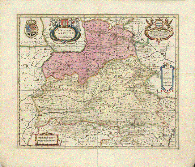
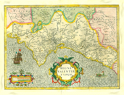
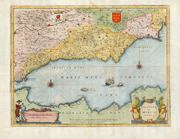
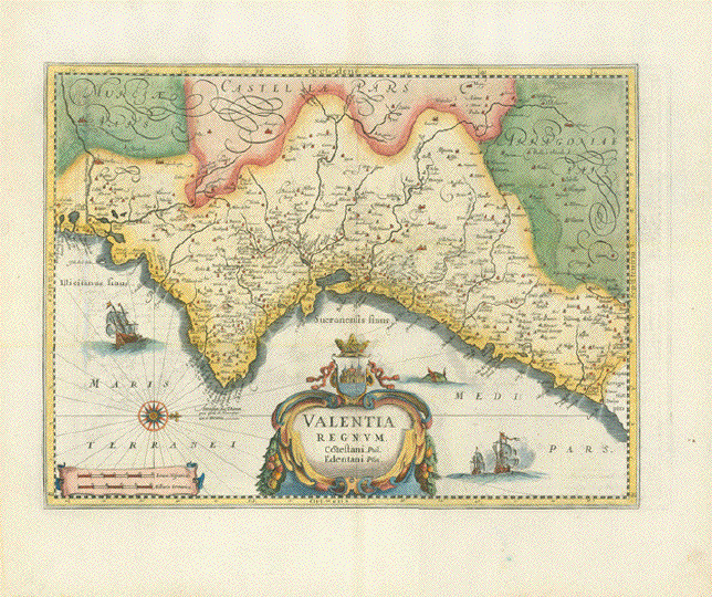
Antique Maps of Spain

Take a look at a selection of our historical maps of Spain. If you are
looking for a particular map, or a special town or city on the maps; please
contact us.

Hablamos Español.

Ordering and Payment

Lieferbedingungen

Sale! Discount!

30% Discount on All maps with a ESPAÑAMAPA number on this page!

Take 30% off the listed price. !

Visit us at the following sites:

https://lovelyantiqueprints.com

twitter.com/philographikon2

"Valentia Regnum. Costestani. Ptol. Edentani Plin."

West-oriented copper engraved map by Joan Blaeu (1596-1673)

Hand-colored copper engraving.

Reverse side: Text in the English language

English language edition. Amsterdam, 1665

Map shows the province of Valencia (Spain). Decorative title cartouche, sailboats and a sea monster

When folding the map at time of printing the still moist printing ink left a faint mirror-inverted print image on the opposite half of map. Since this effect is very faint, it is hardly disturbing, yet is considered in pricing this map.

Attractive hand color, wide margins. Reverse side has text in English

35,3 x 47,8 cm (ca. 13.9 x 18.8")

$ 250.00 (minus 30% discount = $ 175.00)

Order Nr.ESPAÑAMAPA256485


ãGranata et Murcia Regna"

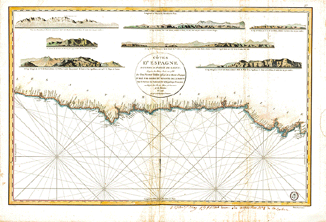
Hand-colored copper etching. Published by Willem Janszoon Blaeu First published in Amsterdam, 1642

This map was probably published in a book (and definately not in Blaeu's atlas)

While appearance and measurements are exact, It differs from the original Blaeu map on several counts: Paper is clearly ca. 1720. Explanitory text on reverse side is missing. Map has several vertical and horizontal folds to fit a smaller book size.

We have discussed this with several high-class colleages, none of whom knew the answer to the question: Who published this map? Since the plate was in the possession of the Blaeu family and their heirs, the map must have been printed in the house. Was a privileg given to someone? Did an employee print with or without permission? I myself and none of the juditious and experienced colleages I asked has seen such a map before.

Reverse side has in black hand-written ink: N. 192 in the style of writing as was habitual around 1700.

Be it as it is, it seems to be rather a rare piece.

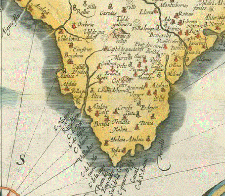
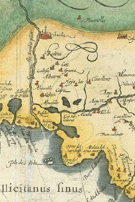
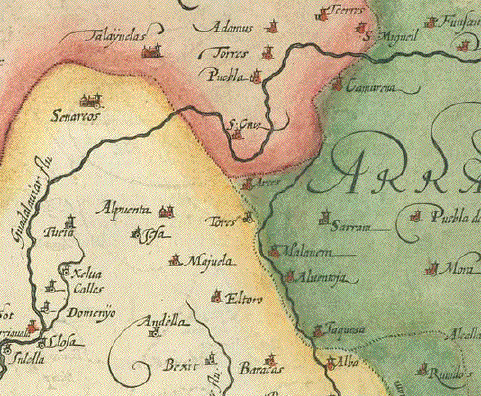
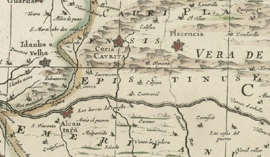
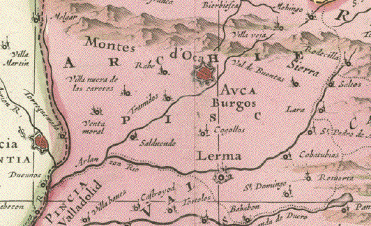
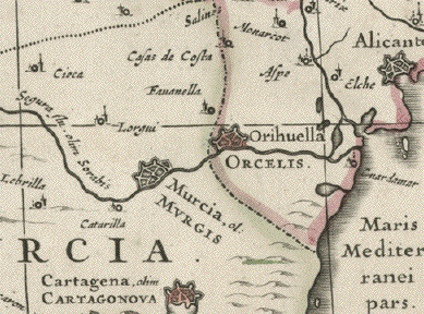
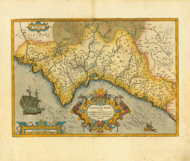
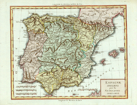
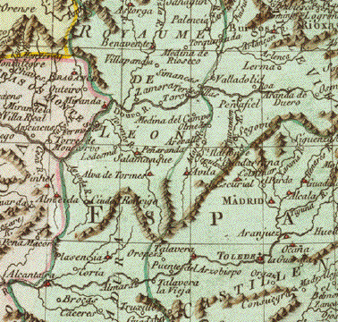
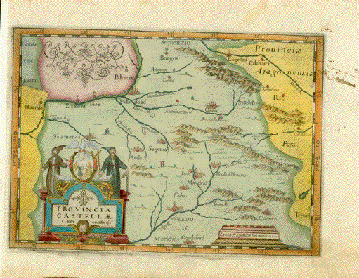
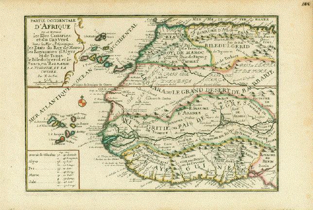
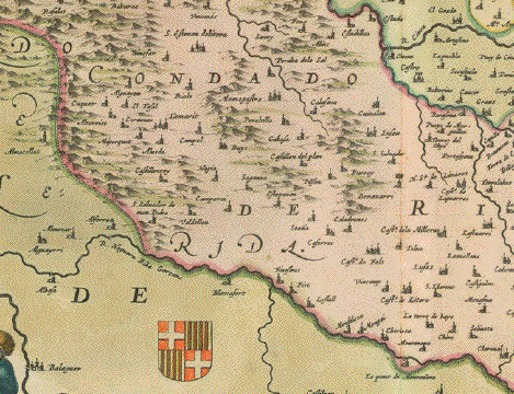
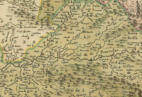
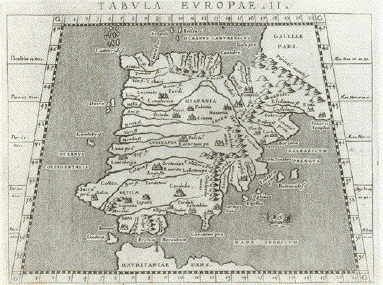
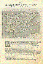
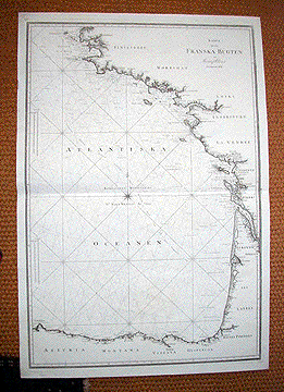
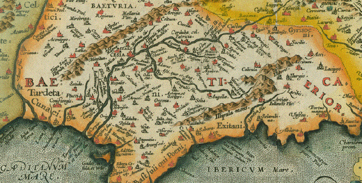
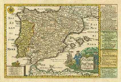
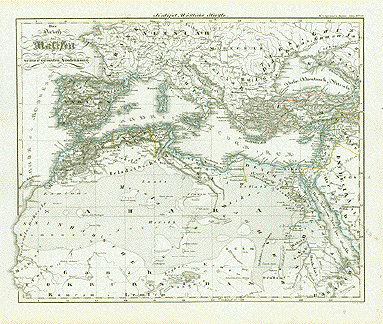
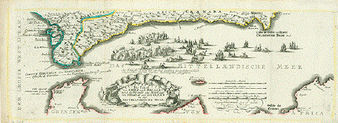
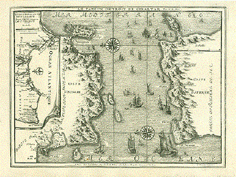
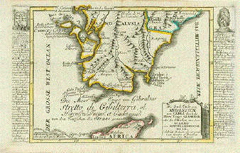
Map shows Southern Spain from just west of Gibraltar to Alicante on the Mediterranean and on a line north of the river Guadalquivir Sevilla via Cordoba - Andujar - Montiel. The North African coastline is shown from Tanger to east of Oran.

Condition: As mentioned several horizontal and vertical folds. Horizontal centerfold has been reenforced.

Upper margin has two repaired holes.

37,5 x 49,3 cm ( 14.7 x 19.4 ")

$ 360.00 minus 30% Discount = $ 252.00

Order Nr. ESPAÑAMAPA237740


"Utriusque Castilliae nova descriptio apud G. Valk et P. Schenk"

Copper engraving map Jan Jansson after G. Valk and P. Schenk.

Published ca 1680. Original hand coloring.

Map is dedicated to Henrico de Reede de Renswoude in Amsterdam.

Lower left and right margin corners are missing.
Centerfold has been partially reinforced on the reverse side.
Light parallel fold along centerfold.
A few signs of age and use. Reverse side is blank

Map image: 41 x 49.5 cm ( 16.1 x 19,4")

$ 460.00 minus 30% Discount = $322.00

Order Nr. ESPAÑAMAPA250431


ãRegni Valentiae Typus". Province of Valencia, Spain. Copper etching from the atlas by J. Janssonius. Original hand coloring. Amsterdam, ca. 1650.

Map shows coastline of the province of Valencia and the hinterland. Two decorative cartouches, ship and sea monster. Riverse side text in German.

General age toning. Wide margins. Very attractive map. Vertical centerfold.

35.2 x 47.5 cm (13.9 x 18.7").

$ 580.00 minus 30% Discount = $ 406.00

Nr. ESPAÑAMAPA1631


"Valentiae Regni olim Contestanorum si Ptolemaeo, Edetanorum si Plinio Credimus Typus"

Copper engraving map from a rare Abraham Ortelius edition. Published in Antwerp. Dated 1584

but may have been later. Ortelius (1527-1598) was known as the Ptolomeus of the 16th Century.

The map has original hand coloring which is shown by the green areas on the reverse side of the map.

The text on the reverse side is Italian.

In the upper left is Murcia and in the Upper right is Teruel. Very decorative cartouche.

Map is in good condition with pleasant natural age toning and normal signs of age and use in margins.

The vertical centerfold has been reinforced on the reverse side. (see scan above).

Map image; 35 x 49 cm (13.7 x 19.3)

$ 1250.00 minus 30% Discount = $ 875.00

Order Nr. ESPAÑAMAPA253703


ãBalearic Islands Majorca & Minorca". Mallorca and Menorca. From Spanish Government Surveys, 1890-95. Published in London, 1897 and corrected in parts in 1901.

Lithographed map by Edward Weller, publisher, lithographer, cartographer.

A very large detailed map of these two Balearic islands (includes Cabrera). Mapped is also the telegraph cable between the two big islands and the depths of the Mediterranean around them. A highly interesting rare map in almost excellent condition.

Page size: 68.5 x 101,3 cm (27 x 40").

$ 1400.00 minus 30% Discount = $ 980.00

Order Nr. ESPAÑAMAPA1636


Iberian Peninsula. -"Das ander buch Hispanien Beschreibung mit seinen kuenigreichen / landschafften und Stätten irem von sitten / gebreuchen der alten und neuwen Spaniern"

(Spain (and Portugal), her kingdoms, landscapes, and towns, about the customs and traditions of ancient and modern Spaniards)

Miniature map, published in "Cosmographia" by Sebastian Münster (1488-1552)

Basel, 1553

German language. Related text print (German) below map. Verso text print is unrelated.

General age toning. Margins stained. Map image: very good condition.

Map: 7,5 x 13,5 cm (ca. 3 x 5.3")

Page size: 31 x 20 cm (ca. 12.2 x 7.8")

$ 90.00 minus 30% Discount = $ 63.00

Order Nr.ESPAÑAMAPA253185


"Espagne Moderne pour la Geographie comparee"

Hand-colored copper engraving published ca 1785. Anonymous.
Fine map of Spain and Portugal with topographical details.
Very good condition.

Map image: 22.5 x 28 cm (8.8 x 11")

$ 125.00 minus 30% Discount = $87.50

Order Nr. ESPAÑAMAPA252967


"Cotes d'Espagne Asturies et Partie de Galicie d'après les Plans levées en 1788 par Don Vicente Tofino Officier de la Marine d'Espagne publie par Ordre du Ministre de la marine pour le Service des Vaisseaux de la Republique Francaise au Depot des Cartes, Plans et Journaux de la Marine 1793"

Hand-colored copper etching by Bouclet. Published on behalf of the French Ministry of the Marine. Paris, 1793

Map reaches from Cabo Prieto in the east to Cabo Ortegal, the northernmost landmark of Spain. There are 7 coastal elevation profiles shown.

Map has several vertical creases near centerfold and on right side. There are traces of age and use in margins. Lower right margin has black ink hand writing. Small piece of right margin has been added. Some fraying on margin edges.

57 x 86,3 cm (ca. 22.4 x 34")

$ 1500.00 minus 30% Discount = $ 1050.00

Order Nr.ESPAÑAMAPA248446


"Cotes d'Espagne Guipuzcoa, Biscaye et Pays de quatre Villes d'après les Plans levées en 1788 par Don Vicente Tofino Officier de la Marine d'Espagne publie par Ordre du Ministre de la marine pour le Service des Vaisseaux de la Republique Francaise au Depot des Cartes, Plans et Journaux de la Marine 1793"

Hand-colored copper etching by Bouclet. Published on behalf of the French Ministry of the Marine. Paris, 1793

Coastal chart from the French / Spanish border St. Jean de Luz / Hondarrabia to Cabo Prieto in Asturias. Very detailed coastline, San Sebastian (Donostia), Bilbao, Santander, just name a few of the major cities along the coast. Upper part of map has 8 coastal elevation profiles.

Very good condition. With only very minor traces of age and use. One little crease in the Atlantic near venterfold. One little foxing spot. Ink hand writing on lower right margin

56,5 x 86 cm (ca. 22.2 x 34")

$ 1800.00

Order Nr.ESPAÑAMAPA248447


"Provincia Castellae cum confiniss"

Copper etching by Giovanni ( Johannes )Montecalerio 1649 in modern hand coloring. Rare.

In the middle of this map is Segovia. Somewhat southeast is Madrid. Ciudad Real is at the center bottom of the map. At the top of the map in the center is Burgos.

Published in "Corographica descriptio Provinciarum et Conventuum Fratum Minorum S. Francisci Capucinorum Praedicatorum, Sacerdotum, Clericorum, Et Laicorum Universorum Eiusden Ordinis Collectio"

Copper engraving map. Contemporary hand coloring. Some spotting and creasing in margins. Ink spotting in right margin. Left margin has been widened. Not printed straight on paper.

Map image: 21.6 x 30.5 cm ( 8.5 x 12 ")"

$320,00

Order Nr. ESPAÑA 250408


No title. Group of islands. Text in German: "Canarien oder hunds inseln" (DOG ISLANDS - Canis

Canary Islands / Kanarische Inseln

Woodcut.

Published in "Cosmographia" by Sebastian Muenster (1488-1552). German edition

Basel, 1553

Sebastian Muenster writes about the Canary Islands: ÉInsulae Fortunatae (The Happy Islands) are now called Canry Islands or Dog Islands - Latin: Canis = Dog), because the indigenous people possess so many dogsÉ

The name Dog Islands did not last very long, however.

Light general age toning. Reverse side with a woodcut showing a man breaking a large rock of salt into pieces.

Island image: 6,8 x 13,5 cm (ca. 2.7 x 5.3")

Page size: 29,5 x 19 cm (ca. 11.6 x 7.5")

$ 120.00

Order Nr.ESPAÑAMAPA253161


"Partie Occidentale d'Afrique ou se trouvent les Isles des Canaries et du Cap Verd dans la Mer
Atlantique des Etats du Roy de Maroc, les Royaumes d'Alger et de Tunis le Biledulgerit et 
le Saara, en Barbarie, La Nigritie, et la Guinee"

North-west Africa with the archpelagos of the Canary Islands and of the Cape Verde Islands.
The Tropic of Cancer running right through this map.

Copper etching with original borderline hand coloring by Nicolas de Fer (1646-1720)

Published in "Petit et nouveau atlas". Paris, 

Very nice colors. Minimal traces of age and use. Good condition.
Old and-written page number in upper rght corner.

Map image: 22 x 32 cm (ca. 8.7 x 12.6")

$190.00 minus 30% Discount = $ 133.00

Order Nr. AFRICAMAP249982 


"Episcopatus Balbastrensis Ribagorca Comit. et Sobrarbe"

Copper engraving by Joannes Bleau and Joanne Baptista Labanna.

Published 1664. Original hand coloring. The crown has gold highlighting in the decorative catouche.

Map shows northern Spain around Huesca. In the lower right is the Valle de Aran.

No text on reverse side.

Map is attractive with signs of age and use. Some light browning and spoting.
especially in margins. Vertical centerfold.

Map image: 38 x 53 cm ( 14.9 x 20.8 ")

$ 580.00 minus 30% Discount = $ 406.00

Order Nr. ESPAÑAMAPA252414


No Title

Steel engraving 1870. From "Hand-Atlas über alle Theile der Erde und über das Weltgebäude" by Adolf Stieler.

On the left side is a detailed inset of Cadiz. In the lower left is Lisabon and the surrounding area. In the lower center is a plan of Madrid.

Original outline coloring. Vertical centerfold. Very good condition except for a small repaired tear on centerfold in lower margin.

30.5 x 37 cm ( 12 x 14.5 ")

$ 125.00 minus 30% Discount = $ 87.50

Order Nr. ESPAÑAMAP235791


"Tavola della Spagna, Seconda dell'Europa" - Spain and Portugal (Iberian Peninsula)

Copper etching after Claudius Ptolemaeus published in ãGeografia cioe Descrittione Universale della Terra" Gio. Battista & Giorgio Galignani Fratelli. Venice, 1598

First edition in Italian prepared by Giovanni Antonio Magini (1555-1617)

Clean. Only minimal traces of age and use.

Sheet size 27.5 x 19 cm (10.8 x 7.5")

Each of the maps: 13 x 17.2 cm (5.1 x 8.8")

Order Nr. ESPAÑA235806 SOLD

Reverse Side:

"Tavola dell'Ibernia, e dell'Albione, Prima dell'Europa" - Irelandf and Great Britain (England, Ireland and Scotland)

Copper etching after Claudius Ptolemaeus published in ãGeografia cioe Descrittione Universale della Terra" Gio. Battista & Giorgio Galignani Fratelli. Venice, 1598

First edition in Italian prepared by Giovanni Antonio Magini (1555-1617)


"Discrittione Del Regno Della Spagna" Spain and Portugal (Iberian Peninsula)

Copper etching published in ãGeografia cioe Descrittione Universale della Terra" Gio. Battista & Giorgio Galignani Fratelli. Venice, 1598

First edition in Italian prepared by Giovanni Antonio Magini (1555-1617)

General age toning. Minor traces of age and use, especially in lower right margin of text.

Sheet size: 28.5 x 19 cm (11.2 x 7.5")

Map size: 12.5 x 17.2 cm (4.9 x 8.8")

$ 380.00

Order Nr.ESPAÑA235807


"Spanien und Portugal 1849" Steel etching by H. Bornmueller from "Neuster Zeitungs Atlas. Alter und Neuer Erdkunde" by J. Meyer, ca 1860. Original outline coloring.

Very detailed map of the Iberian peninsula. In the lower right is a detailed plan of Madrid.

Clean map in fine condition.

21 x 26.3 cm ( 8.2 x 10.3 ")

$ 75.00

Order Nr. ESPAÑAMAPA1637


"Hispania" Steel etching from "Neuster Zeitungs Atlas. Alter und Neuer Erdkunde" by J. Meyer, ca 1860. Original outline coloring.

Very detailed map of the Iberian Peninsula. The area outlined in blue is Lusitania - Portugal at the time.

Clean map in good condition.

21 x 26.3 cm ( 8.2 x 10.3 ")

$ 70.00 minus 30% Discount = $ 49.00

Order Nr. ESPAÑAMAPA1647


"L'Espagne suivant les derniers Observations de lÄAcad. Royal des Sciences.."

Copper engraving map by Faure and Claude Buffier(1661-1737) in Paris.
Published ca 1739. From "Geographie Universelle: Exposee dans les differentes Metodes qui
peuvent abreger l'etude & faciliter l usage de cette science..."

Hand coloring. Very minimal signs of age and use. Two vertical folds to fit original book size.

Map image: 13.5 x 17.5 cm ( 5.3 x 6.8")

$ 95.00

Order Nr. ESPAÑAMAPA252966


"Catalonia"

Very detailed copper etching map of Catalunya ( Catalonia ) circa 1640 by Willem ( Guillelmus ) Blaeu in Amsterdam.

Latin text on the reverse side about northeastern Spain. This map is of great interest because so many
towns and topographical details are shown with old names.

The map has repairs on the lower margin and on the centerfold that have been very professionally done
so that they are hardly visible except against the light. The two upper margin corners
have been repaired so that they are not visible except against the light.Very minor spotting and a few creases.
A very light smearing of the ink in a few places. The map has a fine appearance overall.

Map image 38 x 50 cm ( 14.9 x 19.6 ")
Page size: 50 x 58 cm ( 19.6 x 22.8 ")

$ 720.00

Order Nr. ESPAÑAMAPA150848


"Karta Oefver Nord Westra Kusterne Af Spanien och Portugal Efter Atlas Maritimo de España" Copper engraving by Fr. Akrel after Gustaf Klint of Stockholm, dated 1803. SELDOM!

This map shows the Mar Cantábrica at the top beginning on the right with Cabo de Peñas and Aviles. It reaches as far south as St. Ybes and Troja south of Lisabon. In the upper right is a detailed inset titled "Hamnarne Vid Ferrol och Coruña". This shows very great detail including the depths of the water. In the lower right is an inset titled "Inloppen Till Lisabon"also with great detail. In the sea is a windrose and compass measurements.

Map has a horizontal fold. There are a few creases that were in the thick paper. In the lower right is some very light scattered spotting.

96 x 64.3 cm ( 37.7 x 25.3 ")

$ 1790.00

Order Nr. ESPAÑA MAPA 1590


(Detail of the map)

"Karta Oever Nord Westra Kusterne Af Spanien och Portugal Efter Atlas Maritimo de España".

Copper engraving by Fr. Akrel after Gustaf Klint of Stockholm, dated 1803. SELDOM!

This very large map shows part of the Atlantic Coast of France and northern Spain. At the top of the map is Brest. The many small islands along the coast are shown in careful detail. In the lower left is Cabo de Peñas, Isla Erbosa and Aviles. In the Atlantic is a windrose and the various compass measurements. An interesting map for sailors and coastal inhabitants.

Map is printed on very strong paper. The map is very clean. Horizontal centerfold. A few hardly noticeable creases, some of which are simply in the paper.

96 x 65.3 cm ( 37,7 x 25.7 ")

$ 1790.00

Order Nr. FRANCEMAP1205


"Compendiosa Hispaniae Representatio Spanier Mit Angraenzenden Laendern" Copper engraving ca 1760. Original hand outline color.

Map shows political divisions of the time as well as major rivers.

Map has vertical fold. A few scattered spots. Upper margin corners are browned. Small tear on centerfold on lower margin edge.

15 x 21 cm ( 5.9 x 8.2 ")

$ 85.00

Order Nr. ESPAÑAMAPA1586


"Hispaniae Veteris Descriptio. Ex. conatibus Geographicis Abrah. Ortely." Copper engraving from the atlas:"Theatrum Orbis Terrarum" by Abraham Ortelius, dated 1586. Hand coloring.

Very interesting and decorative map for those interested in the earliest inhabitants and settlements of the Iberian penninsula. In the lower right is an inset with the names of the variuous inhabitants and the towns and cities of the earliest times. Above this inset is another small inset of the region of Tartetes near Cadiz.

Map has small signs of age and use. One minor worm hole in image.

Light natural age toning and minor spots in margins. Centerfold has been reinforced.
On the reverse side are a few very old ink numbers and words.

One of the most interesting maps of Spain.

37.2 x 48.7 cm ( 14.6 x 19.1 ")

Order Nr. ESPAÑAMAPA251123 SOLD


"No Title" . Woodcut from "Claudii Ptolemaie Alexandrini.....Geographiae", by Martin Waldseemüller-Laurent Fries. Published in Strasbourg, 1525. (After editions of 1513 and 1522 by Waldseemüller).

This very attractive Potolemic map shows the Iberian penninsula with the Balearic Islands. On the sides are narrow borders showing degrees of latitude, that are not drawn on map. At the bottom is an Italian distance legend. Verso: Text in Latin.

Map has a wider margin than shown and has light toning. There is a small repair in lower margin along centerfold. Small tears in margins and margin corners have been repaired. Overall condition is Very Good for its age.

29 x 42 cm ( 11.8 x 16.5 ")

$ 2400.00

Order Nr. ESPAÑAMAPA1526


"Isles des Canaries ou Fortunatae". Copper etching published at J.Covens and C. Mortier. Amsterdam, ca 1730. Original hand coloring.

Attractive map showing the Canary Islands, Madeira and Puerto Santo, even of the Salvage Islands which are no more than a few rocks in the Atlantic is actually a sea chart. In the center of the map a windrose showing us north and around it, like a spider web, the navigational lines criss-crossing the entire map, but symetrically so. In the lower right corner is a bit of the African coast with the towns of AreaMonesti, Cap de Non and Albach.Two mermaids hold the title cartouche. And on their far away destinations are five sailships.

Map has overall toning and some scattered spotting on wide margins. Browning of margin edges. A few trivial spots on image. Small repaired tear on lower margin edge on centerfold.. Strong paper.

37.5 x 48.5 cm ( 14.8 x 19 " )

Order Nr. ESPAÑAMAPA241322SOLD


"Insulae Canariae olim Fortunatae Dictae"

Canary Islands which used to be called Happy or Fortunate Islands

Copper etching by Gerard Valck ind Peter Schenck. Very attractive

original hand coloring.

Amsterdam, ca. 1700

One thin paper spot size of a dime (1 cm diameter) in ocean near (north

of) Lanzarote and Fuerteventura. Otherwise very good.

42 x 52 cm (ca. 16,5 x 20,5")

$ 1200.00

Order Nr. ESPAÑAMAPA241304


Canary Islands. - "Insulae Canariae Alias Fortunatae dictae"

Copper etching by Joan Blaeu (1596-1673).

Original hand coloring. Verso blank.

Repairs in centerfold. Traces of age and use.

38 x 49,5 cm (ca. 14.8 x 19.3")

ESPAÑAMAPA241305SOLD


"Spanien und Portugal". Copper etching by Johann Christian Schreibern (1676-1746). His atlas was published after his death ca. 1750 in Leipzig. Original hand coloring.

Map shows the Iberian peninsula as well as southern France and northern Africa. On the right side are explanations matching letters on map.

Map has overall light age toning and scattered light spots. Browning on margin edges. Handwritten number in ink in upper right margin corner. General condition is Better than Good.

16.5 x 25.2 cm ( 6.5 x 9.9 ")

Order Nr. ESPAÑAMAPA1554SOLD


"A correct Chart of the Bay of Biscay, Part of the Western Ocean and Mediterranean Sea describing the Coasts of Spain and Portugal with Part of France from Morlaix to Valencia Done from the latest and best DiscoveriesÉ"

Portolan map of the Iberian Peninsula (and Western France including the Bretagne)

Type of print: Copper etching

Engraver and artist: Richard William Seale (1703-1762)

Published in: "Tindal's Continuation of Rapin's History"

London, ca. 1745

Condition: Several vertical and horizontal folds to fit smaller book size. These folds are well subdued and not disturbing. Lower margin has been widened in lower right. Some short tears have been repaired. Very clean and the image very well preserved.

47 x 37 cm (ca. 18.5 x 14.5")

Order Nr.ESPAÑAMAPA238898 SOLD


GIBRALTAR

ãPlano Geométrico de lka Bahia de Algeciras y Gibraltar"

Copper etching by Juan Antonio Salb(v)ador Carmona (1740-1805). Lettering by Santiago Drouet.

Beautiful original hand coloring.

Published in Sea Atlas by Rear Admiral Vincente Tofiño San Miguel (1732-1795)

Dated 1786

Very impressive birs eye view of the Bay of Algeciras and Gibraltar. With a decorative Title and explanatory cartouche and a decorative mileage cartouche.

Wide Margins. Some ligtht spotting. Several vertical and horizontal folds because of sheer size.
Light creasing on folds.

78 x 52,5 cm (ca. 30 x 20"

$ 1250.00

Order Nr.ESPAÑA238050


GIBRALTAR

ãVue de la Montagne de Gibraltar et de la Ligne Espagnole avec Algesiras et du Detroit come aussi de la Cote de l'Afrique"

Underneath French title: German title in translation

Copper etching by Johann Michael Probst.Augsburg, 1782

Dedication to Prince Beda Abbot in St. Gallen, Switzerland. ãOrdine Supremo della Santissima Annunziata" in French and in German

Dedicated by Baron Thurn and his Regiment-Lieutennant Karl Kache

Splendid bird's eye view of Gibraltar in superb original hand-coloring

Legend on left in French. Legend on right in German

Very good condition. Very light general age toning

RARE, especially in this condition!

Print shows the ãGreat Siege", when, between1779 and 1783 Spanish and French troups tried in vain to wrest Gibraltar from the British.

48 x 55,5 cm including legend (ca 18.9 x 21.9")

$ 1600.00

Order Nr. ESPAÑA238045


ãAndaluziae Pars. Zee Custen van Andaluzien ghemaeckt naet wesen en ghedente, met zyn Rivieren en Havenen"

Copper etching by Jan van Deutecum. from ãSpieghel der Seefaehrt" by Lucas Janszoon Waghenaer. Antwerpen, 1585. Reverse side tex in Dutch.

One of the earliest sea charts ever. Two Renaissance cartouches (title and mileage), a wind rose, sailships and a sea monster add to the very charming appearance of this very rare map. Thick velim indicates first edition.

General light age toning. A few minor blemishes and traces of age and use.

32.5 x 51 cm (12.8 x 20").

$ 3800.00

ESPANA MAPA237768


Huesca

"Episcopatus Oscensis vulgo Huesca" Copper etching by I. Baptista Labanna for Jan Jansson (1588-1664). Published ca 1630. Modern hand coloring.

This east oriented (east is at the top) map has Huesca in the center. In the upper left is Fuentes on the Río Ebro and in the upper rightis the Val de Anso. Clearly visible in the lower right are part of the Pyrenees. Near the title cartouche in the lower left is the Río Cinca.

Map was once mounted on a bit heavier paper. There is minimal spotting in the margins, otherwise clean. General condition is Almost Very Good.

38.1 x 52 cm ( 15 x 20.5 ")

$ 580.00

Order Nr. ESPAÑAMAPA1546


"Isles Canaries." Copper engraving by Andre after M. Bonne ca 1780. Hand coloring.

Map shows the Canary Islands with topographical features.

Map has a repaired tear on upper margin edge and a few scattered spots. Vertical centerfold.

23.5 cm x 34.8 cm ( 9.25 x 13.7 ")

$ 180.00

Order Nr. ESPAÑAMAPA235161


ãDas Reich der Kalifen in seiner groessten Ausdehnung". (The caliphs empire. Largest extension.) Steel etching by W. Behrens. 1846. Faint borderline coloring.

Clean, except for traces of age and use in margins. Two tiny repaired tears in margins.

Page size: 37 x 43.8 cm (14.6 x 17.2").

$ 180.00

Order Nr. MEDITERRANEAN1363


"Fuerstenthums Catalonien Nordoestlicher Theil" Copper engraving by Franz Johann Joseph von Reilly, 1789. Original outline coloring.

On the coast of the Mediterranean, the map extends from Collioure (France) in the north to Lobregat south of Barcelona. In the upper left Ventola and Tregura.

Map has a few light spots in margins.

23 x 25.5 cm ( 9 x 10 ")

$245.00

Order Nr. ESPAÑAMAPA1617


"Fuerstenthums Catalonien Nordwestlicher Theil". Copper engraving by Franz Johann Joseph von Reilly, 1789. Original outline coloring.

Almost in the center of this map are Tremp and Claverol. At the top of the map are the French towns of Marden and Artigues. In the lower right corner is part of the region of Manresa with the towns of Artes, Avina and San pardor. To the right of the title cartouche is Lusas, Balaguer and Trago.

Map has very wide margins. Very light browning on margin edges.

19.8 x 25.5 cm ( 7.8 x 10 ")

$245.00

Order nr. ESPAÑAMAPA1616


"Des Fuerstentums Catalonien Suedwestlicher Theil". Copper engraving by Franz Johann Joseph von Reilly, 1789. Original outline coloring.

This map shows the southwest part of Cataluña. In the lower are the towns of Alcanar and Valdecona. The Mediterranean coast reaches as far north as the Remola Lake, Multra Lake and Candlesans near Cabo Margos. In the upper right corner are the towns of Rocafort, Caldes and Villatorrada. In the upper left corner to the right of the cartouche are the towns of Fraga, Segria and Lerida.

Map has very wide margins and is very clean except for a spot in the lower margin.

23 x 26 cm ( 9 x 10.2 ")

$ 245.00

Order Nr. ESPAÑA MAPA 1555


ãGallaecia Regnum". (Spanish Galicia.) Copper etching by F. fer. Ojea. Published by Blaeu. Amsterdam 1647. Outstanding original hand coloring!

Attractive, decorative map of the northwest corner of the Iberian Peninsula. Two cherubs hold royal Galician coat of arms with a monstance containing the holy of holies, the body of Christ our Lord. Neptune stepping from the Atlantic holding the maop's title cartouche.

Lively sailship staffage. Reverse side is printed ( in Latin ). Text related to Galicia.

Elegant general age toning. The map is in excellent condition. The original colors marvellous! Very wide margins. Vertical centerfold.

38 x 49.6 cm (15 x 19.5")

$ 1200.00

Order Nr. ESPAÑAMAPA1635


'Die Fahrt von Cadiz nach Malaga durch die Strasse oder Meer-Enge von Gibraltar aus dem Ocean in daß Mittellaendische Meer'.

Copper engraving by Gabriel Bodenehr ca 1705. Original outline coloring.

Map has vertical folds to fit book size. Light yellow line in margins. Fine crease in upper margin.

17 x 49.5 cm (6.7 x 19.4 ")

$ 360.00

Order Nr. ESPAÑAMAPA1644


"Spagna Secondo le ultime Osservazioni dell'Accademia Reale delle Scienze". Copper etching from
the Italian edition atlas of the Royal Academy of Sciences in Paris, 1720. Modern hand coloring.

This decorative map of Spain shows the major towns and cities as well as regional divisions.

Upper and right margins have been widened. Light creasing on lower left margin corner. Overall condition is Better
than Good.

13 x 16.5 cm ( 5.1 x 6.5 ")

$ 155.00

Order Nr. ESPAÑAMAPA1528


"Ferrol and Corunna" Copper engraving by J. Luffman. dated 1800.

Plan of the two ports in Galicia.

Map is in good condition. The leftmargin is very wide and has three binding holes near margin edge.

15 x 12.2 cm ( 5.9 x 4.8 ")

$ 145.00

Order Nr. ESPAÑAMAPA1640


"Le Fameux Detroit de Gibraltar" Copper engraving by Nicolas de Fer ca 1700.

Very interesting map of the Strait of Gibraltar. Notice the decorative inset in the upper left showing the coast of Algarve and Andalucia. In the upper right is the peninsula of Ceuta. There are many kinds of historical sailing vessels in the Strait. In the lower left is Cadiz.

Map is clean and in good condition.

23.2 x 31.2 cm ( 9.1 x 12.2 cm )

$ 420.00

Order Nr. ESPAÑAMAPA1639


"Die Sud Cuest von Andalusien von Cadiz durch die Meer Enge Gibraltar oder die Strasse aus dem Oceano ins Mittellaendische Meer" Copper engraving by Gabriel Bodenehr ca 1705. Original hand coloring.

The Strait of Gibraltar and the southern tip of Spain is the theme of this detailed map. On both sides of the map is very detailed historical information (in German) about the places shown on the map. At the bottom is a bit of northern Africa with Tangier and Ceuta.

Map has a hardly visible vertical centerfold. Map is in good condition.

16.5 x 27.3 cm ( 6.4 x 10.7 ")

$ 225.00

Order Nr. ESPAÑAMAPA234877


"Valentia Regnum" Copper etching in contemporary hand coloring from the pocket atlas by A. Ortelius. Antwerp, French edition ca 1620.

This early east-oriented map shows the region of Valencia extending as far north to the Cernia River and to Atasaia de Pinet in the south. In the upper right of the map is part of Aragon. On the reverse side is text in French about Cadiz.

Upper margin is narrow. A few minor signs of age.

7.5 x 10.5 cm ( 2.9 x 4.1 ")

Order Nr. ESPAÑAMAPA234798 SOLD


"Andalvsia". Copper etching in modern coloring from the pocket atlas by A. Ortelius. Antwerp, Latin edition 1587.

Historical map of Andalucia from the Portuguese border on the left to Cadiz at the bottom. In the upper right is Córdoba and S. Nicolas del puerto. On the backside is text in Latin about Valencia.

Very minor spotting in margins. Crease in left margin.

7.3 x 10.1 cm ( 2.8 x 3.9 ")

$ 140.00

Order Nr. ESPAÑAMAPA1564


This map is identical to the map except that the
coloring is different. There is a water stain in the lower right
corner which does not affect image and light browning on edges.
One brown spot on upper edge.

$ 180.00

Order Nr. ESPAÑAMAPA1515


"Cartagena". Copper engraving by Joseph Roux from "Recueil des principaux plans des ports et rades de la Mer Mediterranée", ca 1780.

At the top of the map is Cartagena. To the left is Cabo de las Palomas and at the bottom is Isla de Ascombrera.

Map has repair on lower right margin corner. Binding marks in left margin.

12.5 x 19.2 cm ( 4.9 x 7.5 ")

$ 90.00

Order Nr. ESPAÑAMAPA1568


"Hispanien nach aller seiner gelegenheit in Bergen/Stetten/Voelkern/Koenigreichen/Waessern und Inseln". Copper etching by Sebastian Muenster ca 1550. Modern hand coloring.

Very early map of the Iberian Penninsula with the Baleares to the east . In the Medeterranean are two historic sailing vessels and a spouting sea monster. On one half of the backside is a decorative title and cartouche.

Map has some light, scattered creasing that is hardly visible. Some scattered spotting, especiall in margins. Light crease parallel to vertical centerfold. Repair on lower margin edge on centerfold. For its age this map is in Good condition.

30.5 x 35 cm ( 12 x 13.7 ")

Order Nr. ESPAÑAMAPA1560 SOLD


"Of Spain". Copper etching from "Geography rectivied" by Robert Morden. London,1688.

Left margin widened. Verso text description of France. The condition is good.

12.5 x 14 cm ( 4.9 x 5.5")

Order Nr.ESPAÑAMAPA1497SOLD

Cadiz

" Gades" (Cadiz) Copper etching in modern coloring from
the pocket atlas by A.
Ortelius. Antwerp, 1598.

Attractive map of city and bay of Cadiz with a regatta of
sailboats. Condition near Very Good. Verso text in French.

7.8 x 10.6 cm ( 3.1 x 4.2")

Order Nr. ESPAÑAMAPA1498SOLD


No Title

Copper engraving ca 1780. Original hand outline coloring.
Map has two vertical folds to fit book size. Wide margins with a few light, scattered spots.

9.5 x 12.2 cm ( 3.7 x 4.8 ")

Order Nr. ESPAÑAMAPA1583 SOLD


More Antique Maps of Spain >>>>>>>

Hablamos español.

Views of Spain

Corrida de Toros - Bullfighting

MAPS: Maps of many countries from the great cartographers of the last 500 years.

PRINTS OF THE ENTIRE WORLD: Antique town and city views.

BOTANICAL PRINTS

BIRDS

Email

Methods of payment

Terms of sale - Lieferbedingungen

Return to Home Page

Impressum

Datenschutz

© Rainer Rauhut