Antique Maps of the Middle East

View our selection of historical maps of the Middle East. Each map is illustrated and carefully described. Please contact us if you are looking for a specific map.

Ordering and Payment

"Imperii Persici Delineatio". Copper etching by Petrus Schenk. Amsterdam, dated1705. Beautiful original hand coloring.

This map was designed after the geographic descriptions of the famous orientalist Adrian Reland (1676 - 1718).

Map shows the Persian Empire at the turn of the century ca 1700. Very attractive original hand coloring. Two uncolored baroque cartouches, one with the map printing date: MDCCV = 1705.

Map has attractive general age toning. Typical for original coloring: Reenforcement along the green border line coloring (against oxidation). In general: a very fine and attractive map.

45.6 x 56.4 cm (18 x 22.2")

$ 650.00

Order Nr. MIDDLEEAST1868


"Iran und Turan, Persien, Afghanistan, Beludschistan, Turkestan" Steel engraving by C. Metzeroth after the new design by F. von Stuelpnagel in 1843. Original outline coloring.

This very detailed map reaches from the Black Sea on the left to the Himalaya Mountains on the right. In the center is Khiwa south of the Aral Sea. At the bottom of the map is the Persian Gulf and Beludschistan (shown in blue).

Map has overall light age toning. Light browning and a few spots in margins. Vertical centerfold.

34.2 x 39.5 cm ( 13.4 x 15.5 ")

$ 145.00

Order Nr. MIDDLEEAST1878


“Kalifat, oestliche haelfte". (Eastern part of the Caliphat.) Steel etching. 1846. Original borderline coloring.

Map includes the entire Middle East and extends into Asia to the Ganges delta.

Insets: Al Dschesira. And: Irak Arabi.

Clean, except for minimal traces of age and use in margins.

Page size: 37 x 43.8 cm (14.6 x 17.2").

$ 180.00

Order Nr. MIDDLEEAST1879

The Place of Paradise
the Habitation of
Adam and Seth
And the
Land of Nod

Copper etching, ca 1770.
Modern hand coloring.
Very good condition.

28 x 18.7 cm ( 11 x 7.3 ")

$ 240.00

Order Nr. MIDDLEEAST1853


"Carte De La Perse, De La Féorgie, Et De La Tartarie Indépendante". Copper etching by André for Rigobert Bonne (1729-1795), published ca 1780.

In the upper left is part of the Sea if Azow and a little below the eastern part of the Black Sea. In the upper right is part of Tartarian China. In the lower right is Tibet and Bhutan. In the lower left is the Persian Golf.

Map has vertical centerfold. Very light browning along centerfold.

21 x 32 cm ( 8.2 x 12.5 ")

$ 225.00

Order Nr. MIDDLEEAST1865


“Arabie". Anonymous French copper etching. Ca. 1700.

Very detailed map of the Arabian peninsula, of Irak (south of Bagdad) and the Gulf of Basra.

This obvious book illustrating map has several vertical and horizontal folds in order to fit booksize. Map is clean except for attractive general age toning and minimal spots. Right margin partiallyadded.Lower margin narrow.

33 x 36 cm (13 x 14.2")

$ 450.00

Order Nr. MIDDLEEAST1877


“Antiquor Imperiorum tabula, in qua prae coeteris Macedonicum seu Alexandri Magni Imperium et Expeditiones exarantur". Copper etching by Robert de Vaugondy (1688 -1766). Very fine recent hand coloring. Paris, 1757.

Map centers on the Arabian Peninsula. Decorative title cartouche. Mileage cartouche and, in lower right corner, an inset showing a piece of India east of the Indus river.

Clean map (margins along edges a bit dirtied. Alongside centerfold insignificant creases. One additional vertical crease through the Red Sea. In general a beautiful map with few blemishes. Upper margin is narrower. Light browning on margin edges. Small creases in lower left margin corner.

48 x 63 cm (18.9 x 24.8")

$ 980.00

Order Nr. MIDDLEEAST1872


“Arabia, Egypt, Abyssinia, Red Sea etc." Copper etching by J. & G. Menzies for Thomson's New General Atlas. dated 1814. Original outline coloring.

Map centers on the Arabian Peninsula giving a lot more detail to places in the Golf Region and the Red Sea.

Clean with very ample margins. A few minimal spots in margins. Small repaired tear on upper margin edge. No significant blemishes to mention.

50 x 58 cm ( 19.6 x 22.8 ")

$ 650.00

Order Nr. MIDDLEEAST1873.


"Carte Des Premiers Ages Du Monde. Geographie Ecclesiastique De La TurquieDS'Asie, Et De la Perse." Copper engraving by E. Dussy for Robert D. Vaugondy, dated 1762. Original outline coloring.

This map shows the ancient regions with early names of people and places.

Map has wide margins. Vertical centerfold. Light browning on margin edges and a few trivial spots in margins.

23.7 x 24.2 cm ( 9.3 x 9.5 ")

$ 220.00

Order Nr. ASIAMINOR1837


"Carte De L'Empire Ottoman". Wood engraving from "Le Monde Illustre", 1860.

Very interesting historical map showing the Ottoman Empire. On the right is a detailed map of the Ear East.

Map has vertical centerfold with a bit of light graying on centerfold line. Reverse side is printed.

21.5 x 32.3 cm ( 8.4 x 12.7 ")

$ 85.00

Order Nr. ASIAMINOR1838


"Mission Stations of the A.B.C.F.M. ( American Board of Commissioners for Foreign Missions) in Turkey and Persia". Pen lithograph from "The Missionary Herald", 1868. Rare.

Interesting map that shows the various mission stations of the United Church. The mission stations are printed in bold letters. Major towns, rivers and mountains are shown. In the upper right is the Caspian Sea. In the lower right is the confluence of the Tigris and Euphrates Rivers. There is an extra page of text attached to the map with the names and activities of many missionaries.

Map has two vertical folds to fit book size. A few minor wrinkles. Light spot in lower right image and margin.

19 x 33.3 cm ( 7.4 x 13.1 ")

$ 145.00

Order Nr. ASIAMINOR1842


“Turcicum Imperium". Copper etching from the atlas by Frederick de Wit (1630 - 1706). Extremely beautiful original hand coloring. Amsterdam, ca. 1680

Very attractive map of the Ottoman Empire centering on the Arabian Peninsula.

Wide margins. Clean. Margins have some smudging along edges. Parallel to centerfold insignificant vertical folds. A few minor spots in margins. In order to prevent damage from oxidation, the original green color has been strengthed with Japan paper on the reverse side. Title cartouche also originally colored shows Sultan and administrators. Below them: Prisoners of war. Very nice map!

43 x 53 cm (16.9 x 21")

$ 1100.00

Order Nr. MIDDLEAST1874


"Turcicum Imperium. Tuerkische Reich". Copper engraving by M. Merian, ca 1650.

Finely detailed map of the Turkish Empire. Notice the detailed cartouche with the sultan in the center.

Map image is fine and clean. Light brown9ng od margin edges. Left and right margins are narrower. Vertical centerfold.

27.5 x 36 cm ( 10.8 x 14.1 ")

$ 340.00

Order Nr. MIDDLEEAST1871


“Imperium Turcicum in Europa, Asia et Africa..." Copper etching by Gerard Valk (1652 - 1726) and Leonard Valk. Amsterdam, ca. 1700. Original hand coloring.

Map shows Turkish Empire. Centering on the Arabian Peninsula. Lower left inset map: North African coast from Gibraltar to Tunisia.

Clean map. Good sized margins with some insignificant creases). Parallel creases to centerfold and some creases left from centerfold.

48.7 x 59.5 cm (19.2 x 23.4")

$ 850.00

Order Nr. MIDDLEEAST1875


"Carte De L'Arabie, du Golfe Persique, et de la Mer rouge; avec L'Egypte, La Nubia, et L'Abessine." Copper etching by Rigobert Bonne (1729-1795) for "Atlas de toutes les parties connues du globe terrestre" by Guillaume Thomas Francois Raynal (1713-1796). Published 1780 in Geneva. Modern hand coloring.

In the left center of the map is the Red Sea and the surrounding area with the names of major settlements and topography. In the upper right is the Persian Gulf. Surrounding the title cartouche is the Indian Ocean.

Map has vertical centerfold. Light creasing in lower margin and upper right corner. The map impression is a bit light.

21.4 x 32 cm ( 8.4 x 12.5 ")

$ 180.00

Order Nr. MIDDLEEAST1870


"Iran und Turan. Persien, Afghanistan, Biludschistan, Turkestan." Steel etching from "Neuster Zeitungs Atlas. Alter und Neuer Erdkunde" by J. Meyer, dated 1859. Original outline coloring.

Map extends from Armenia in the west to the Himalayas in the east. At the top of the map is Khirgaz. Hyderbad and Karachi are left of the information cartouche in the lower right.

Map image is clean. A few minor spots in margins.

18.3 x 24.8 cm ( 7.2 x 9.7 ")

$ 120.00

Order Nr. MIDDLEEAST1876


"Nuoua Carta del Regno di Persia". Copper etching by Isaac Tirion (1705-1765), published in Amsterdam ca 1750. Fine, modern hand coloring.

This map shows the various Perian kingdoms of the time. In the upper left is a bit of the Black Sea and Sea of Azov. In the upper right is part of Tartaria and the kingdom of Tashkent. In the lower right is the mouth of the Indus River.

Map has various folds to fit atlas size. Repaired tear on right margin edge reaching into yellow part of margin. Upper and right margins are narrow. Some spotting on left margin edge. Black ink from printing in lower margin. Overall condition is otherwise better than Good.

28 x 35.4 cm ( 11 x 13.9 ")

$ 445.00

Order Nr. MIDDLE EAST 1861


Persia
Afghanistan y Beluchistan.

Originally borderline-colored copper etching by Ramon Alabern, 1830.

This is one of the few maps of Persia that were printed in Spain. It reaches from turkestan in the north to the Indian Ocean in the south. In the upper left is part of Armenia. In the lower right is Kurachi and Hyderabad. In the center of the map is the region known as Khorasan.

Map is clean with wide margins. Vertical centerfold. In the lower margin are four worm holes.

31 x 41.5 cm ( 12.2 x 16.3 ")

$ 390.00

Order Nr. MIDDLEEAST1869


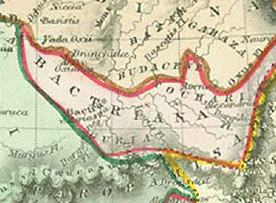
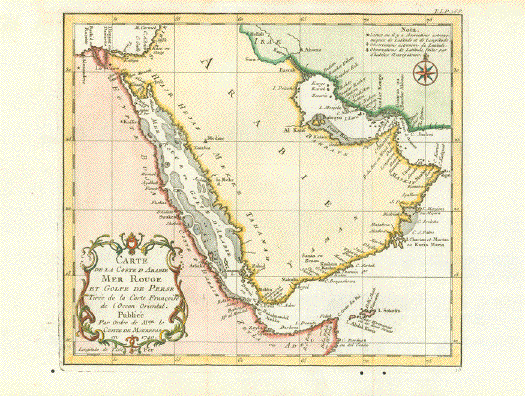
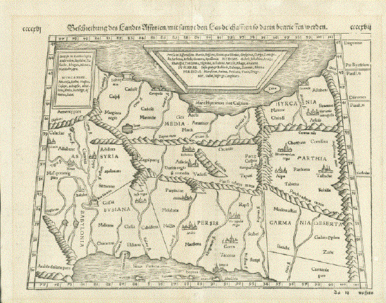
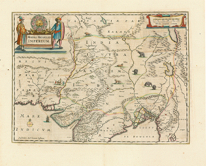
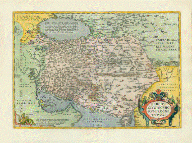
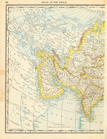
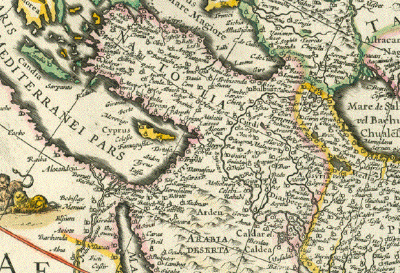
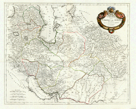
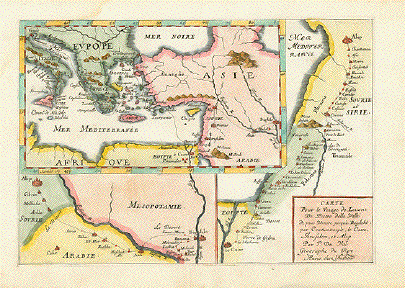
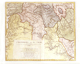
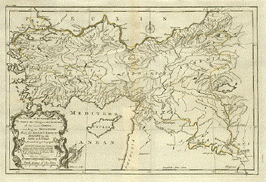
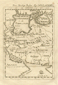
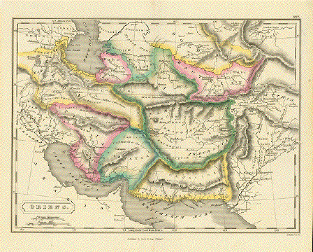
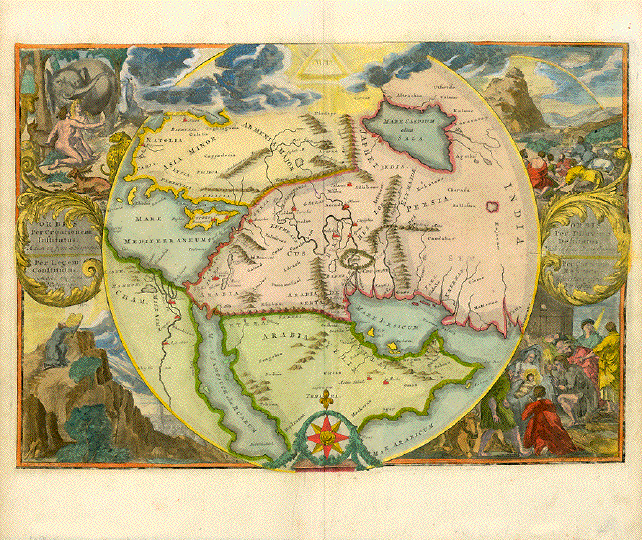
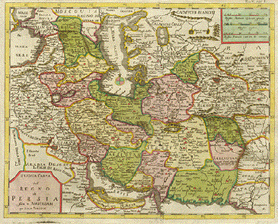
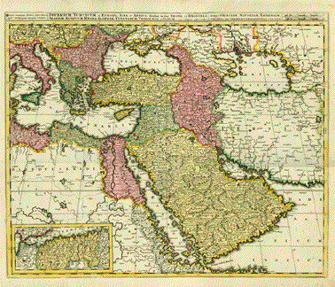
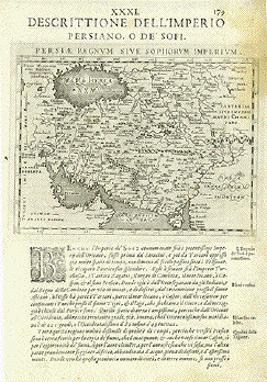
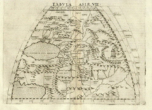
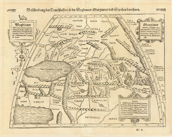
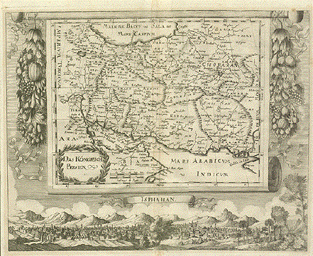
"Das Koenigreich Persien" Copper engraving published in 1680. Rare!!!

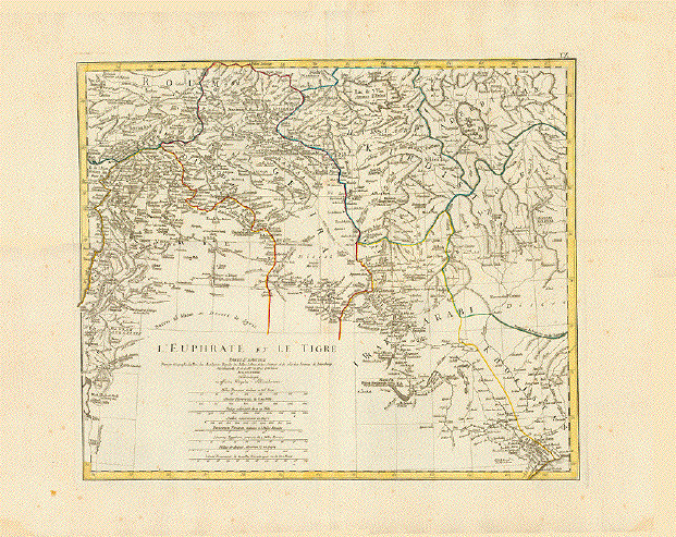
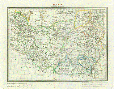
This very decorative Persian map shows the kingdom of Persia as it was divided at the time. In the upper right is the Oxus River that flows into the Caspian Sea. In the lower right is the mouth of the Indus River. On the left side near the middle is the Euphrates River flowing through Bagdad and on to the Persian Gulf. Notice the highly decorative girlands of fruits on both sides of the map image. Below the map image is a historical view of the walled city of Isphahan.

Map has vertical fold with light browning. Some light browning and spotting in margins. Conditionis otherwise Almost Very Good.

26.4 x 33.5 cm (10.3 x 13.1 ")

$620.00

Order Nr. MIDDLE EAST 1860


"Persia". Copper etching from an Italian atlas, ca 1720. Modern hand coloring.

This interesting little map shows the ancient regions of Persia and the surrounding area.

Left margin is narrow with a crease that reaches into image (original crease in the paper). Folds to fit book size. Light crease in lower right margin corner. The overall condition is Almost Very Good.

13 x 16.5 cm ( 5.1 x 6.5 ")

$ 150.00

Order Nr. MIDDLEEAST1854


"Persici sive Sophorvm Regni Typus". Copper etching by Abraham Ortelius , ca 1570. Modern hand coloring.

This Persian map shows the area that was once the kingdom of Persia. At the top left of the map is the Caspian Sea and at the bottom the Persian Gulf and northern part of the Indian Ocean. In the lower right above the decorative cartouche is the Indus river. Tartaria is the area in the upper right corner. The names on the map are very old. Verso: Text in German on one side.

Map has vertical centerfold. Repaired tear in lower margin parallel to centerfold. Tear reaches 1 cm into lower image. Scattered light spotting in margins, especially near centerfold in lower margin. Small repaired tear on upper margin edge. Small creases in upper left margin corner. Condition is Better than Good for a map this age.

35 x 50 cm (13.7 x 19.6 ")

$ 800.00

Order Nr. MIDDLEEAST1863


Perse Moderne

Copper etching by Mallet, 1683.
Modern hand coloring.
Half page text on backside.
Binding holes on left margin edge,
otherwise Very Good condition.

14 x 10 cm ( 5.5 x 3.9 ")

$ 160.00

Order Nr. MIDDLEEAST1851

"A Chart of the Expedition of Cyrus the Younger, and the Return of 10000 Greeks according to Xenophon". Copper etching by E. Boven after Jean Baptiste d'Anville for "Rollin's Antient History", 1739. The routes of Cyrus are original hand outline color (yellow).

Maps has the ancient names of Asia Minor and part of the Middle East. In the upper right is part of Georgia. In the lower right is Babylon and Bagdad.

Map has vertical centerfold with light browning. Strong, clear impression. A few very minor spots in margins. Two small repairs in upper left margin corner. Overall condition is Much Better than Good.

22 x 33.4 cm ( 8.6 x 13.1 ")

$ 245.00

Order Nr. ASIAMINOR1826


"Persicum Regnum". Copper etching by Peter Kaerius (1571-1624). Amsterdam, ca 1620. Fine modern hand coloring. Verso text in Latin.

In the cartouche is the following title: "Persici vel Sophorum Regni Typus" with the name Petrus Kærius, and refers to the Persian empire shown on this map. In the northwest is the Caspian sea, in the southwest the Persian Golf and in the south the Indian Ocean. In the southeast is the Indus river In the north is part of Turkmenistan.

Map has some scattered spotting in margins. Lower margin has minimal fraying. Two small repaired wormholes in the Caspian Sea are invisible except against the light. General condition is Almost Very Good.

13 x 19 cm ( 5.1 x 7.5 ")

$ 230.00

Order Nr. 1840 SOLD


“Part of the Red Sea". Copper etching by James Basire. Published in “Philosophican Transactions of the Royal Society of London, 1772.

Map shows Red Sea from just north of Judda to Cap St. Antoine (east ern shore) and the according opposite western shore areaa.. Very detailed map of that part of the Red Sea including all islands, depth, etc.

Map has centerfold plus two vertical and four horizontal folds to fit book size. Some creasing parallel to fold lines. Map is very clean except for very light browning on some fold lines. Narrow margins, especially on right side. Otherwise in very good condition.

67.5 x 50.5 cm ( 26.6 x 19.9")

$ 500.00

Order Nr. NORTHAFRICA 1630


"Syria/Cypern/Palestina/Mesopotamia/Babylonia/zwey Arabia/mit Bergen/Wässern und Stetten:" Wood cut by Sebastian Münster ca 1550. Modern hand coloring.

In the upper right corner of this very historic map is part of the Caspian Sea and in the lower right part of the Perian Gulf. In the lower left is the mouth of the Nile river. Cyprus is off the coast of Syria. Two insets give information about the areas shown on the map. Decorative title on backside.

Margins have scattered spotting. Some browning along centerfold. Creases in lower inset and at top of centerfold. The centerfold has been reinforced. Uneven area in lower margin on centerfold. Very thin crease in left margin reaching into image. Spot in lower inset. General condition is Better than Good for a map over 400 years old!

30.5 x 35.5 cm ( 12 x 13.9 ")

$ 340.00

Order Nr. MIDDLEEAST1852


"Prospectus Mediae, Assyria, Babyloniae, Mesopotamiae, Arabia desertae et Armeniae." Copper engraving by M. Bonattus after Mediolani for De La Rue, 1825.

This rather rare historical map was made after the "Stratae Regioni" by Procupius (507-560 A.D). This is how this area was known at the time with its very ancient names.

Map has folds to fit book size. Wide margins. Two small repaired tears on upper margin edge.

28.5 x 37 cm ( 11.2 x 14.5 ")

$ 325.00

Order Nr. MIDDLEEAST1864


"Perse Modern". Copper etching by Mallet , re-issued in 1719 with German text.

Map has the ancient names of the regions of Persia. Horizontal line near the bottom is the Tropic of Cancer.

Overall light age toning. Some scattered spots in margins and one in the upper right corner by the title.

14 x 10 cm ( 5.5 x 3.9 ")

$ 90.00

Order Nr. MIDDLEEAST1855


" Tabvla Asiæ V ". Copper etching from: "Geographia" by Claudio Ptolemy. Originally edited and published by Willibald Pirckheimer. This edition, which comprises all 64 maps of the "B" edition, including the "New World", was published by Josephus Meletius 1562 in Venice.

The area between the Caspian Sea and the Persian Gulf is featured on this early map. In the northwest is part of Armenia. Further south is Mesopotamia and in the lower left part of Arabia. Babylon is shown near the confluence of the Tigris and Euphrates. A bit further south is a region titled Babylonia. The "Aræ Herculis" is shown as a block with flames near the confluence of the great rivers. In the northeast is the ancient region of Hyrcania. The Masdoranus Mountains form the eastern border and the ancient region of Carmania is in the southeast. Verso: Text in Italian.

Light browning along centerfold. Some creasing on left side that hardly affects image. Light offsetting. Condition is Almost Very Good.

18 x 25 cm ( 7.1 x 9.8 ")

$ 320.00

Order Nr. MIDDLEEAST1836


"Tabvla Asiæ VII" Copper etching from: "Geographia" by Claudio Ptolemy. Originally edited and published by Willibald Pirckheimer. This edition, which comprises all 64 maps of the "B" edition, including the "New World", was published by Josephus Meletius 1562 in Venice.

Ancient names and the geography known to Ptolemy are shown on this interesting map with the Caspian Sea and Persian Gulf in the west. In the north is Scythia. Persia is shown with very old names between the Caspian Sea and Persian Gulf. In the southeast is India with the Indus river. On the back is text in italian describing this ancient area.

This print has a very strong impression and is very clean. Some offsetting on edges that is from the time of printing. Hardly noticeable browning along centerfol. Overall condition is Very Good.

18 x 24 cm ( 7 x 9.4 ")

$ 320.00

Order Nr. MIDDLEEAST1848


"Tabvla Asiæ IX". Copper etching from: "Geographia" by Claudio Ptolemy. Originally edited and published by Willibald Pirckheimer. This edition, which comprises all 64 maps of the "B" edition, including the "New World", was published by Josephus Meletius 1562 in Venice.

For orientation one can see part of the Indian Ocean and the mouth of the Indus in the lower part of this map. In the far west is much of present-day Persia. In the northeast are the Paropamsis mountains of Afghanistan. Further south is Pakistan and a bit of India. On the backside is a location description in italian of the major towns shown on the map. The names shown are the ancient names.

Map is very clean with a strong impression. Very light browning along centerfold. Small repaired tear on upper centerfold. Overall condition is Almost Very Good.

17.8 x 24 cm ( 7 x 9.4 ")

$ 320.00

Order Nr. MIDDLEEAST1849


"Beschreibung der Lantschafften so die Sogdianer / Margianer und Scythen bewohnen". Woodcut from the "Cosmographia" acording to Ptolomy by Sebastian Münster. Published in Basel 1574. The original map was drawn by Pomponius Mela, a Roman geographer born in Tingentera, Spain. In 43 A.D. he finished a geographical work first known as "De situ orbis" and later "De chorographia". After bookprinting became possible this work was widely known.

Just looking at this map arouses interesting thoughts of this area and its history. The Caspian Sea (left middle) and the Persian Gulf (lower left) give good orientation for this map. The cartouche in the upper left describes the ancient folk known as Sogdianer while the cartouche in the upper right describes the Margianer who lived east of the Caspian Sea. The cartouche in the lower right tells about the Scythier who inhabited the northern region and supposedly spread much further west into central Europe. Notice that in the southeast is part of northern India.

Condition is almost Very Good.

Verso: Text in German

25 x 34.2 cm ( 9.8 x 13.5 ")

$ 350.00

Order Nr. MIDDLEEAST1831


" Beschreibung des Landts Assyrien mit sampe den Landschaften so darin begrieffen werden". Woodcut from the
"Cosmographia" acording to Ptolomy by Sebastian Münster. Published in Basel 1574. The original map was drawn by Pomponius Mela,
a Roman geographer born in Tingentera, Spain. In 43 A.D. he finished a geographical work first known as "De situ orbis" and later "De chorographia". After bookprinting became possible this work was widely known.

The main area of focus on this map is the area between the Caspian Sea (at the top) and the Persian Gulf ( at the bottom). In the northwest is part of Armenia. Syria and Mesopotomia fill the west and to the southwest is Babylonia In the middle is the Persian empire and ancient Hyrcania is in the northwest. To the south on the right side is ancient Parthia and the Carmania Desert.

A small hole has been repaired in the right margin. Otherwise the condition is almost Very Good.

Verso: Text in German

25.3 x 34.5 cm ( 10 x 13.6 ")

$ 350.00

Order Nr. MIDDLEEAST1832


"Arabie"

Copper etching by Mallet, 1683.

Spotting in lower right margin corner.

14.2 x 10 cm ( 7.4 x 3.9 ")

$ 140.00

Order Nr. ME1856

SOLD


"Laender des Penschab". Lithograph published by C. Flemming in Glogau, ca 1850.

In the upper left corner of this very detailed map is Kabul. In the upper right is part of Tibet. In the lower right corner is Delhi and the Indus River flows into the lower left corner. On the right side is one of the Sikhs outlined in blue.

Map is very clean and in Very good condition.

31.2 x 39.7 cm ( 12.2 x 15.6 ")

$ 170.00

Order Nr. INDIA1688


"The Kingdom of Persia with the cheef Citties und Habites described". Copper etching by John Speed, 1626. Modern hand coloring.

The border of city views at the top and various inhabitants on the sides is typical of the decorative maps by John Speed. The cities shown at the top are: Spaha, Ormus, Tarvis and Gilan. In the Caspian Sea and in the cartouche in the lower right is information about Persia. Verso: Text in English.

Map has light toning with some minor repaired tears (ca, 0.5 cm long) on margin edges. The center fold has a repair at the bottom. In the two upper margin corners are some creases. Overall condition is Almost Very Good.

39.5 x 51.7 cm ( 15.6 x 20.4 ")

$ 1500.00

Order Nr. MIDDLEEAST1850 SOLD


"Tartarie Indépendante" Copper etching by André for Rigobert Bonne (1729-1795), published ca 1780.

This map reaches from the Black Sea in the west to Chinese Tartaria in the east. Southeast of the Caspian Sea is part of Persia and Afghanistan. In the lower right is part of Nepal. The city of Xian is on the right edge.

Map has vertical fold to fit atlas size. Margins are wider than shown. Light browning on upper margin edge. Small repaired tear on upper margin edge. Map is otherwise in almost very good condition.

23.3 x 34.2 cm (9.1 x 13.4 ")

$ 190.00

Order Nr. MIDDLE EAST 1862


"Westliches Hochasien". Lithograph by H. Mueller after Handtke, ca 1860. Published by C. Flemming in Glogau. Original outline coloring.

At the top center of this map is part of the Aral Sea. Tiflis is in the upper left corner. The Tigris and Euphrates Rivers "flow" into the left center of the map. In the upper right is the high mountainous area of the Muz-Tagh. The light green area near the center is Afghanistan. To the left of the map legend is the mouth of the Indus River.

Map has scattered spotting in margins and a few spots in image.

32 x 40 cm ( 12.5 x 15.7 ")

$ 240.00

Order Nr. MIDDLE EAST1859


"Der Sikh - Staat". Lithograph ca 1860. Published by C. Flemming in Glogau. Original outline coloring.

Part of Afghanistan is on the left side of this map. Kabul is in the upper left corner. The mouth of the Indus is in the lower left. In the upper right is part of Tibet. Dehli is in the lower right corner.

Map has overall spotting.

31 x 40 cm ( 12.2 x 15.7)

$ 150.00

Order Nr. MIDDLEEAST 1858


Prints of the Middle East

Prints of Afghanistan

Maps of the World

Ordering and Payment

E-mail

Terms of Sale - Lieferbedingungen

Return to Home Page