Antique Maps of North America

A selection of historical maps of North America that is sure to please you. Each map is illustrated and carefully described. Please contact us if you are looking for special maps.

Maps of Hawaii and the Pacific Islands

Ordering and Payment

Lieferbedingungen

Sale! Discount!

30% Discount on All maps with a NORTHAMERICAMAP number on this page!

Take 30% off the listed price. !

Visit us at the following sites:

https://lovelyantiqueprints.com

twitter.com/philographikon2

"L'Isle de Terre Neuve, L'Acadie, ou La Nouvelle Ecosse, I' Isle St. Jean et la Partie Orientale du Canada"

Detailed copper engraving map of Nova Scotia, St. John'S Island, Newfoundland, New England and the St. Lawrence River. 

The map extends south to  Long Island and New Jersey.  In the upper left is part of St. James Bay.

The map is by Bonne and Raynal, published ca 1780.

Pleasant hand coloring. Vertical centerfold.

Copper engraving. Light age toning. Repaired and blackened crease under Newfoundland.

Image: 32 x 21 cm ( 12.5 x 8.2 ")"

Order Nr. NORTHAMERICAMAP250075 SOLD


Climate of the United States

"Climate of the United States"

Wood engraving ca 1880. On the reverse side is text with images about cotton growing in the United States.

A few minor creases.

Page size: 27 x 22 cm ( 10.8 x 8.6 ")

$ 45.00

Order Nr. NORTHAMERICA249708


"Schoeners Erdglobus b. J. 1520"

Very interesting historical map made after the globe by Johannes Schoener (1477-1547).

This globe is one of the world's oldest and is in the Historischen Museum von Frankfurt am Main.
The globe is one of the two oldest with the name "America".

This map was published in 1881. Light natural age toning.

Image: 10.5 x 17cm ( 4.1 x 6.6")

Order Nr. WORLDMAP253323SOLD


"Map to accompany Dr. Bigsby's Paper on the Geography and Geology of Lake Huron"

Lithograph by C. Hullmandels after B. R. Baker.

Published 1824 in "Notes on the Geography and Geology of Lake Huron. In Transactions of the Geological Society."

John Jeremiah Bigsby ( 1792-1881 ) was a British doctor and Geologist. He was one of the first to do geological exploration in Canada.

Lithograph. Folds to fit original book size. Right margin and upper right area have been repaired and added.Some light creases in several places. On the left side is a repair in Lake Michigan. This repair was done on the reverse side.

Map size: 38.5 x 43 cm ( 15.1 x 16.9 ")"

$ 240.00

Order Nr. NORTHAMERICA250214


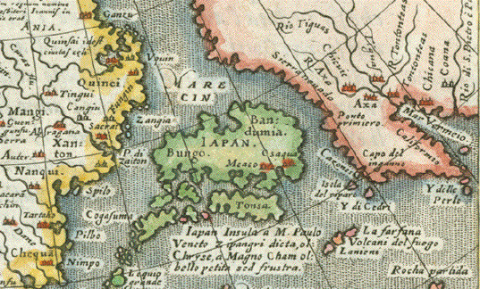
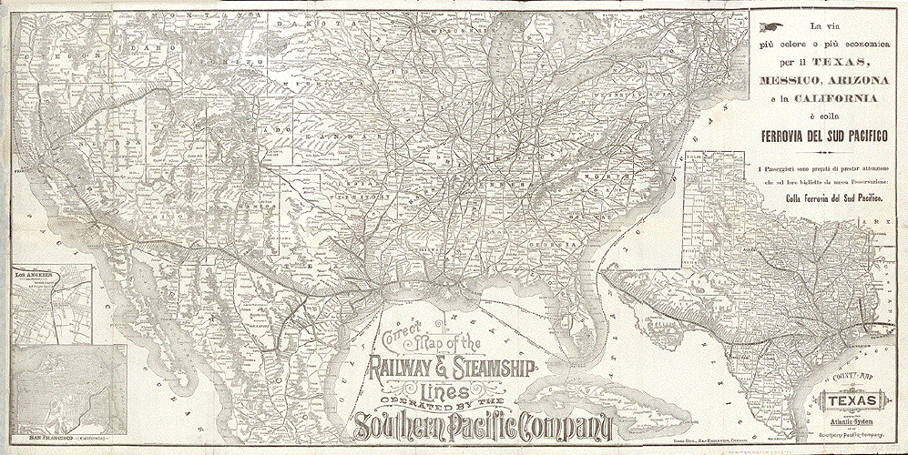
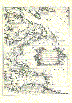
RAILROAD & STEAMSHIP LINES NORTH AMERICA

"Correct Map of the Railway & Steamship Lines operated by the Southern Pacific Company"

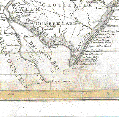
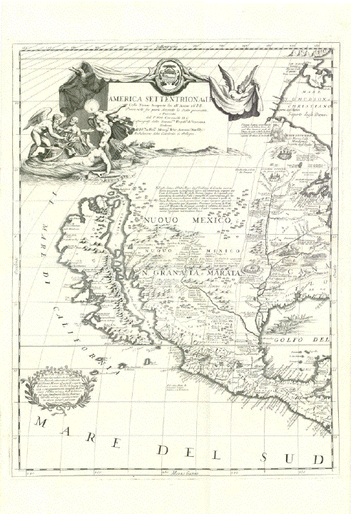
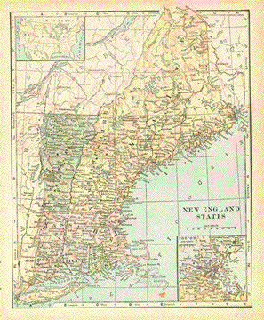
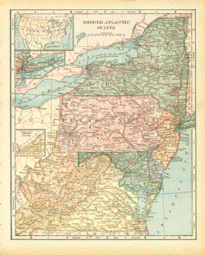
A historically important railway map of the United States of America south of the 45th parallel north from Portland, OR to the state of Maine.

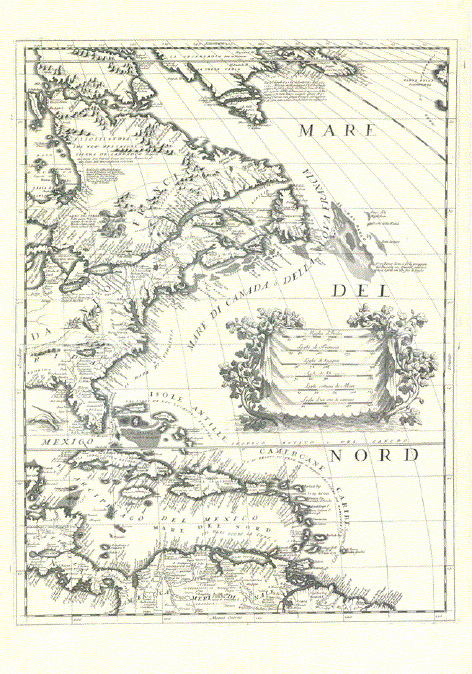
The map extends south well into Mexico, shows the entire Gulf of Mexico including Cuba and the large Steamship lines along the Atlantic Coast and within the Gulf of Mexico operated by Southern Pacific.

With a large inset county map of Texas and 2 small inset maps of Los Angeles, CA and of San Francisco, CA.

In the upper left is the twon of Kalama, Washington.

The additional title in the Italian language reflects on the large numbers of Italian immigrants towards the end of the 19th century. (There was also an identical map issued with a German title for the largest non English speaking immigrant group).

Lithograph issued by Poole Brothers. Chicago, ca. 1885

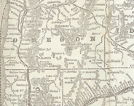
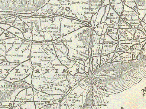
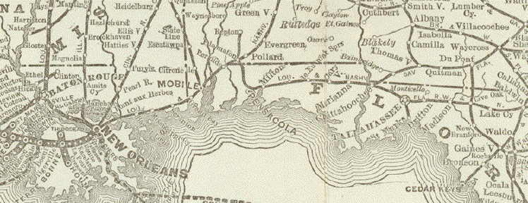
This Railroad map shows the immense network of railroads, which had already been spun clear across the United States on behalf of the Southern Pacific Railroad Company. The map is extraordinarily detailed naming all stations along the various operated lines. Hatchings show mountain ranges.

This Railway map was part of an advertising brochure with time tables for departures and arrivals as well as all travel information necessary and desirable for especially the (Italian) traveler. It was issued by the Southern Pacific Company in cooperation with the printing outfit Pool Brothers in Chicago.

Condition: As part of the above described brochure the large map had to be folded several times vertically and horizontally. As the map was obviously used it was unfolded often. This left some traces of usage.

Some of the folds were in danger of braking. Therefore some folds were backed for support very carefully with thin paper. We show scans of the reverse side. In some of the crossings of folds small holes are covered under the backing paper. The margins are narrow all around. Some have small tears. And the left margin, where the mad had been fastened to the brochure, has been widened with thin paper. There are some other traces of age and use which we are zealous to document with scans. The condition in general is surprisingly good considering age, handling and the thin paper it was printed upon.

An interesting item with regard to railways in the USA.

39,5 x 79 cm (ca. 15.5 x 31")

$ 680.00

Order Nrt. NORTHAMERICA

"America noviter delineata"

Copper etching by Matthaeus Merian ( 1593 - 1650 ).

This attractive map shows North abd South America based on the world map by Willem Blaeu.

At the top of the map is a small inset showing Iceland and Greenland.

The Azores, Canary Islands, and Cape Verde Islands are clearly shown off the coast of Africa.

Notice how much of North America is yest to be discovered and mapped.

Map has very pleasant contemporary hand coloring.

This map was published in Frankfurt in 1638.

Map has repairs in the upper and lower margins on the centerfold that are
hardly visible on the front side. Fine image.

27.5 x 36.5 cm ( 10.8 x 13.9 ")

Order Nr. SOUTHAMERICA250780 SOLD

"Die neuwen Inseln so hinder Hispanien gegen Orient bey dem land Indie ligen"

Early map of the Americas. Woodcut published in "Cosmographia" by Sebastian Munster (1488-1552).

This woodcut is from a German edition of the "Cosmographia"

printed in Basel, 1553.

"The "New World", still oddly shaped before mapping got more precise. We have to realize, that the discovery of America was just about half a century before this map was carved into a woodblock and published. But that's the charm of very early map making! In the Caribbean Sea some of the islands were already named and placed fairly accurately: Cuba, Jamaica, Hispaniola. Sciana (now Puerto Rico) carries the pennant of Spain. On the North American (US)-mainland we have only Florida named and shown much larger than the State of Florida comprises in modern times.

For the first time on a map the Pacific Ocean is named as such: Mare pacificum. While South America is definitely recognizable (even the Magellan Strait is mapped), the West Coast of North America is totally undiscovered. An interesting marginal note is the placing and naming of Japan. Japan is shown as one island quite near to North America and iras name is "Zipangri". Name and placement were taken from a globe produced by Johannes Schoener, which is a precious piece of art at the Germanic National Museum in Nuremberg.

Condition: Woodcut has typical but new hand coloring. There is general light age toning. Margins all around show traces of age and use. Lower margin has reinforcements for no obvious reasons, applied probably centuries ago. A slightly visible crease through the Atlantic in lower right corner. Considering the age of the print, it condition is much better than good.

25,7 x 34,2 cm (ca. 10.1 x 13.5")

Order Nr. SOUTHAMERICA251769SOLD

********

Reverse side:


No title. Map of Mexico and Central America / Karte von Mexico and Zentralamerika

Map reaches from the southern tip of Baja California via Sinaloa, Durango, State of Chiuhahua, Coahula, Nuevo Leon to The coast line of Texas, Louisiana, Mississippi, Alabama and Florida. Maps shows also western Cuba and it reaches south as far as Panama.

Map has an interesting inset map titled. "P. Eusebius Franz Kino aus der G.J. entdeckte zwischen dem 1698 und 1701 dass Kalifornien eine Halbinsel sey"

Padre Kino S.J. discovered between 1698 and 1701 that California was indeed a peninsula and not an island. (See detailed scan)

Copper etching in very fine original hand coloring by Franz Anton Schraembl (1753-1803) after Thomas Pownall (1722-1805).

Map was published in "Allgemeiner Grosser Atlas". Publisher Franz Anto Schraembl. Vienna / Wien, 1786-1800

The Schraemble-Atlas had a very small edition. Map is RARE!

Good condition. Very strong paper. Vertical centerfold. Minor spotting in margins.

50,5 x 58,5 cm (ca. 19.9 x 23"")

$ 2050.00

Order Nr. MEXICO252336


"Carta della Virginia della Baja Chesapeack e Paesi vicini"

Map of the U.S. State of Virginia of Chesapeak Bay and surrounding areas. These are Maryland, Delaware, Southern New Jersey, Southern Pennsylvania.

Hand-colored copper etching by an anonymous Italian engraver. Ca. 1750.

This very nicely hand-colored map with a decorative flower-bordered title cartouchewas published in a
very small (duodez-size) book. Map has several vertical and one horizontal folds to make it fit into this book.
The folds are hardly visible fro the front.

Map is clean and in very good condition.

Map image: 18.5 x 28.5 cm (ca. 7.3 x 10")

$ 280.00

Order Nr. NORTHAMERICA250052


"Novus Orbis sive America Meridionalis et Septentrionalis per sua Regna, Provincia et Insulas iuxta Observationes et Descriptiones et centiss. divisa et adornata cura et opera. Matti. Seutter, Sai. Caes. Maj. Geogr. Aug. Vind."

Copper etching. Very pleasant original hand coloring.

Published in ãAtlas Novus" by Matthaeus Sautter (1678-1757)

Augsburg, ca. 1730

Very attractive map of North and South America with decorative Baroque title cartouche.

Shows Discovery voyages in the Pacific Ocean by name of explorers and dates.

California is shown as an island. Central North America and the West of North America still unexplored.

Upper left shows an extra cartouche explaining and demonstrating the Christianization of North and South America

Very good condition. Fresh original hand color. Strong impression. A decisively proud wall decoration.
Vertical centerfold with a few parallel creases new the lower margin.

50 x 57 cm (ca. 19.7 x 22.4")

$ 2200.00 (Please look for discount at top of this page. Here 30% = $ 1540.00)

Order Nr.SOUTHAMERICMAP255468


"America"

Copper engraving map published by Calografia Vignozzi in Livorno ca 1770.
Interesting map of the Western Hemiphere with Italian names. Seldom!

Map has vertical and horizontal folds to fit original atlas size.
Small repaired hole in left margin. A few minor signs of age and use.

Map image. 34.5 x 27 cm ( 13.5 x 10.8")

$ 240.00

Order Nr. NORTHAMERICA254475


"Carte de la Partie Sud des Etats Unis de L'Amerique Septrionale"

Detailed copper engraving map of Georgia, Virginia and the Carolinas.

The map extends from Chesapeake Bay in the north to Amelie Island in the south. 

The map is by Bonne and Raynal, published ca 1780.

Pleasant hand coloring. Vertical centerfold.

Copper engraving. A few color spots in margins. Some ink on plate marks.

Image: 21 x 31 cm ( 8.2 x 12.2 ")"

$ 190.00

Order Nr. NORTHAMERICAMAP250078


"Virginiae Item et Floridae Americae Provinciarum nova Descriptio".

Very attractively hand-colored copper etching. This map was first published in the Mercator/Hondius atlas. Amsterdam, 1606. Our exemplar has French text on reverse side, indicating, that it was published in 1628. Flanking the Renaissance style ornamental title cartouche are two Native American villages: On the left one in Florida, on the right one in Virginia. A native American royal couple is depicted on the left of map. And in the Atlantic a manned boat with Native Americans is shown.

The focus of this map is the area of nowadays Georgia and the Carolinas. But its actually reaches from St. Augustin, FL to Chesapeak Bay. We have to consider, that this map was printed exactly 170 years before the Declaration of Independence. Pioneer discoverers where Spanish, geographers, explorers still fumbled when they cartographed this new land. The map shows many Native American and Spanish place names. Sea monsters, sail ships, a compass rose and another Renaissance cartouche complete this highly decorative, importantly early American map, which is so innocently charming.

Centerfold has repairs. There is a vertical pleat on the right of centerfold. General age toning and some traces of age and use in margins. Very tiny repaired tears on margin edge. In general, and considering its age, the condition of this early map is very good.

34.3 x 48.5 cm (13.5 x 19")

$ 3200.00

Order Nr. NORTHAMERICA 235200


"Die vereinigten Staaten von Nord-Amerika"

Steel engraving map by Th. Duvotenay. Published 1838.

Two vertical folds to fit original book size, Very minor signs of age and use.

Map image 17.5 x 22.5 cm ( 6.8 x 8.8")

$ 40.00

Order Nr. NORTHAMERICAMAP253078


"Charte von der Northwestkueste Americas Nach Vancouver Prag 1818"

Copper engraving published in Prague, 1818. This map was made after one by Captain Vancouver
who explored the north west coast of North America. The map extends from Kodiak Island in the upper
left as far south as Monterrey and San Antonio in California.

On the left side is a numbered list of the most important geographical features.
This map is seldom.

Map has one hardly visible horizontal centerfold to fit original book size.
Page number written in reddish ink in upper left margin. Tiny repair on right margin edge.
Left margin has been added. Normal signs of age and use.

25 x 20 cm ( 9.8 x 7.8 ")

$ 540.00

Order Nr. NORTHAMERICA248878


"Neueste Karte von Arkansas mit seinen Canaelen, Strassen und Entfernungen der Hauptpunkte"

Arkansas, newest map with its canals, roads, distances between principal cities and places.

Map o the State of Arkansas.

Steel engraving. Original hand coloring.

Published in Meyer's Atlas. In Hildburghausen, Amsterdam, Paris and Philadelphia.

Dated 1845

37 x 30 cm (ca. 14.5 x 11.8")

$ 120.00

Order Nr. NORTHAMERICA253970


"A Map of The Provinces of New-York and New Jersey with a part of Pennsylvaniy

and the Province of Quebec from the Topographical Observations of C. J. SauthierÉ"

Hand colored copper etching.

Engraved and published by Matthew Albert Lotter 1777.


Map shows more than mentioned in title: Connectecut, Rhode Island, Massachusets, New Hampshire. In lower left corner we find an inset map of Chesapeak Bay

Lower margin and part of map (8 cm / 3.1") have been backed as repair of some tears. Right margin has been backed (2,2 cm / 0.9"). A missing triangle above the word "Quebec" has been replaced and backed up.

In spite of the shortcomings, this is a are map by Lotter produced in Germany with the use of the English language. Map is quite detailed and large.

77,5 x 57,5 cm (ca. 30 x 22.5")

Order Nr.NORTHAMERICA248616SOLD


ALASKA

Lituya Bay, Alaska

Lituya Bay, Alaska "Plan du Port des Francais sur la Cote du Nord-Ouest de l'AmeriqueÉ Decouvert le 2 Julliet 1786 per les Fregattes Francaise la Boussole et l'Astolabe"

Copper etching by Bouclet. Paris, ca 1825

Lituya Bay was the site of a mega tsunami in 1958 when an earthquake caused 90 million tons of landslide into the bay. This bay was discovered and mapped during the Voyage of Captain Jean Francois de la Perouse. This was the northernmost point La Perouse reached on his sailing expedition.

A bit spotty in lower margin. Vertical centerfold. Light fraying on lower margin edge.

50 x 69 (ca. 19.7 x 27.2")

Order Nr.NORTHAMERICA248444SOLD


"Carte de la Cote N.O. de L'Amerique et de la cote N.E. de l'Asie"

Chart of the North West Coast of America and of the North East Coast of Asia (Russia)

Copper etching by Jacques Francois Benard

Published in Paris, 1785

This map was published as an account of the thrid voyage of James Cook which led him to the North Pacific. The progress of his voyage is shown in great detail, thus being the first map of that region. In so far this map, which makes no visual impression on map collectors used to colorful showing of the world, is still of immense importance for the mapping of that region. When Cook arrived at Nootka, for example, he had no idea that he actually had reached the western coast of Vancouver Island. But his sailing has been minutely documented.

Map was published in a quart-size book. Hence there are several horizonte and vertical folds to make the map fit book size. It shows some small traces of age and use. But in general it is in good condition.

38.7 x 66.2 cm (ca. 15.2 x 26")

$ 400.00

Order Nr.NORTHAMERICA248370


The Western Hemisphere

"America nach der zwyten Ausgabe von Arrowsmiths Weltcharte und dessen Globular Projection......." Copper etching by C. Mannert and edited by Adam Gottlieb Schneider und Weigel. Published in Nuremberg in 1796. Modern hand coloring.

America is shown on this map with the outlines complete but in the northwest still not fully charted. In the very north is still "Terra Incognita". In the upper right are the coasts of France, Spain and part of Africa.

Map has light age toning and the upper margin has been widened. Because of the book fold, there is ca 8cm of bottom margin that is narrow. The lower part of centerfold (ca 8cm) has been repaired. On the left side between the yellow line and the "S" of Stille is a small missing piece that has been added. All the repairs are well done and hardly noticeable. Condition is still Better than Good.

52.7 x 60.2 cm ( 20.7 x 23.7 ")

$ 1600.00

Order Nr. NORTHAMERICA MAP 2020


"America noviter delineata"

Copper etching by Matthaeus Merian (1593-1650)

Map shows North- and South-America based on the world map by Willem Blaeu.

Map has a small inset map at top showing Greenland and Iceland. Notice 

the Azores and Canary Islands in the Atlantic Ocean.

Published by Matthaeus Merian in Frankfurt, 1638

Natural age toning. Light spotting in margins. Centerfold has some parallel folds.
Lower left margin has repair not touching map image.

Map image: 27.5 x 35.5 cm ( 10.8 x 13.9 ")"

Order Nr. NORTHAMERICA250042 SOLD


Central California map

"Californie Central pour servir au voyage de M. W: Hepworth Dixon"

Wood engraving engraved by Erhard, published 1877.
Two original vertical folds to fit atlas size. A few minor spots.

16 x 23.5 cm ( 6.2 x 9.2 ")

Order Nr. NORTHAMERICA249795SOLD


"Carte de L Entree de Norton, et du Detroit de Bhering on l on von le Cap le plus Oriental de L Asie et le Pointe la plus Occidentale de L Amerique". Copper engraving by Benard for Rigobert Bonne 1788.

Map shows the Bering Strait from the coast south to Norton Sound to the Coast north of Cap du Prince du Galles. The lines show the voyages of Captain Cook in 1778 and 1779.

Map has original folds to fit book size. A few minor spots.

26.5 x 38.5 cm ( 10.4 x 15.1 ")

$ 145.00

Order Nr. NORTHAMERICAMAP2109


"Totius Americae Septrionalis et Meridionalis Novissima Repraesentatio quam ex finguilis......" Copper etching by Johannes Baptista Homann ( 1663-1724). Published in 1723. Original hand coloring.

Fine map of the American hemisphere of the time. Notice that much of North America is not yet explored. In the upper right is part of France, Spain and Africa. Notice that many of the Atlantic and Pacific islands are also included. The decorative catouche is supported by Native Americans.

A few signs of age and use in margins. The vertical centerfold has been reinforced with paper repairs.
There is a small paper repair in the Pacifc off the coast of Peru.

Map Image: 48 x 57 cm ( 18.8 x 22.4 ")

$1400.00

Order Nr. NORTHAMERICAMAP253822


"Geologische Karte von Nord-Amerika"

Chromolithograph showing the geological formations in North America.
In the lower left is a color key with the names of the formations in German.
Publishd 1904.

21 x 14,5 cm ( 8.2 x 5.7")

$ 35.00

Order Nr. NORTHAMERICA253851


" Das Russische Amerika". Copper etching from a German atlas, ca 1780. Original outline coloring.

This interesting little map shows the coast of Alaska and the Aleutian Islands in fine detail.

The map has some light creasing that was originally in the map. Wide margins. Tiny repaired tear on right margin edge.

19 x 27 cm ( 7.5 x 10.6 ")

Order Nr. NORTHAMERICA MAP 2034SOLD


Greenland and Northeast Canada

Groenlande

Copper etching after Mallet, 1685. Modern hand coloring.
Brown spot on upper right margin edge.

This interesting map shows the southern part of Greenland as well as northeast Canada.

14.5 x 10.2 cm ( 5.7 x 4 ")

$ 190.00

Order Nr. SCANDINAVIAMAP1465


"Nova Tabula Americae Sic dictae ab Americo Vesptio Florentino qui Emmanuelis Regis auspicijs eam Anno 1497É"

Type of print: Copper etching

Color: Original hand coloring

Author: Jacob von Sandrart (1630-1708)

Engraver: Johann Baptist Homann (1664-1724)

Published separately in Nuremberg, ca. 1697

Characteristics: Very rare map of North and South America. Seldom on the market. With decorative cartouche depicting native Americans in various poses. Map is embellished with indigenous animals of North America, Slave punishment, a battle scene of natives in Brazil, rich sail ship traffic on Atlantic and Pacific, a vague coast line idea of Australia. California is depicted as an island. This map is an early witness of J.B. Homann's mastership in map etching, which, in 1723, he had turned into a profitable business as he produced his famous atlas. Both, Sandrart and Homann were at the crest of German map makers as the center of gravity with regard to map making shifted from Amsterdam to Nuremberg and Augsburg.

Condition: Map is printed on nice thick paper. Left, top and right margins have been professionally added. This individually published map had been bound into a private map collection. On reverse side: No text print. Book joint for private binding. Minimal soiling in margins. Superb original hand coloring.

Order Nr.NORTHSOUTHAMERICA242285 SOLD

"Orbis 'T'abula quatenus a Veteribus cogniti...."

Copper engraving by Hermann Moll, 1732. In the upper left is the american hemisphere showing California as an island.
Island is given the name Thule Aliorum.Map shows the Roman Empire by means of a fine dotted line.

Tiny repair on lower margin edge.

Map image: 16 x 22.5 cm ( 6.2 x 8.8 ")

$ 240.00 - Maps with a WORLD number are 30% off.

Order Nr. WORLD248258

------

Map Detail:


"Spanish North America" (Mexico)

Copper etching from Thomsen's New General Atlas.

Dated 1814

Original hand coloring.

Very good condition.

Map shows all of Mexico and South-West USA: Texas, New Mexico, Arizona, Southern Rocky Mountain areas (well defined), Baja California (well defined)

Margins, especially the edges a bit browned. Otherwise good condition.

50,5 x 62 cm (ca. 20 x 24")

Order Nr. NORTHAMERICA 240415 SOLD


ãAmerica"

Type of print: Copper etching

Author: Giovanni Lorenzo d'Anania

Published in: ãL'Universale Fabrivca del Mondo"

Where and when published: Venice, 1600 second state with pagination Fac. 193

Ref.: Burden, entry 54

Condition: Centerfold has been repaired in lower half of map.


Lower margin has been added including some of the longitude figures, which have been partially or complete added by ink.

Upper margin is conically cut towards the letter ãR" in title America.. Title is complete.

Map itself is totally complete. Verso has former owner in ink with no shine-through towards the front. Map is very clean and has good.

Map shows North and South America derived from Abraham Ortelius' earlier map of America.

Measurements including title and graduation: 18.3 x 24.3 cm (ca. 7.2 x 9.6")

$ 1700.00

Order Nr. NORTHAMERICAMAP238447


"Karte von einem Theil der Norswestlichen Kueste von America zu der Reise des Cap George Vancouver in den Jahren 1792, 1793 und 1794 verjuengt gezeichnet von D.F. Sotzmann 1800"

(Map of the NW-American coastline according to the voyage of George Vancouver 1792-1794)

Map shows the American Westcoast from San Francisco to the Island of Kodiak. It is the oldest, quite precise map of the area according to the findings and drawings of Captain Vancouver. While the US-American coastline of California, Oregon and Washington is relatively scarcely mapped, the Canadian part of the map and Alaska's coastline is etched in great detail.

There is in lower left of map an inset:

"General Karte der Entdeckungen, die im Jahr 1787 in den Chinesischen und Tartarischen Meeren oder von Manilla bis Awatscha hin, von den franzoesischen Fregatten La Boussole u. L'Astrolabe gemacht worden sind. Zur Reisebeschreibung der La Perouse, im Jahre 1800 verjuengt gezeichnet von D.F.Sotzmann"

(Map of the Pacific coastlines between Manila and Kamchatka also engraved by Sotzmann)

Type of print: Copper etching

Engraver: Daniel Friedrich Sotzmann (1754-1840)

Publisher: Ferdinand Sproegel

Published: Berlin, 1800

Condition: Very Fine. Vertical and horizontal folds to make map fit book size.

Left margin narrow. Repaired tear in left margin. Lower left fold has been reinforced on reverse side

Size: Ca. 51 x 40,5 cm (ca. 20 x 16") over all

Size: Ca. 28 x 20,5 cm (ca. 11 x 8")

Order Nr. NORTHAMERICA126843 SOLD


"Descrittione del Potentissimo Imperio della Tartaria - Tartariae Imperium". Plate XXVIII (28)

This map shows suggestively in outlines the West Coast of North America from what later became Alaska, British Columbia, Washington (State), Oregon and California (which was already named). It also shows Japan, China, Russia, Mongolia, Central Asia.

Type of print: Copper etching

Artist: Girolamo Porro

Published in: "Geografia cioe Descrittione Universale della Terra"

Publisher: Gio. Battista & Giorgio Galignani Fratelli

First published in: "Geographia" von Claudius Ptolemy

Edition: Italian edition

Editor: Giovanni Antonio Magini (1555-1617)

Text: Italian. Complete on front and reverse side

Published in: Venice

Date: 1598

Measurements:

Map size: Ca. 12,5 x 17 cm (ca. 4.9 x 6.7")

Page size: Ca. 28,5 x 19 cm (ca. 11.2 x 7.5")

Condition: Near perfect. Left margin a bit narrow. Very minor traces of age.

$480.00

Order Nr. ASIAMAP236461


"Descrittione dell'America o dell'India occidentale" Plate XXXIIII (34)

Type of print: Copper etching

Artist: Girolamo Porro

After: Giovanni Lorenzo d'Anania

Published in: "Geografia cioe Descrittione Universale della Terra"

Publisher: Gio. Battista & Giorgio Galignani Fratelli

First published in: "Geographia" von Claudius Ptolemy

Edition: Italian edition

Editor: Giovanni Antonio Magini (1555-1617)

Text: Italian. Complete. 8 double pages with the following chapters:

The discovery of America

North America

Quivira ( a legendary area in North America, 1541 mentioned by Francisco Vazquez de Coronado

New Spain (Mexcio)

Nicaragua

Yucatan

Florida

Apalaches (Allegheny Mountains)

Norumbega (a legendary area in NE-USA)

New France (French territories in North America)

Labrador (Canada)

Estotilandia (Labrador, Greenland, Iceland)

Central America

Castella Aurea (Legendary area in Brazil where gold was found)

Peru

Chile

Brazil

Caribic Islands (2 articles)

Published in:Venice

Date:1598

Measurements:

Map size: Ca. 12,5 x 17 cm (ca. 4.9 x 6.7")

Page size: Ca. 28,5 x 19 cm (ca. 11.2 x 7.5")

Condition: Near perfect. Left margin narrow. Very minor traces of age.

Order Nr. NORTHAMERICA236454SOLD


"America Settentrionale Colle Nuove Scoperte sin all' Anno 1688É"

Copper etching by Vincenzo Maria Coronelli (1650-1718)

Published in: "Atlante Veneto, nel quale si contiene la descrittioneÉdegl' Imperii, Regni, Provincie, e Stati dell' Universo"

Publisher: Girolamo Albrizzi

Published in Venice, 1691

Map is published on two sheets. The two sheets are not united.

Particularity of this important map of North America is the depiction of California as an Island!

Measurements:

61 x 45 cm (ca. 24 x 17.7"). If connected: 61 x 90 cm (ca. 24 x 35")

Condition: Near Excellent. Most minimal traces of age and use. Clean. Good margins all around each map. Side margins are narrower than those on top and bottom.

Order Nr. NORTHAMERICA 242284SOLD


"Karte der Forschungsreisen Nord-Amerika"

Chromolithograph published 1904 showing the various expedition
routes. The names of the various explorers is given on the colored lines.

Image: 21 x 15 cm ( 8.2 x 5.9")

$ 35.00

Order Nr. NORTHAMERICA253846


"America 1841"

From "Zeitungs-Atlas fuer alte und neue Erdkunde". Published by J. Meyer. Hildburghausen, Amsterdam and New York. 1849.
Engraved by Joh. David. Original hand coloring.

Interesting map showing the political divisions of the time.

Map has folds to fit original atlas size.Small repair on lower left margin.

26 x 21 cm (10.2 x 8.2 ")

Order Nr. NORTHAMERICA242287SOLD


"California"

Illustrated map by George Otto Hanft (1926-2010) Dated (with copyright by the Wyman Co. Inc.) 1967

Map depicting charmingly the state of California in Renaissance style during the discovery period. All principal catholic missions are shown as well as discovery travels and voyages by Juan Rodriguez Cabrillo (1542), Francis Drake (1579), Sebastian Vizcaino (1602), Gaspar de Portola / Junipero Serra (1769) and Juan Bautista de Anza (1774).

Printed in tones of brown and beige, thereby creating the impression of old age. On parchment paper. Two small repaired paper breaks repaired. Backside has surrounding margin reenforcement from earlier framing. In general condition is good.

45.5 x 28.5 cm (ca. 17.9 x 11.2")

Order Nr.NORTHAMERICA237686SOLD


"Geographisch-statistische und historische Charte von Illinois" State map

Copper etching by Carl Ferdinand Wieland. Original outline hand coloring. Weimar 1825

This map was published as the rare German edition of Carey & Lea's American Atlas which was published in 1822. Surrounding the map on three sides is explanitory text in the German language about all kinds of state-related specialties, such as towns and counties, physical facts, population, state constitution, religion, history, trade etc. etc. Wieland's German edition maintains a very high printing standard compared with the original American edition. He re-engraved all maps for his atlas edition.

General age toning. Crease through text on right side. Otherwise good.

Map size: 29.9 x 21.8 cm (11.8 x 8.6")

Sheet: 48 x 60 cm (19 x 23.5")

Order Nr.NORTHAMERICAMAP235018SOLD


"Geographisch-statistische und historische Charte von Missury". State map of Missuri.

Copper etching by Carl Ferdinand Wieland. Original outline hand coloring. Weimar 1825

This map was published as the rare German edition of Carey & Lea's American Atlas which was published in 1822. Surrounding the map on three sides is explanitory text in the German language about all kinds of state-related specialties, such as towns and counties, physical facts, population, state constitution, religion, history, trade etc. etc. Wieland's German edition maintains a very high printing standard compared with the original American edition. He re-engraved all maps for his atlas edition.

Very light and pleasant general age toning. Very good condition

Map size: 29.4 x 24 cm (11.6 x 9.4")

Sheet: 48 x 60 cm (19 x 23.5")

Order Nr. NORTHAMERICAMAP235017SOLD


"Geographisch-statistische und historische Charte von Connecticut". State map. Copper etching by Carl Ferdinand Weiland. Original outline hand coloring. Weimar 1825

This map was published as the rare German edition of Carey & Lea's American Atlas which was published in 1822. Surrounding the map on three sides is explanitory text in the German language about all kinds of state-related specialties, such as towns and counties, physical facts, population, state constitution, religion, history, trade etc. etc. Weiland's German edition maintains a very high printing standard compared with the original American edition. He re-engraved all maps for his atlas edition.

Clean. Except for a thin paper spot alongside centerfold to be seen only against a light source, this map is in very good condition.

Map size: 23.3 x 29.1 cm (9.2 x 11.5")

Sheet: 48 x 60 cm (19 x 23.5")

Order Nr. NORTHAMERICAMAP235027 SOLD


"Geographisch-statistische und historische Charte von Rhode Island" Copper etching by Carl Ferdinand Wieland. Original outline hand coloring. Weimar 1825

This map was published as the rare German edition of Carey & Lea's American Atlas which was published in 1822. Surrounding the map on three sides is explanitory text in the German language about all kinds of state-related specialties, such as towns and counties, physical facts, population, state constitution, religion, history, trade etc. etc. Wieland's German edition maintains a very high printing standard compared with the original American edition. He re-engraved all maps for his atlas edition.

General age toning. Otherwise very good.

Map size: 28.8 x 20.9 cm (11.3 x 8.2")

Sheet: 48 x 60 cm (19 x 23.5")

$ 140.00

Order Nr. NORTHAMERICAMAP235026


"New England States"

Wood engraving printed in color ca 1880. On the reverse side is text and images of the Middle Atlantic States.
In the lower right corner is an inset of Boston and surrunding area.

27 x 22 cm ( 10.6 x 8.6 ")

$ 40.00

Order Nr. NORTHAMERICA249709


"Middle Atlantic States"

Wood engraving printed in color ca 1880. On the reverse side is text and images of the Middle Atlantic States
especially about New York. On the .upper left is a small inset of Long Island.

27 x 22 cm ( 10.6 x 8.6 ")

$ 40.00

Order Nr. NORTHAMERICA249710


"Geographisch-statistische und historische Charte von Delaware". State map. Copper etching by Carl Ferdinand Wieland. Original outline hand coloring. Weimar 1825

This map was published as the rare German edition of Carey & Lea's American Atlas which was published in 1822. Surrounding the map on three sides is explanitory text in the German language about all kinds of state-related specialties, such as towns and counties, physical facts, population, state constitution, religion, history, trade etc. etc. Wieland's German edition maintains a very high printing standard compared with the original American edition. He re-engraved all maps for his atlas edition.

General age toning. Otherwise very good.

Map size: 28.6 x 19.2 cm (11.3 x 7.6")

Sheet: 48 x 60 cm (19 x 23.5")

$ 140.00

Order Nr. NORTHAMERICAMAP235025


"Map of the Oregon Territory from the best Authorities 1849" and ãColumbia River reduced from a survey made by the U.S. Ex. Ex. 1841"

Steel engraving by Edward Yeager for Charles Wikes' US-world exploring expedition.

Published: Philadelphia, 1845

Two maps side by side showing the nowadays States of Washington, Oregon, Idaho and Montana as well as British Columbia, Alberta, Saskatchewan before any settlers to speak of and just before goldrush times. - The second map, an inset on the leftside, shows the run of the river Columbia from Walla Walle, WA to to Cape Disappointment, WA.

Clean. Two vertical folds to fit book size. Very good condition.

20.8 x 33 cm (8.2 x 13"")

Order Nr. NORTHAMERICA MAP 234588 SOLD


"Neuste Karte von Sued Carolina mit seinem Canaelen Strassen
Dampfshiff Routen und Entfernungen der Hauptpunkte"

Steel engraving map published in Hildburghause, 1852. In the lower left is a street map of Charleston.
In the lower right is a mileage chart of distances and ship routes.
Hand-colored outlines of the borders of South Carolina.

Some light browning in the margins and along the borders.

Map image: 30 x 37 cm ( 11.8 x 14.5")

$ 140.00

Order Nr. NORTHAMERICA254476


"West Central States" Wood engraving printed in color dated 1875.

Light browning in margins. Backside is printed. Tiny repaired tear on lower margin edge.

27.2 x 21 cm ( 10.7 x 8.2 ")

$ 45.00

Order Nr. NORTHAMERICAMAP2083


"Map of the dominion of Canada Western Section, Map of the Dominion of Canada Eastern Section" Wood engraving printed in color dated 1875.

In the upper left of the lower image is an inset of New foundland.

Light browning and spotting in margins. Backside is printed. Tinypiece of lower right margin corner is missing and tiny repaired tear on right margin edge.

27.2 x 21 cm ( 10.7 x 8.2 ")

$45.00

Order Nr. NORTHAMERICAMAP2082


No Title. Map of North America. Copper etching. Anonymous, ca 1770. Modern hand coloring.

This map shows the early divisions of North America. Notice the borders between Canada, the United States and Mexico.

Map has light age toning and some smudging. There are scattered ink rests from publishing . Four vertical folds are in the map, one being in left margin). There is a horizontal fold to fit book size. In the margins are a few small creases. Left margin has two small, repaired tears. Otherwise the condition is Almost Very Good.

44.5 x 56 cm ( 17.5 x 22 ")

Order Nr. NORTHAMERICAMAP 2030.SOLD


Christochina Gold Field in Alaska

Map of Chistochina
Gold Field, Alaska

Lithograph printed with color, 1901.
By T.G. Gerdine, topographer.
Published by Julius Bien & Co. N.Y.

21 x 14 cm ( 8.2 x 5.5 ")

$ 60.00

Order Nr. NORTHAMERICAMAP 2037


Western End of Seward Penninsula

Western End of Seward Penninsula

Lithograph printed in color. Dated 1901.
By topographers T.G. Gerdine and Alfred Brooks.
Published by Julius Bien & Co. N.Y.

Print has folds to fit book size.
Repaired tear in left margin that reaches slightly into image.

$55.00

Order Nr. NORTHAMERICA MAP 2038


"Chart of the Northern Passage Between Asia & America". Copper etching by Neele for "Thomson's New General Atlas" published in 1816. Original outline coloring.

Map shows the Northern Passage and surrounding area. On the left side is the Kamtchatka Penninsula and part of Siberia. On the right side of the Northern Passage is the coast of Alaska reaching as far south as Santa Cataline and San Clemente Islands off the coast of California. In the upper right is part of the Mackenzie River with the names of the Indian tribes in the region.

Map has browning along centerfold. Repaired tears on margin edges. Light scattered spotting, especially in margins. Light creasing. Repaired tear near Siberian coast. General condition is Good.

49.5 x 59 cm ( 19.5 x 23.2 ")

$ 480.00

Order Nr. NORTHAMERICA MAP 2048SOLD


The Bering Strait

No Title
Map showing the Bering Strait between Alaska and Russia.

Copper etching ca 1770. Anonymous.

Map shows the Chukchi Peninsula of Siberia and the Seward Peninsula of Alaska with the
Bering Strait in between. In the inset are details of the Kuril Islands.

The left margin has rust brown (from binding glue?). There is a noticeable spot on the right side under
"America". There is some spotting in right margin and some miniscule scattered spots on image.
Margins are 1-2cm wide. Folds to fit book size.

21.8 x 38 cm ( 8.6 x 14.9 ")

$ 350.00

Order Nr. NORTHAMERICA MAP 2017


More Maps of North America>>>>

Maps of Hawaii and the Pacific Islands

Maps of the World

Maps of Mexico

Views of Mexico

Views of Puerto Rico

Views of Eastern Time Zone - USA

Ordering and Payment

To order by e-mail

Terms of Sale - Lieferbedingungen

Return to Home Page

Impressum

Datenschutz

© Rainer Rauhut

We have a large selection of old prints (town and city views) of North America.
Please contact us with your particular interest areas.