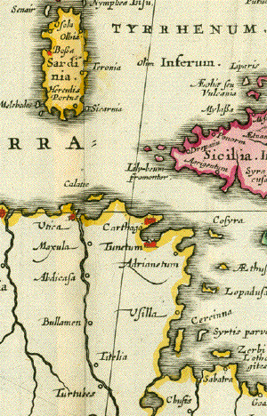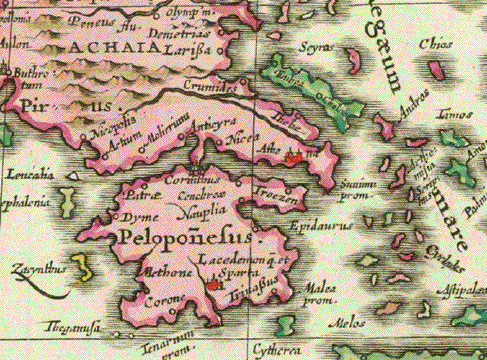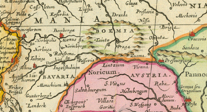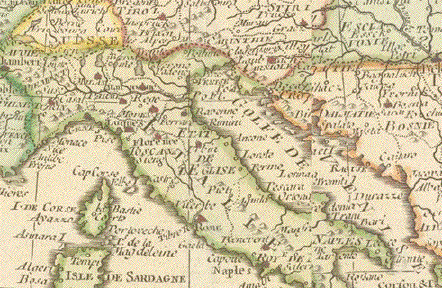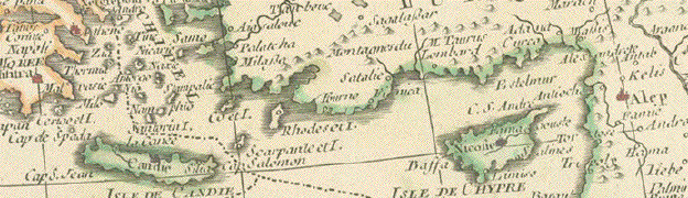
Antique Maps of Europe
This is a selection of our historical
maps of Europe. Please
contact us if you are looking for a special map.
Maps are in good condition unless
otherwise mentioned.
Antique maps shown signs of age and use.
Sale! Discount!
30% Discount on All maps with a EUROPEMAP number on this page!
We accept offers.
Visit us at the following sites:
https://lovelyantiqueprints.com
twitter.com/philographikon2
|
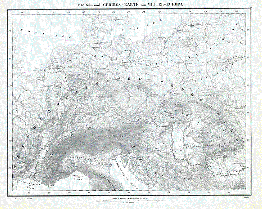
"Fluss- und Gebirgs-Karte von Mittel-Europa" Lithograph by H. Mueller after F. Handke ca 1860. Minor signs of age and use. 31 x 40 cm ( 12.2 x 15.7 ") $ 35.00 minus 30% Discount = $ 24.50 Order Nr. EUROPEMAP239852 |
|
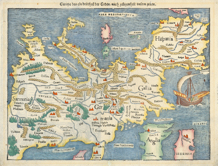
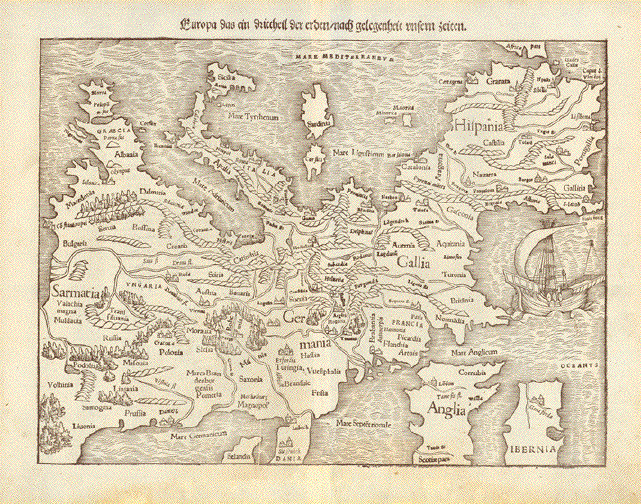
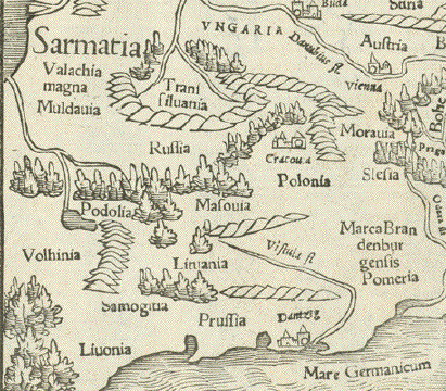
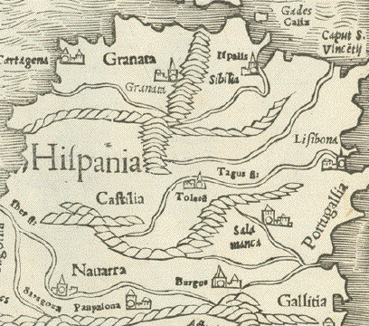
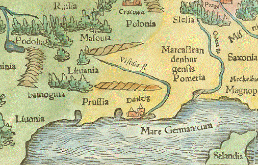
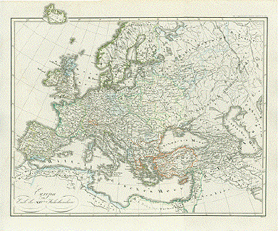
"Europa das ein drittheil der Erden / nach Gelegenheit unsern Zeiten" ("Europe one third continent on earth as it shows itself in our times") Hand-colored woodcut. Published in "Cosmographia". German edition. By Sebastian Muenster. Basel, ca. 1550 This map is especially charming and interesting because of its south orientation. This "upside-down" look at Europe was not totally uncommon in the 16th century (we know also west- and east-oriented maps) as the orientation of maps was discussed among cartographers and "north-orientation" became the "normal" depiction in the 17th century, at a time when more atlases, charts and maps were produced. Very nice and decorative map with high conversational value. Except for some minimal vertical creasing hardly any traces of age and use. Just the usual and desirable patina of of almost 500 years of age! Ca. 25 x 34 cm (ca. 9.8 x 13.4") Order Nr. EUROPE242276SOLD |
|
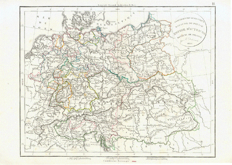
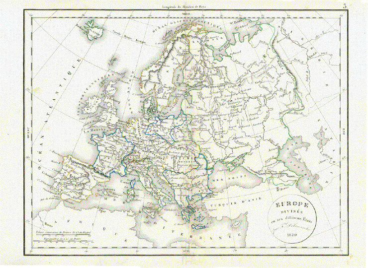
"Confederation Germanique Royaume de Prusse Empire D'Autriche Royaume de Pologne" Map shows the various divisions of Europe at the time. Copper engraving by F.
Delamarche dated 1828. Published in his atlas in 1832. Vertical centerfold. Small repairs in margins on centerfold. Light creasing on right side. 27.5 x 36 cm ( 10.8 x 14.1 ") $ 45.00 minus 30% Discount = $ 31.50 Order Nr. EUROPEMAP242279 |
|
"Fluss und Gebirgskarte von Mittel Europa" Interesting map of the rivers and mountains of Middle Europe published 1892. Vertical centerfold. Light natural age toning. Image: 21 x 27 cm ( 8.2 x 10.6") $ 25.00 minus 30% Discount = $ 21.00 Order Nr. EUROPA257462 |
|
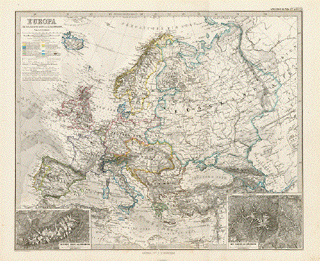
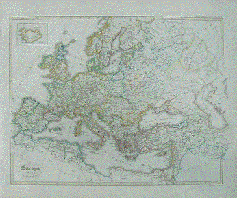
" Europa" Steel engraving by A. Petermann for Stieler`s Atlas dated 1871. Original hand outline coloring. Detailed map of Europe with the historical borders of this time. The sea depths are shown. In the lower left is a topographical detail of Mt. Blanc. In the lower right is a topographical detail of Mount Kasbeck and the surrounding area. Map image is clean. Repair on reverse side on centerfold. Tiny repaired tear on lower margin edge. 33.3 x 40 cm ( 13.1 x 15.7 ") $ 55.00 minus 30% Discount = $ 38.50 Or4er Nr. EUROPEMAP236424 |
|
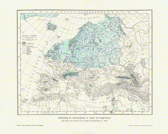
"Verbreitung der
Gletschergebiete in Europa zur Haupt Eiszeit" Wood engraving printed in color
after the map by Dr. Albrecht Penck. Published 1904. 21 x 27 cm ( 8.2 x 10.6 ") $ 40.00 minus 30% Discount = $ 24.00 Order Nr. EUROPEMAP246315 |
|
�Europa" Type of print: Copper etching Author: Giovanni Lorenzo d'Anania Published in: �L'Universale Fabrivca del Mondo" Where and when published: Venice, 1600 second state with pagination Fac. 193 Condition: Centerfold has been repaired. Lower margin has been added including some of the longitude figures, which have been partially or complete added by ink. Letter �G" has been added in lower right square corner. Some very old ink writing on reverse side of map. Map itself is totally complete. Map has good impression. Very minor spotting. Measurements including title and graduation: 18 x 24.3 cm (ca. 7 x 9.6") $ 280.00 minus 30% Discount = $ 196.00 Order Nr. EUROPEMAP238445 |
|
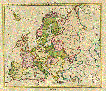
"Europa" Steel engraving map published
1858. Original hand-colored border lines. Light natural age toning. Image: 9 x 14.5 cm ( 3.5 x 5.7") $ 35.00 minus 30% Discount = $ 24.50 Order Nr. EUROPEMAP256950 |
|
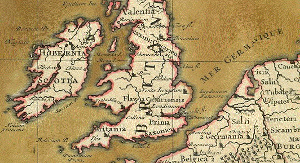
"Imperium Romanum sub Augusto potissimum et Trajano notatis simul accessionibus�" Roman Empire / Römisches Reich in its farthest borders Copper etching. Original hand-coloring No publisher given in title cartouche. Published in "Atlas historicus" by Johann Matthias Haas. Nuremberg, 1750 Very good condition 16,7 x 21,8 cm (ca. 6.6 x 8.6") Order Nr. EUROPEMAP240244 SOLD |
|
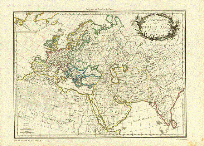
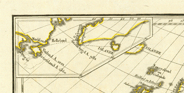
"Geographie du Moyen Age Principalement des IX et X Siecles" Copper engraving map of the Middle Ages ( 9th and 10th Centuries ). What makes the map interesting
is that a small piece of Newfoundland is shown which This map was egraved by
Chamouin after Giraldon and published 1812. Fine map image. The margins have some spotting. Map image 22 x 30 cm ( 8.6 x 11.8 ") $ 155.00 minus 30% Discount = $ 108,00 Order Nr. EUROPEMAP252602 |
|
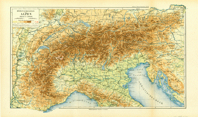
"Hoehenschichten des Alpen" Map of the European Alps published in Leipzig 1892. The map has light natural age toning in margins and two vertical folds. Map image: 22 x 37 cm ( 12.5 x 14.5 ") $ 40.00 minus 30% Discount = $ 28.00 Order Nr. EUROPA256546 |
|
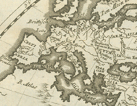
"Charte von dem Auffenthalt und Wohnstaedten derer Celten, oder Gommiers und Scythen, die ersten in Europa, und die letzten in Asien" Very interesting copper
engraving map from "Neue Sammlung der merkwuerdigsten Map has two vertical folds to
fit original book size. Ink spot in upper right area. 19.5 x 31 cm ( 7.6 x 12.2 ") $ 165.00 minus 30% Discount = $ 115.00 Order Nr. MAPEUROPE251731 |
|
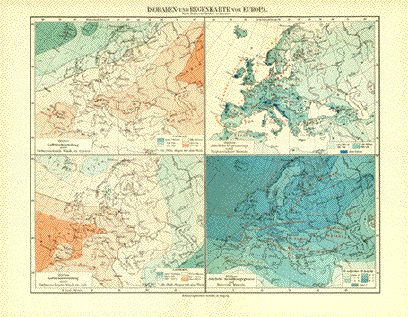
"Isobaren- und Regenkarte von Europa" Interesting map showing air pressure and rainfall published 1906. Vertical centerfold. 21 x 27 cm ( 8.2 x 10.6 ") $ 35.00 minus 30% Discount = $ 24.00 Order Nr. EUROPEMAP250667 |
|
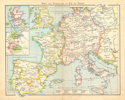
"Mittel- und Westeuropa zur Zeit der Staufer" Wood engraving printed in color 1896. Vertical centerfold.Small repaired tear on lower margin edge. 23 x 29 cm ( 9 x 11.4 ") $ 25.00 minus 30% Discount = $ 17,560 Order Nr. EUROPEMAP247959 |
|
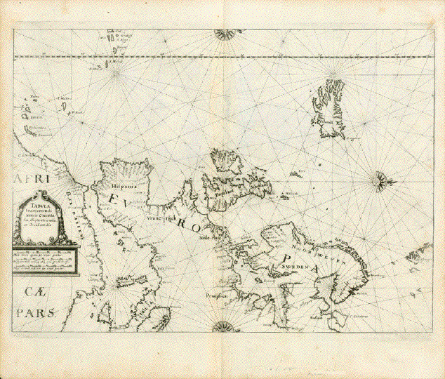
Europe. - "Tabula transeundi maris Orientalis Septentrionalis et Occidentalis" Copper engraving by Julian Angelus von Werdenhagen 1581-1652 Aus: �De rebus publicis Hanseaticis tractatus cum urbium earum iconismis, descriptionibus, tabulis geographicis, et nauticis, nec non inductione generali Rom. Imper Germ. noviter auctus et reuisus" Publisher: Matthaeus Merian (1593-1650) Published as part of "Theatrum Europaeum" Frankfurt on the Main, 1641 Werdenhagen copied this map from the Maritime Atlas published "Zeespiegel" by Guillermo Blaeu (1571-1638) in the year 1623 in Amsterdam. He scaled the map down to the size of Merian's book West-oriented map. Copper engraving. Showing Western and Northern Europe. Partially as a portolan map. Map reaches out into the Atlantic showing the Canary Islands, the Azores, Iceland, north to Spitzbergen, as well as portions of North Africa. Lightly age-toned, especially
along edges. Vertical centerfold smoothed. Map image: 27,3 x 36,2 cm (ca. 10.7 x 14.3") Order Nr. EUROPA255851SOLD |
|
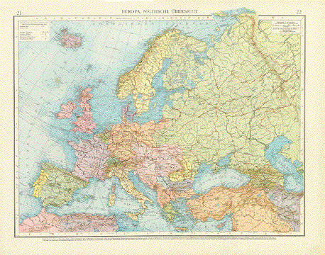
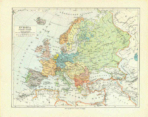
"Europa Politische Ubersicht" Political map of Europe published 1892. Vertical centerfold. minor signs of age and use in margins. Image: 20 x 25.5 cm 8 7.8 x 10") $ 30.00 minus 30% Discount = $21.00 Order Nr. EUROPA256545 |
|
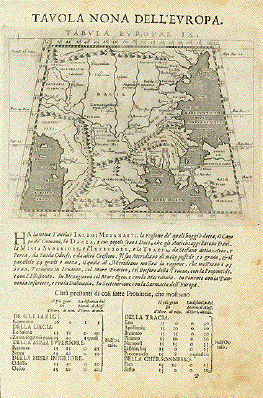
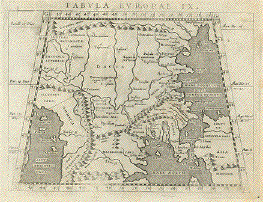
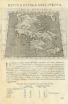
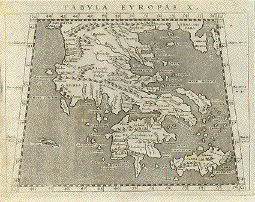
"�Tavola Nona dell'Europa" . Reverse side: �Tavola Decima dell'Europa" (Griechenland)" Copper engraving �Geografia cioe Descrittione Universale della Terra" by Gio. Battista & Giorgio Galignani Fratelli. Venice, 1598 First Italian edition edited by Giovanni Antonio Magini. Early map of Europe with a map of Greece on the reverse side. ( See images below.) These maps are in the typical Ptolemy trapeze form. Many of the geographical names are old. Page size: 28.7 x 18.6 cm ( 11.2 x 7.3 ") Map size 12.5 x 17. 3 cm (4.9 x 6.8 ") $ 360.00 Order Nr.EUROPEMAP236102SOLD Reverse side:
|
|
"Europe: Politische Uebersicht" This map, published 1899, shows
the political borders of that time. The red lines show the
railroad Map has a repair on the
vertical centerfold. It has been reinfoced. Map image: 38 x 47.5 cm ( 14.9 x 18.7 ") Order Nr. EUROPE248850SOLD |
|
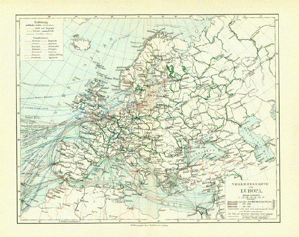
"Verkehrskarte von Europa" ( Transportation map of Europe ) Map published 1906. Verical centerfold. Fine condition. 21 x 27 cm ( 8.2 x 10.6 ") $ 35.00 minus 30% Discount = $ 24,50 Order Nr. EUROPE251676 |
|
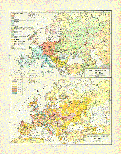
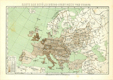
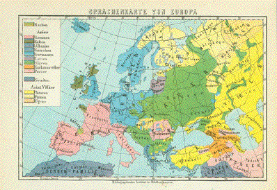
Upper map: "Voelker und Sprachenkarte von Europe" ( Language and Ethnic map of Europe ) Lower map:"Bevoelkerungsdichtigkeit von Europe" ( population density of Europe ) Map published 1906. Horizontal centerfold. 27.5 x 21 cm ( 10.8 x 8.2 ") $ 40.00 minus 30% Discount = $ 28.00 Order Nr. EUROPE251675 |
|
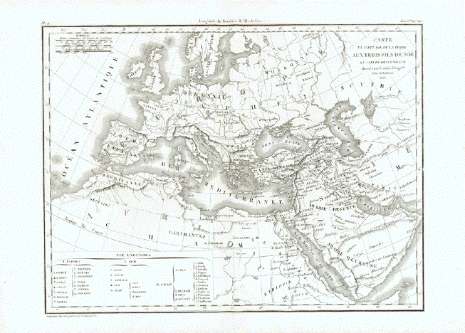
"Carte du Partage de la
Terre Aux Trois Fils de Noe Very interesting historical map of the regions inhabited by the three sons of Noah. Noah had three sons: Sem, Ham and Japheth. According to the Hebrew Bible (Genesis). After the biblical flood, they dispersed into different directions. And their descendants were named Semite, Hamites and Japhetites. This map shows the regions of the world into which they dispersed. And in the legend at the bottom of this map we see the key for tribal names and according geographical aereas In the lower left corner are
the names Japhet, Sem and Cham and the The names on the map are mostly
Old Testament names, Map is in very good condition. Vertical centerfold. Image: 24 x 32 cm ( 9.4 x 12,5 ") $ 90.00 minus 30% Discount = $ 63.00 Order Nr. MIDDLEEAST252743 |
|
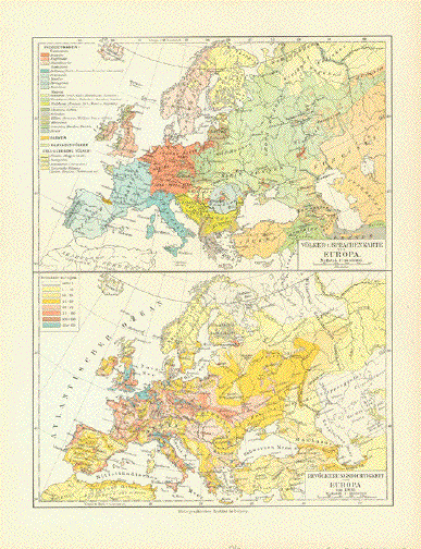
Upper
Map: "Voelker- u. Sprachenkarte
Europa" (ethnic and language map of
Europe) Published 1906. Horizontal centerfold. Map image: 27.5 x 20.5 cm ( 10.8 x 8") $ 40.00 minus 30% Discount = $ 28.00 Order Nr. EUROPEMAP254118 |
|
Sale! Discount! 30% Discount on All maps with a EUROPEMAP number on this page! We accept offers. ! |
|
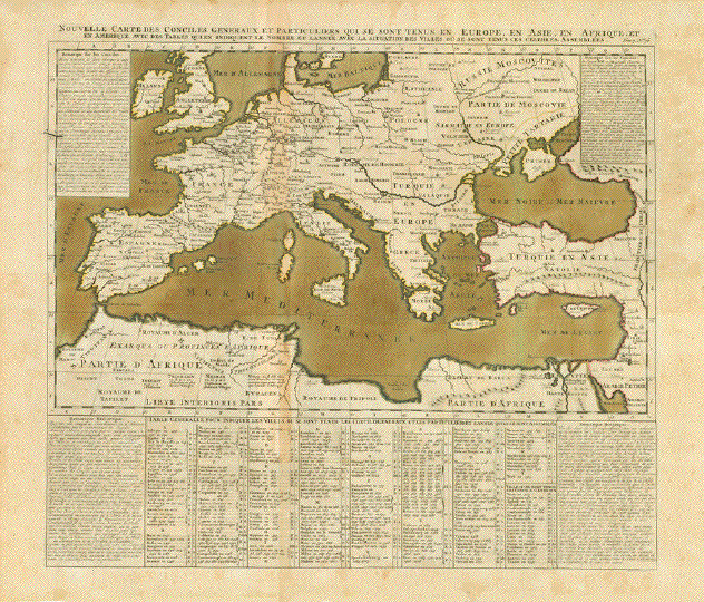
Europe - Europa - Church councils - Religion - Catholicism "Nouvelle Carte des Conciles Generaux et particuliers qui se sont tenus en Europe, en Asie, en Afrique et en Amerique avec des tables quines indiquent le nombre et l'anse avec la situation des villes ou sde sont tenus ces celebre assemblées" Beautifully hand-colored map of Europe and the neighboring countries o fAsia and Africa by Henri Abraham Chatlain.. Published in "Atlas Historique, Ou Nouvelle Introduction A l'Histoire, à la Chronologie & à la Géographie Ancienne & Moderne: Représentée dans de Nouvelles Cartes, Où l'on remarque l'établissement des Etats & empires du Monde, leur durée, leur chûte, & leurs differens Gouvernemens" Amsterdam, 1720 Map of church councils held in Europe, Asia, Africa and America (Before 1720, when this map was published there were only two: in Lima, 1583, and Mexico Cty 1585. These are just mentioned in the alphabetical list but not shown on the map). The list of cities is in alphabetical order. Each has the dates of councils in numeric sequence. In the 4 corners of map historical remarks in the French language. Map has folds to fit original
atlas size. Natural age toning. Map imqge: 35,8 x 55,7 cm Sheet: 50,5 x 61cm $ 420,00 minus 30% Discount = $ 294.00 Order Nr. EUROPE 252188 |
|
"Carte De La Germanie Et Les Diferents Etats Ou Ses Peuples Ont Porte Leurs Conquestes" Copper engraving map by Henri Abraham Chatlain (1684-1743), published1720. Hand colored. Published in "Atlas Historique, Ou Nouvelle Introduction A l'Histoire, à la Chronologie & à la Géographie Ancienne & Moderne: Représentée dans de Nouvelles Cartes, Où l'on remarque l'établissement des Etats & empires du Monde, leur durée, leur chûte, & leurs differens Gouvernemens" This map is a treasure for historians of the ancient kingdoms of Europe. In the lower left are tables with the names of the earliest peoples in Europe and their rulers. Direct on the left side of the map are the names of rulers from Castille, Leon, Aquitaine, Italia, etc. On the right side of the map are the names of the early rulers of France including North Africa. On the lower right are tables of villages and States on the map with the keys to finding the places on the map. The vertical centerfold of this map has been flattened. Light parallel folds near centerfold. The margins have some wrinkles. Repaired tear on lower margin edge. Natural age toning. Normal signs of age and use. Map image with surrounding text: 34 x 45 cm (13.3 x 17.7") Page size: 43 x 51 cm (16.9 x 20 ") $ 350.00 minus 30% Discount = $ 245.00 Order Nr. EUROPE257300 |
|
"Carta dell'Europa" Rare map of Europe. Copper etching by Carlo Cominotti. Published by Vignozzi. Livorno, ca. 1820 This map of Europe produced by an Italien engraver and publisher, was part of a duodez (small) book. Several vertical and horizontal folds indicate the duodez format. Place names are spelled in the Italian version. The map reaches from the southern tip of Greenland (Cape Farewell on the island of Eggers), and Iceland clear across northern Europe to beyond the Ural mountains, to the Caspian Sea and to Bagdad. Northern Africa is barely defined beyond the Mediterranian coastline. Condition: Map has been trimmed on three sides to little beyond its extension. Upper margin is original and wide. The other three margins were added later with the use of 19th century paper. Watermark: STELLA in a laurel wreath. And separate: CCC 8. Two broken folds supported on reverse side with paper strips. One hole in paper in Tunesia repaired. 27,8 x 34,4 cm (ca. 10.9 x 13.5") $ 80.00 minus 30% Discount = $ 56.00 Order Nr. EUROPEMAP252730 |
|
Reverse side:
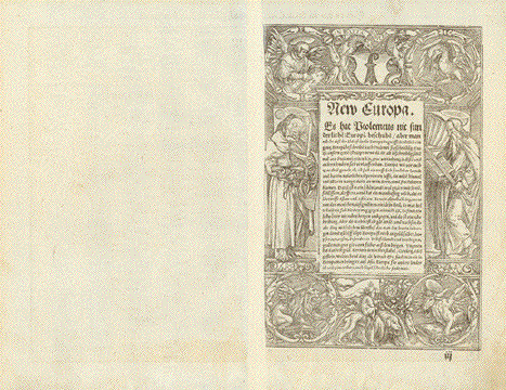
"Europa das ein Drittheil der erden nach Gelegenheit unsern zeiten" An early map of Europe. Woodcut. Published in "Cosmographia" German edition by Sebastian Muenster (1489-1552) Publisher: Heinrich Petri Basel, ca. 1575 This map is curiously "upside down", i.e. it is south-oriented. In general most maps, even those printed as early as this one, were printed north-oriented. There are exceptions such as this, which makes the map even more desirable, because it appears very special. The condition of this map is very good. A little wear and tear in margins and a little general age toning may be regarded as desirable patina. Nicely wide margins. Reverse side has on right half tite "New Europa" and a summed up brief description surrounded by a decorative woodcut bordure. 25,4 x 34,3 cm (ca. 10 x 13.5") EUROPEMAP251642 SOLD |
|
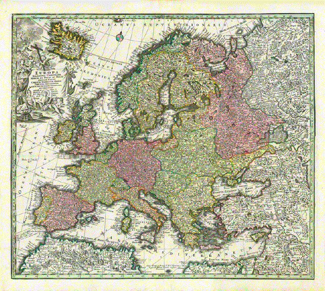
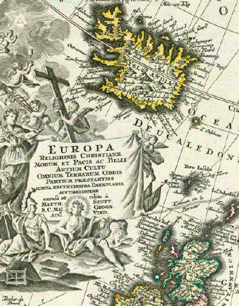
"Europa Religionis Christianae Morum et Pacis ac Belliartium Culto Omnium Terrarum Orbis Partium Praestantiss. Iuxta Recentissima Exemplaria Acuratissime expusa et edita" Copper etching. Very pleasant original hand coloring. Published in �Atlas Novus" by Matthaeus Sautter (1678-1757) Augsburg, ca. 1730 Very attractive continental map of Europe. Special feature is detailed depiction of the island of Iceland in the upper left corner. Very good condition. Fresh
original hand color. Strong impression. A decisively proud
wall decoration. Map image: 49.5 x 57 cm (ca. 19.4 x 22.4") $ 980.00 (Please look for discount at top of this page. Here 30% = $ 686.00) Order Nr. EUROPA255473 |
|
"Europa Religionis Christianae, Morum, et Pacis ac Belli Artium Cultu omnium Terraum orbis" Copper engraving by Matthaeus
Seutter ( 1678-1757). Published in Augsburg by Conrad Lotter
1744. Map shows signs of age and use.
Laid down on very thin backing paper. Map image: 19.5 x 26 cm ( 7.6 10.2") $ 300.00 minus 30% Discount = $ 210.00 Order Nr. EUROPE255827 |
|
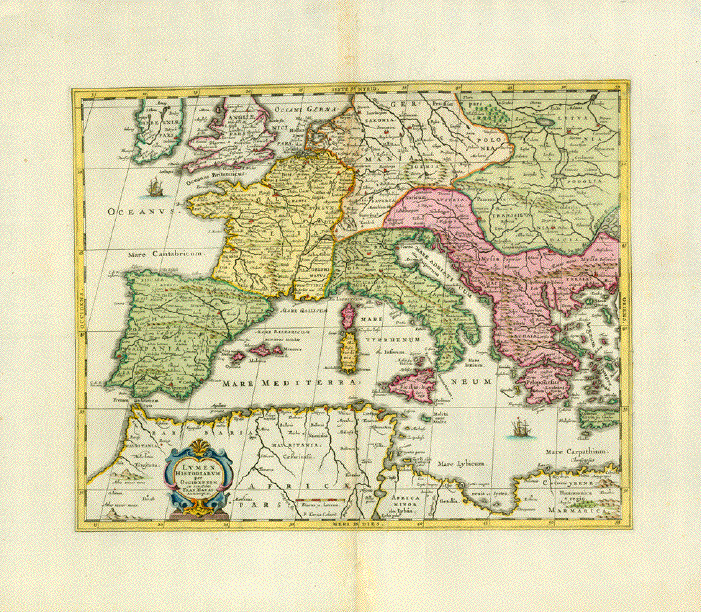
"Lumen Historiarum per Occidentem ex conatibus Fran. Haraei Autuerpiae" Handc-olored copper etching, originally published in a similar version in the Parergon by Abraham Ortelius, Jan Janssonius adopted title and subject for his Atlas Novus, published in 1652. The here available version, slightly amended, was published ca. 1700., in Amsterdam. It has no explanatory text print on reverse side. The measurements are those of the Janssonius map: 38 x 48 cm (ca.15 x 18.9") Map is historical retrospect to ancient times. In the north we find England and Ireland and the map's extend near the 53rd parallel into Russia. Western and Central Europe from Portugal to the western shores of what is nowadays Turkey.Northern Africa from the Atlantic to the Mediterranean coastline of Libya. The place names as described in ancient documents by Strabo, Virgil, Caesar and others. Map has wide margins and is clean. The centerfold in upper part a little wrinkly. Centerfold in lower margin has been repaired. There is a crease running vertically from Prussia, Bohemia, Italy, Sicily to Libyia. Order Nr. EUROPE252698 SOLD |
|
"Europa Antigua" Rare copper engraving map by
Joshua Archer (1792-1863) Map has light natural age toning in margins. Map image: 9 x 14 cm ( 3.5 x 5.5") $ 180.00 minus 30% Discount = $ 126.00 Order Nr. EUROPE255191 |
|
Sale! Discount! 30% Discount on All maps with a EUROPEMAP number on this page! We accept offers. ! |
|
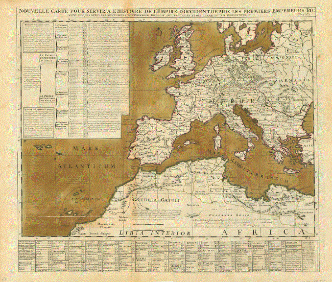
"Nouvelle Carte pour servira L'Histoire de L'Empire D'Occiendent depuis les premiers Empereurs Romains jusques après les successeurs de l'empereur Theodose avec des tables et des remarques très instructives" The Roman Empire (West Rome) around 400 A.D. Interesting names given by the Romans to the peoples in Europe. Map has 2 vertical and 1 horizontal folds. All Sea waters have original hand color as well as border lines. Copper engraving map. Published in: "Atlas Historique, Ou Nouvelle Introduction A l'Histoire, à la Chronologie & à la Géographie Ancienne & Moderne: Représentée dans de Nouvelles Cartes, Où l'on remarque l'établissement des Etats & empires du Monde, leur durée, l eur chûte, & leurs differens Gouvernemens" Published in Amsterdam 1720 Overall natural age toning and
a few signs of age and use. Overall size: 50 x 58 cm (19.6 x 22.8") Order Nr. EUROPE255021SOLD |
|
"Karte der Bevoelkerungs Dichtigkeit von Europa" Xylograph published ca 1875.
Attached to the map is a separate page with very Map image: 10 x 15.5 cm ( 3.x 6.1") $ 25.00 minus 30% Discount = $ 17.50 Order Nr. EUROPA255009 |
|
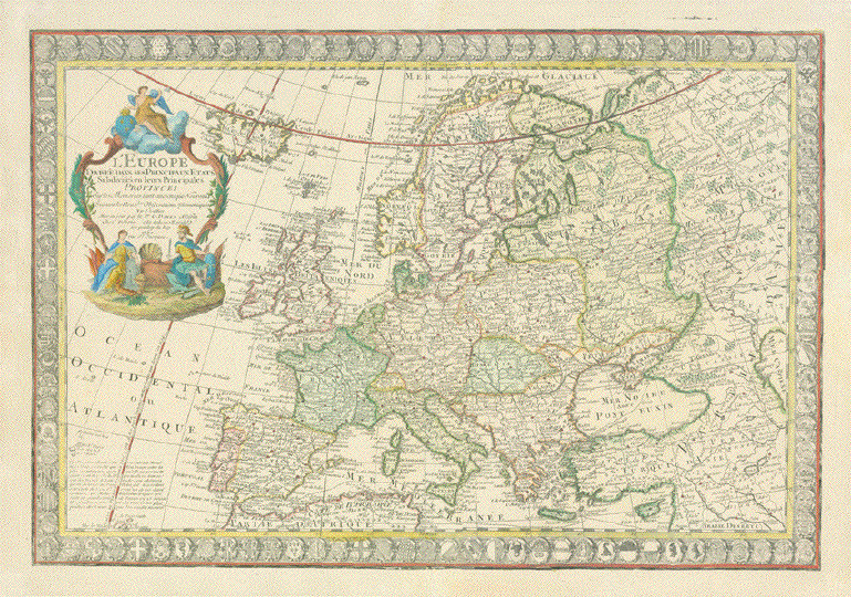
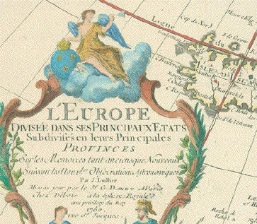
"L'Europe divisee dans ses Principaux Etats Subdivises en leurs Principales Provinces�" Hand-colored copper etching by J(an) L'(H)hillier and finished by Guillaume Danet Dated: Paris, 1750 Decorative map of Europe. Shows the "0 Meridian" fixed under the rule of Louis XIII in the year 1634 (Later- 1884 - changed to the Greenwich Meridian). Map has a bordure consisting of 110 coats of arms of cities, provinces, states. A winged "Europe" is ruling over the continent, blowing a trumpet with one hand, the other hand resting on the royal insignia of France. She is sitting on clouds over a baroque title cartouche, a female figure with a cornucopia and an armed soldier. A large map reaching in the east well across the Volga river in Russia, showing the west coast of the Caspian Sea and Bagdad in the lower right corner. The bordure of so many coats of arms is holding this decorative map together. There are only minor traces of age and use, such as expertly repaired small tears in margins. The map had been folded several times horizontally and vertically, because it was obviously published for an octavo size book or kept folded by a former owner. The creases are well smoothed out, so that, on the front side of the map, they do not matter. In general this rare map is in a much better than good condition. 48,9 x 70,3 cm (ca. 19.3 x 27.7") Order Nr. EUROPE251911SOLD |
|
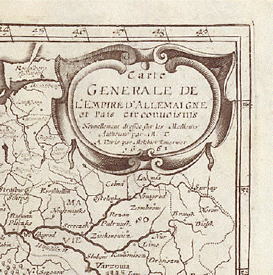
"Carte generale de l Empire d Allemaigne et Pais circonvoisins" Copper engraving map by M. Tavernie. Pubished at Pierre Davity, Paris, 1661 Engravings from topographic works by Davity are very rare! Vertical centerfold. Margins
with creasing show signs of age and use. Image: 31 x 37 cm (12.4 x 14.5") Page size: ca. 36,5 x 40,5 cm (14.3 x 15.9") $ 320.00 minus 30% Discount = $ 224.00 Order Nr. DEUTSCHLAND255152 |
|
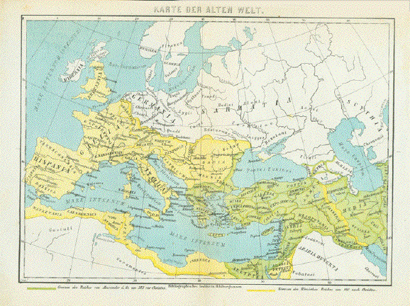
"Karte Der Alten Welt" (map of the Old World) Map shows the known parts of
the Old World in color. Wood engraving Map has a vertical centerfold to fit original atlas size. Map image: 15 x 21 cm ( 5.9 x 8.2") $ 70.00 minus 30% Discount = $ 42.00 Order Nr. EUROPE255292
|
|
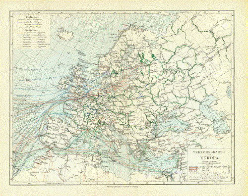
"Verkehrskarte von Europa" (trasportation map of Europe) Published 1906 in Leipzig. Vertical centerfold. Map image: 21 x 27 cm ( 8.2 x 10.6") $ 30.00 Order Nr. EUROPEMAP254114 |
|
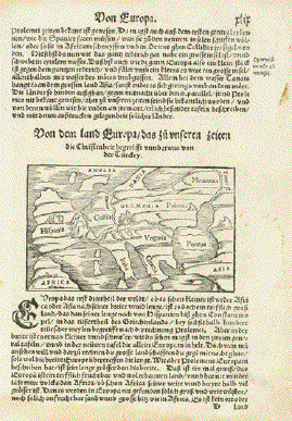
Europe. - "Von dem land Europa das zu unseren zeiten die Christenheit begreift unnd etwas von der Thuerckey" (About Christian Europe and a little about Turkey) Woodcut map. Published in "Cosmographia" by Sebastian Münster (1488-1552) Basel, 1553 This distorted rendering of Europe resembles a human - the Iberian peninsula looks like the head, Italy and Denmark the outstretched arms, Greece and Poland the legs. We discover the United Kingdom, Corsica, Sardinia, Sicily, the Pelopennese and Cyprus and a . We can see the Black Sea and a hint of Anatolia (Turkey). Margins have some age-old stains. Map itself is in very good condition. Language of text is German. Reverse side has also text print, which is devoted to Europe, but not a complete paragraph. Map: 8 x 13,4 cm (ca. 3.1 x 5.3") Page size: 31 x 20 cm (ca. 12.2 x 7.8") $ 110.00 Order Nr. EUROPEMAP253183 |
|
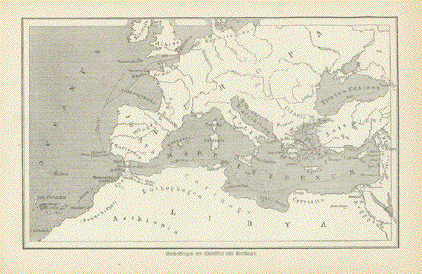
"Entdeckungen der Phoenizier und Karthager" Wood engraving map showing the
discoveries of the Cathaginians and Phoenicians. Image: 11 x 18 cm ( 4.3 x 7") $ 35.00 Order Nr. EUROPEMAP255437 |
|
"Europa Vetus" Copper etching with beautiful original hand color. Published in the historical atlas "Geographiae antique" By Christoph Weigel (1654-1725) Nuremberg, ca. 1720 Map shows Europe antique times,
and the Roman provinces during the time Very good condition. Some minor traces of age and use in margins. Plate mark measurements: 33,4 x 41,5 cm (ca. 13.1 x 16.3") Sheet size: 39,7 x 49,8 cm (ca. 15.6 x 19.6") Order Nr. EUROPE254538 SOLD |
|
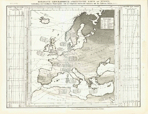
"Botanisch-Geographisch-Statistiche,
Karte von Europa" Steel engraving map from the
Bibliographische Institut, published 1859. Vertical centerfold has been flattened. Right margin has been widened. Image: 21 x 27 cm ( 8.2 x 10.6") $ 60.00 Order Nr. EUROPE254789 |
|
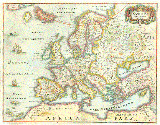
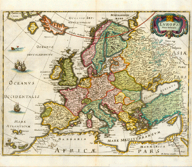
"Europa Nova Delineatio" Hand-colored copper engraving map by Matthäus Merian. Pleasant pastel colors. Published in "Theatrum Europaeum" Frankfurt am Main, 1640 Margins are wider than shown. Image: 28.4 x 36.5 cm (11.1 x 14,3") Left margin has been widened by
half a centimeter. Hardly visible light folds to right of
centerfold. $ 680.00 Order Nr. EUROPEMAP251543 |
|
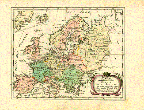
"Europa. Zweyte
Einleitungskarte zum ersten Theile des Schauplatzes der
fünf Theile der Welt Hand-colored copper etching. With a small inset upper left corner showing Iceland and Greenland Published by Franz Johann Joseph von Reilly (1766-1820) Vienna, 1791 Very good condition. The map image was printed with a small slant to the right. 22 x 27,5 cm (ca. 8.7 x 10.8") $ 145.00 Order Nr. EUROPE252742 |
|
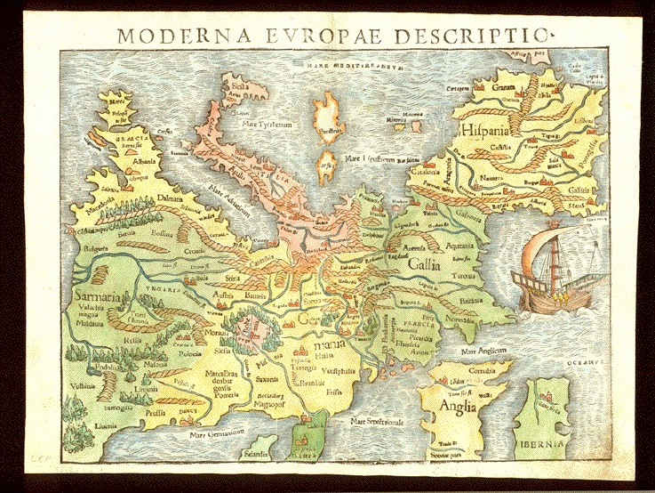
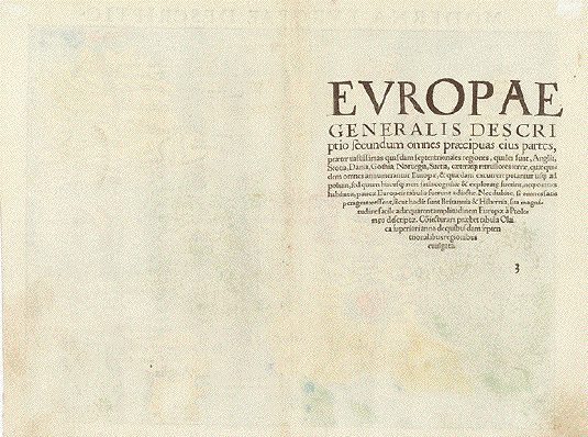
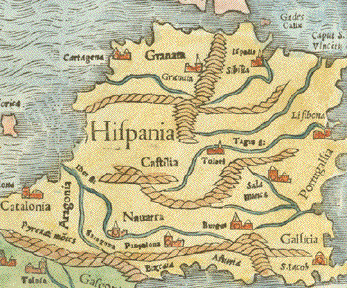
"Moderna Europae Descriptio" Hand-colored woodcut. Published in "Cosmographia" by Sebastian Muenster (1488-1552) Latin edition Basel, 1554 At the early time in printing, when Sebastian Muenster published his "Cosmographia", there was no consent among cartographers about printing maps north-oriented. Muenster printed the European continent "upside down", i.e. south-oriented, which makes it look awkward. But really the scurrility and peculiarity of portraying Europe this way makes the map a specialty of its own kind. This 16th century map shows the European continent in the west-east extension from Portugal and Ireland to Poland and the Baltics and Greece, while Scandinavia and Finland are omitted. On verso the Latin title: "Europae generalis descriptio�" Especially margins show traces of age and use. Lower right margin conner with the typical smut resulting from turning pages. The print itself in very good condition. On reverse side remnants of attachment as the map was once matted and possibly framed. 25,2 x 34 cm (a. 10 x 13.4") Order Nr. EUROPEMAP251859 SOLD |
|
Sale! Discount! 30% Discount on All maps with a EUROPEMAP number on this page! Take 30% off the listed price. ! |
|
"Carte du premier periode du Monde depuis Adam jusque' a Moise ou l'on voit la Chronologie & la genealogie des premeirs patriarches avec des remarques pour conduire a l' intelligence de l' Histoire sacree." Copper engraving published by Henri Abraham Chatelain ( 1684-1743 ). The map was published ca 1730.. Original hand coloring. This interesting map shows what we call the Eastern Hemphere as it was in ancient times, On bothe sides of the map are listed key Biblical personalties with information ( in French). The map goes back to 4004 B.C. when according to the Old Testament God created man. The decorative geneological chronology around the map has the names of the Biblical persons. Map has overall pleasant age toning. Light browning along verical centerfold. 37.5 x 46.5 cm ( 14.7 x 18.3 ") $ 420.00 Order Nr. WORLDMAP240773 |
|
"Europe am Ende der Voelkerwanderung" Wood engraving printed in color 1896. Horizontal centerfold.Small repaire in left margin. 29 x 22.5 cm ( 11.4 x 9 ") $ 25.00 Order Nr. EUROPEMAP248009 |
|
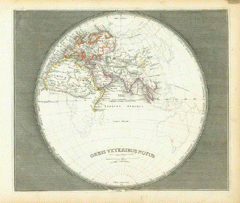
"Orbis Veteribus Notus" Steel etching from "Neuster
Zeitungs Atlas. Alter und Neuer Erdkunde" by J. Meyer, ca
1855. Diameter of circle: 22 cm ( 8.6
") $ 85.00 Order Nr. EUROPEMAP254594 |
|
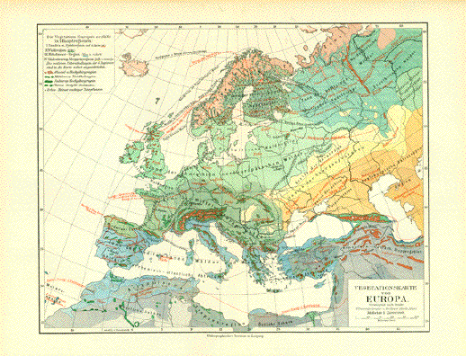
"Vegetationskarte von Europa" Map published 1906 shows the various sorts of vegetaion and growing areas of Europe. Vertical centerfold. 21 x 27 cm ( 8.2 x 10.6 ") $ 30.00 Order Nr. EUROPEMAP250665 |
|
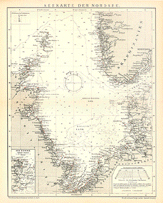
"Seekarte der Nordsee" Wood engraving with small red
dots and flags to show light houses and light ships. 30 x 23.5 cm ( 11.8 x 9.2 ") $ 30.00 Order Nr. EUROPEMAP247545 |
|
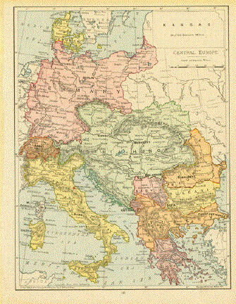
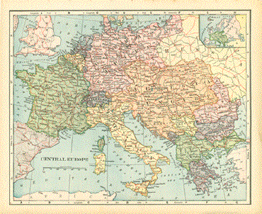
"Central Europe" Map of Central europe printed
in color and published 1894. Image: 27 x 20.5 cm ( 10.6 x 8") $ 30.00 minus 30% Discount = $ 21.00 Order Nr. EUROPE255965 |
|
"Europa" Steel etching by C. Metzroth from "Neuster Zeitungs Atlas. Alter und Neuer Erdkunde" by J. Meyer, ca 1855. Original outline coloring. Detailed map of Europe . Map is clean with wide margins. 16.8 x 20.2 cm ( 6.6 x 7.9 ") $ 45.00 Order Nr. EUROPEMAP300666 |
|
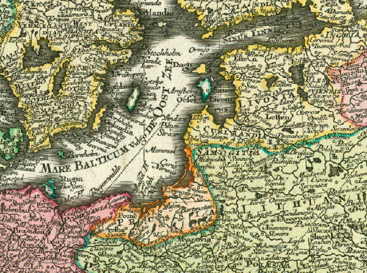
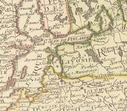
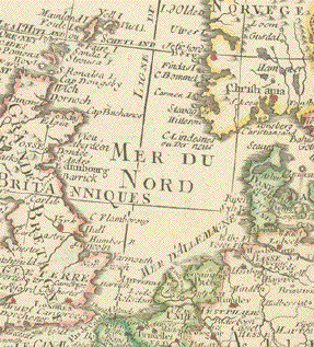
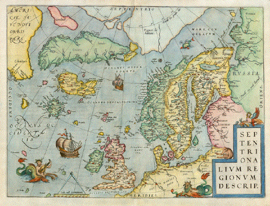
"Septentrionalium Regionum Descrip." Hand-colored copper etching from �Theatrum Orbis Terrarum" By Abraham Ortelius Antwerp. From the very rare First Edition, 1570 Verso: Latin Atlas page nr. 45 This is the much sought North Atlantic map from the �Theatrum" . Map shows Scandinavia. Finland, The Baltic Sea with its roundabout coastline of Germany, Poland, Lithuania, Latvia, Estonia up to Pechora in Russia. the North Sea coastline along Germany, the Netherlands, Belgium and France as far south as Dieppe. It shows the British Isles, All island groups in the North Atlantic, Greenland, Iceland, the first hint of the American continent in Nova Scotia. It also shows the mythical island of Frisland, which appeared on all North Atlantic maps up to the 1660ies and the North polar region. Adorned with sea monsters and sail ships this is one of the most collected maps ever. Along centerfold some very minor repairs. Otherwise excellent, especially for this First Edition exemplar. 35,7 x 48,7 cm (ca. 14 x 19.1") Order Nr. ATLANTICMAP237384SOLD |
|
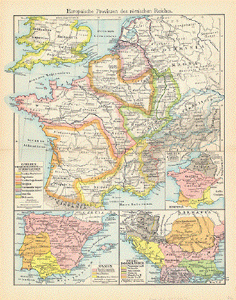
"Europaeische Provinzen des roemischen Reiches" ( European provinces of the Roman Empire ) Map printed in color 1896 with
a color key of the regions of the Roman Empire. 29 x 22.5 cm ( 11.4 x 8.8 ") Order Nr. EUROPEMAP245804SOLD |
|
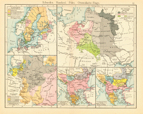
"Schweden. Russland. Polen. Orientalsche Frage" Map printed in color 1896. In
the upper left is a map showing the various stages of
expansion of Sweden. Vertical centerfold to fit original book size. 22.5 x 29 cm ( 8.8 x 11.4 ") Order Nr. EUROPEMAP245805SOLD |
|
Sale! Discount! 30% Discount on All maps with a EUROPEMAP number on this page! We accept offers. |
|
"Carte linguistique et ethnographique de l'Europe orientale, par M. Casimir Delamarre." Wood engraving ca 1870. This map shows the various languages of Eastern Europe. Dotted lines show the boundaries of the languages or language groups. The map reaches as far north as St. Petersbourg. In the lower left is the northern part of the Adriatic Sea. In the lower right is the Maramara Sea. Major cities are also shown on the map. Map has a horizontal fold that shows signs of rubbing in the lower part of the map. Margins are narrow. Backside is printed. 21.5 x 15 cm ( 8.4 x 5.9 ") $ 25.00 Order Nr. EUROPEMAP3000 |
|
"L'Europe". Copper etching by Rigobert Bonne (1729 - 1795) for "Atlas de toutes les parties connues du gglobe terreste" by Guillaune Thomas Francois Raynal (1713 - 1796). Published 1780 in Geneva. Modern hand coloring. An interesting map of Europe including Russia. Map has overall light age toning with margin edges a bit darker. General condition is Very Good. 20.8 x 31.5 cm ( 8.2 x 12.4 ") $ 145.00 Order Nr. EUROPEMAP2482 |
|
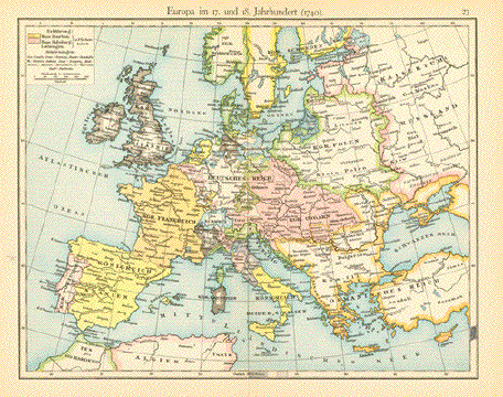
"Europa im 17. und 18. Jahrhundert ( 1740 )" Wood engraving printed in color, 1896. Vertical centerfold. 22.5 x 29 cm ( 8.6 x 11.4 ") $ 25.00 Order Nr. EUROPEMAP247960 |
|
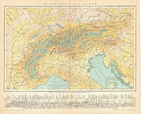
"Einteilung der Aplen ) ( divisions of the Alps ) Wood engraving printed in
color, 1894. At the bottom of the map are the major Alpine
peaks in 21.5 x 27.5 cm ( 8.2 x 10.8 ") $ 40.00 Order Nr. EUROPEMAP246784 |
|
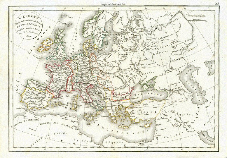
"L'Europe a l'Epoque du demembrement de l'Empire de Charlemagne j'usqu'au onzième Siecle" Europe during the decay of the Empire of Charlemagne until the 11th century. Copper engraving from:"Atlas de la Geographie ancienne, du moyen-age et moderne". By Felix Delamarche, who followed his father Charles Francois Demarche (1740-1817) in his cartographic business. Original border line hand-coloring. Paris, dated 1829 The Califat in Spain and Portugal at its largest extension. Almost very good condition. Only minimal traces of age and use. 29,3 x 42 cm (ca. 11.5 x 16.5") $ 100.00 Order Nr. EUROPEMAP241747 |
|
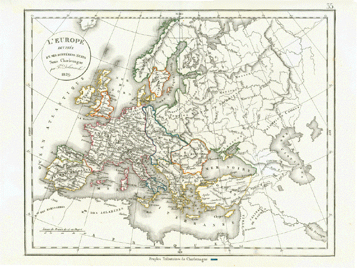
"Europe divisée en ses différents États Sous Charlemagne" Europa zur Zeit Karls des Grossen. Copper engraving from:"Atlas de la Geographie ancienne, du moyen-age et moderne". By Felix Delamarche, who followed his father Charles Francois Demarche (1740-1817) in his cartographic business. Original border line hand-coloring. Paris, dated 1829 Minimal traces of age and use. Very good condition. 27,7 x 35,5 cm (ca. 10.9 x 14") $ 90.00 Order Nr. EUROPEMAP241740 |
|
"Europe divisée en ses différents ´États" Map of Europe in ca. 1830 Copper engraving from:"Atlas de la Geographie ancienne, du moyen-age et moderne". By Felix Delamarche, who followed his father Charles Francois Demarche (1740-1817) in his cartographic business. Original border line hand-coloring. Paris, dated 1829 Some duplicate folds along centerfold. Other minor traces of age and use. 27,7 x 37 cm (ca. 10.9 x 14.5") $ 60.00 Order Nr. EUROPE241739 |
|
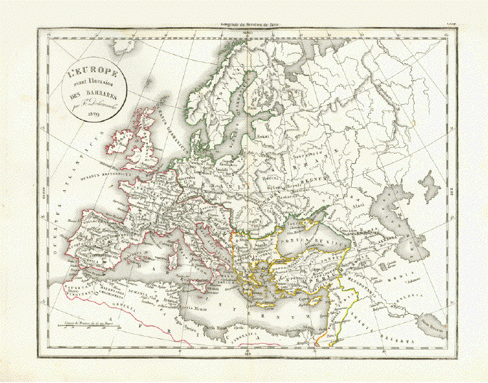
"L'Europe avant l'Invasion des Barbares" Europe before Barbarian invasion. Europa for der Voelkerwanderung Historical map showing names and places of European tribes. Copper engraving from:"Atlas de la Geographie ancienne, du moyen-age et moderne". By Felix Delamarche, who followed his father Charles Francois Demarche (1740-1817) in his cartographic business. Original border line hand-coloring. Paris, dated 1829 Very few non disturbing traces of age and use. Little repairs in margins far away from image. In general: Good. 27,7 x 35,5 cm (ca. 10.9 x 14") $ 90.00 Order Nr. EUROPEMAP241738 |
|
"Mitteleuropa zur Zeit der Karolinger" ( Middle Europe during the time of the Carolingians ) Very interesting map showing
the various divions during the time of the Carolingians.
This was Map has a vertical centerfold. Very light age toning. 22.5 x 29 cm ( 8.8 x 11.4 ") $ 35.00 Order Nr. EUROPEMAP244467 |
|
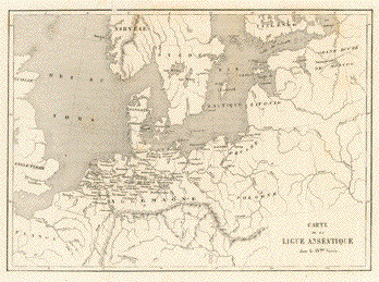
"Carte de la Ligue Anseatique dans le XVme siècle" (Chart of the Hanseatique League during the XVth century) Steel engraving. Published in Paris, ca. 1840 Very minor signs of age and use. Map has 2 vertical folds to fit book size. 16,7 x 23,2 cm (ca. 6.5 x 9.1") $ 45.00 Order Nr. EUROPEMAP246437 |
|
"Central Europe" Wood engraving printed in color ca 1900. Reverse side is printed. 22 x 27 cm ( 8.6 x 10.6 ") $ 25.00 Order Nr. EUROPEMAP248006 |
|
�Europa am Ende des XIVten Jahrhunderts". ( Europe at the end of the 14th century.) Steel etching by W. Alt. Slight original borderleine coloring. 1846. Clean. Page size: 37 x 43.8 cm (14.6 x 17.2"). $ 70.00 Order Nr. EUROPEMAP3003 |
|
"Sprachkarte von Europa" Xylograph published ca 1875.
Attached to the map is a separate page with very Map image: 10 x 15.5 cm ( 3.x 6.1") $ 30.00 Order Nr. EUROPA255011 |
|
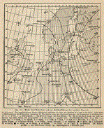
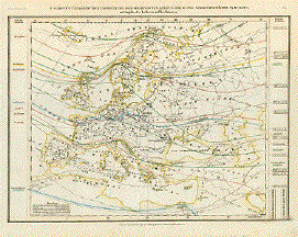
Probe einer Wetterkarte nach
den Veroeffentlichungen der deutschen Seewarte. Wood engraviesting weather map of Europeng ca 1875. On the reverse side is an interesting depiction of the winds of the earth. Interesting map with detailed explanation (in German) about weather in Europe. 12.9 x 11.9 cm ( 5.1 x 4.7 ") $ 20.00 Order nr. EUROPEMAP30065 |
|
"Europa Politische Uebersicht" ( political map of Europe. Politcal situation of Europe in 1906. Vertical centerfold. Map image: 20 x 26 cm ( 7.8 x 10.2") $ 30.00 Order Nr. EUROPEMAP254116 |
|
" Europa Noua Delineatio ". Copper etching by M. Merian in recent coloring. Ca. 1650 A nice map of all of Europe reaching as far east as the Volga River. Some fine sailing ships and a sea monster add a decorative not in the Atlantic. Notice the Arctic Circle in red and in the northeast is part of Greenland. In the southwest are the Canary Island and Madeira. Vertical centerfold. Minor signs of age and
use. 28.2 x 36 cm (11.1 x 14.2 ") Order Nr. EUROPEMAP241737SOLD |
|
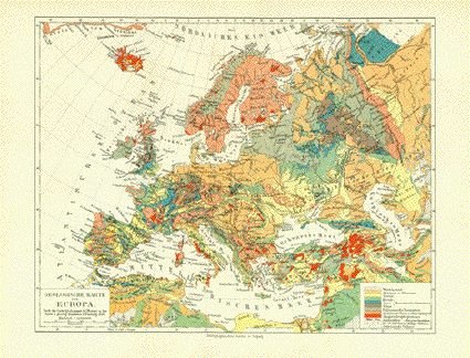
"Geologisches Karte von Europa" Map published 1906 shows the various geological regions of Europe. Vertical centerfold. 21 x 27 cm ( 8.2 x 10.6 ") $ 35.00 Order Nr. EUROPAMAP250669 |
|
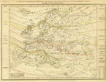
"J. Schouws Uebersicht der Verbreitung der Wichtigsten Kultur- Baum- und Strauchgewaechse in Europa mit Angabe der Isotheren und Isochimenen." Steel etching from "Neuster Zeitungs Atlas. Alter und Neuer Erdkunde" by J. Meyer, ca 1855. Original hand-colored lines. This very interesting map shows the various growing areas of Europe with the Isotherms and Isochimenen. On the left is a list of major plants such as wheat, grapes, corn, olives and others. On the right is a list of trees such as oak, chestnut, deciduous trees and others. 20 x 27 cm ( 7.8 x 10.6 ") $ 75.00 Order Nr. EUROPEMAP235474 |
|
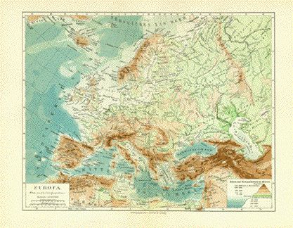
"Europa Fluss und Gebirgssysteme" This map published 1906 shows the rivers and mountain systems of Europe. Vertical centerfold. 21 x 26.5 cm ( 8.2 x 10.3 ") $ 30.00 Order Nr. EUROPE250668 |
|
"Europa zur Zeit der Kreuzuge" Copper engraving from Dr. Karl von Spruner's "Historisch-Geographischer Hand Atlas". Published in Gotha, 1846. Original hand outline coloring. This map shows Europe at the time of the Crusades. In the upper left is a small inset of Iceland. A few scattered light spots in map image and margins. Light age toning. Outer margin edges have light browning. 30 x 39 cm ( 11.8 x 15.3 ") $ 140.00 Order Nr. EUROPEMAP3001 |
|
"Europa" . Copper etching, ca 1720. Modern hand coloring. This map shows all of Europe, including Iceland and the part of Russia known as "European Russia". Map has a few little spots in margins. Some light browning of edges. General condition is Almost Very Good. 16.2 x 19.2 cm ( 6.3 x 7.5 ") $ 120.00 Order Nr. EUROPE MAP 2485 |
|
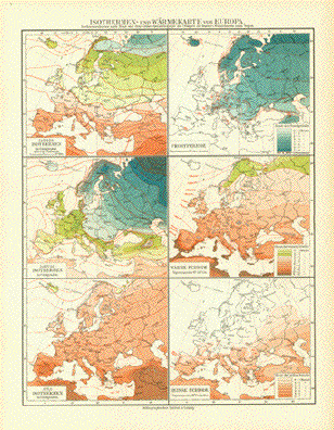
"Isothermen- und Waermekarte von Europa" Map published 1906 shows the
various isothermal yearly and monthly results Horizontal centerfold. 28 x 21.5 cm ( 11 x 8.4 ") $ 35.00 Order Nr. EUROPAMAP250666 |
|
|
Europe Copper etching for a German Map shows central Europe
and Some spotting in margins. 13.2 x 10 cm ( 5.2 x 3.9 ") $ 100.00 Order Nr. EUROPEMAP2487 |
|
J. Schouw's Uebersicht der Verbreitung der Wichtigsten Kultur. - Baum- und Strauchgewaechse in Europa" Steel etching from "Neuster Zeitungs Atlas. Alter und Neuer Erdkunde" by J. Meyer, ca 1855. Original outline coloring. Map shows the areas where certain trees and bushes grown in Europe. These include, organges, grapes, oak trees, barley, corn and others. Map has overall light toning and a few very minor spots. 20 x 27.2 cm ( 7.8 x 10.7 ") $ 50.00 Order Nr. EUROPEMAP2499 |
|
Antique Prints of Towns and Cities NUREMBERG CHRONICLE, LIBER CHRONARCUM, SCHEDELSCHE WELTCHRONIK Terms of Sale - Lieferbedingungen © Rainer Rauhut
|