|
Antique Maps of Asia A selection of historical Asian Maps. Each map is illustrated and carefully described. Please contact us if you are looking for a particular map. Maps have wider margins than shown below and normal age toning. Sale! Discount! 30% Discount on All maps with an ASIAMAP number on this page! Take 30% off the listed price. ! We accept reasonable Offers. Visit us at the following sites: https://lovelyantiqueprints.com twitter.com/philographikon2 Our maps are well packed and sent registered air mail and insured. |
|
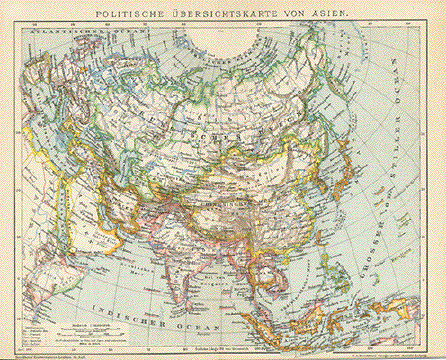
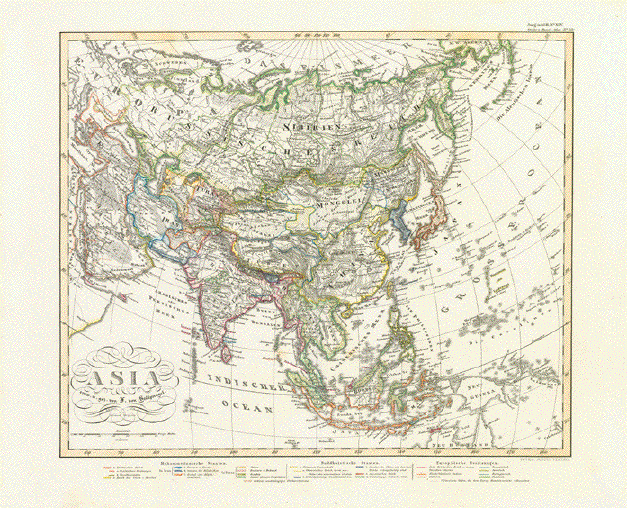
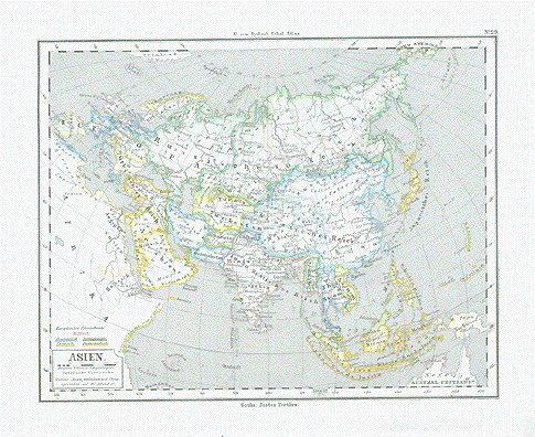
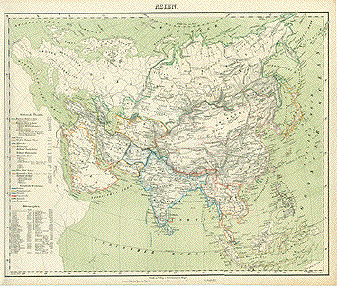
"Politische Uebersichtskarte von Asien" Wood engraving printed in color
1894 showing the political divisions of Asia at the
tieme. 22.5 x 27.5 cm ( 8.8 x 10.8 ") $ 35.00 minus 30% Discount = $ 24.50 Order Nr. ASIAMAP246821 |
|
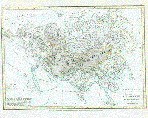
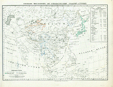
"Asia Europa in Beziehung auf das Fliessende und seine Vertheilung in Stromgebiete" This steel engraving map concentrates on the rivers of Asia and Europe. Published ca 1860. Some original hand outline coloring. Map was printed slightly slanted on the page. Map image: 21 x 30 cm ( 8.2 x 11.8 ") $ 70.00 minus 30% Discount = $ 49.00 Order Nr. ASIAMAP250568 |
|
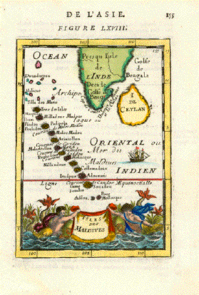
"Isles des Maldives" Hand-colored copper etching by
Alan Manesson Mallet ( 1630-1706) Very good condition. 13.1 x 9.2 cm ( 5.2 x 3.6 ") $ 140.00 Order Nr. INDIAMAP244763 |
|
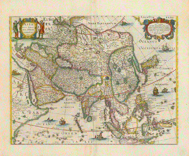
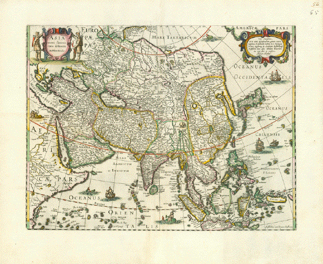
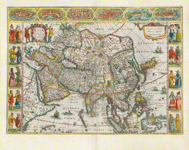
"Asia recens summa cura delineata" Map of Asia Type of print: Copper etching Color: Very pleasant hand coloring Author: Hendrik Hondius (1597-1651) Published: Amsterdam, dated 1631 Verso: Text in Latin language Condition: Very nice appearance. Centerfold in parts a bit worn. Margins show minor traces of age and use. In general: Much better than good. 37,5 x 49,5 cm (ca. 14.8 x 19.5") Order Nr. ASIAMAP238862SOLD |
|
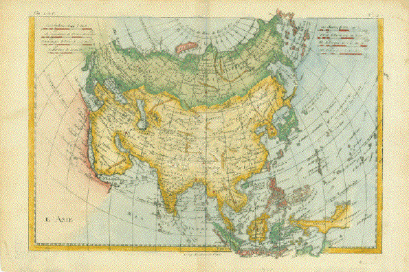
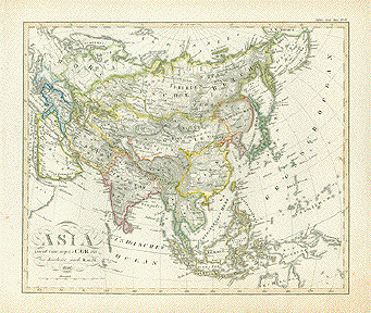
"Asia Concinnata Secundum Observationes Academiae Regalis S Scientiarum et nonnullas alias et juxta annotationes recentissimas Per G. De L'Lisl Geograph Venalis nunc prostat Augustae Vindilicorum apud T.C. Lotter Geogr." Asia according to the latest knowledge by de L'Isle. Copper etching by Gustav Conrad Lotter. Fine original hand coloring. Published by Tobias Conrad Lotter (1717 - 1777), Augsburg, ca. 1760 Flawless. 48 x 57.5 cm (19 x 22.5") $ 800.00 minus 30% Discount = $560.00 Order Nr. ASIAMAP235211 |
|
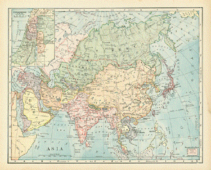
"Asia" Wood engraving printed in color ca 1900. Reverse side is printed with information (in English) about Asia. This map shows the political divisions of the time using various colors. Red lines show the major railway routes. In the upper left is a special inset showing Palestine. In the lower left is a map of Pennsylvania for size comparison. Light spot on right margin edge. 22 x 27 cm ( 8.6 x 10.6 ") $ 35.00 Order Nr. ASIAMAP239882 |
|
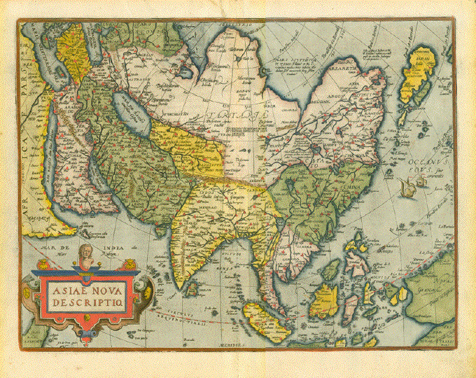
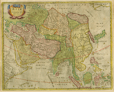
"Asiae Nova Descriptio" Hand-colored copper engraving Published in the atlas; "Theatrum Orbis Terrarum" by Abraham Ortelius (1527-1598) Antwerp, ca. 1580 Text about Asia in Latin language on the reverse side. There is a paper loss at the
top of this map (ca. 5 x 3 cm see scan) which has been
repaired (filled with a copy of the missing piece) Map image: 37 x 50 cm ( 14.5 x 19.6 ") With regard to to the mentioned repair: $ 1400.00 (after 30% discount: $ 980.00) Order Nr. ASIAMAP255409
|
|
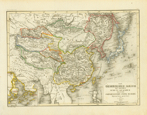
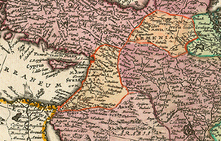
"Das Chinesische Reich mit
Seinen Schutz Staaten nebst dem Japanischen Insel
Reiche" Very interesting map of Asia showing the political divisions of the time. In the lower left is a special inset showing the area around Macao and Canton. Map was designed by J. Graessel. Published 1856. Original hand outline coloring. Vertical centerfold. Steel engraving map. Light natural age toning. Image size: 18.5 x 25.5 cm ( 7.2 x 10 ")" $95.00 Order Nr. ASIA250140 |
|
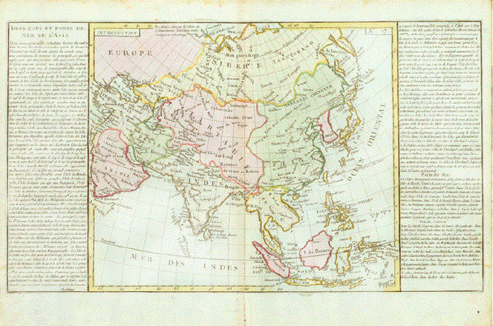
"Isles, Caps et Ports de Mer de l'Asie" Copper engraving map of Asia by
Jean Baptise Louis Clouet. On both side of the map is detailed information about the many ports and geography of Asia. Original hand coloring. Map has a vertical centerfold
that was reinforced long ago. Repair on lower
centerfold. Map image without text: 32 x 36
cm ( 12.5 x 14.1" Order Nr. ASIA251702SOLD |
|
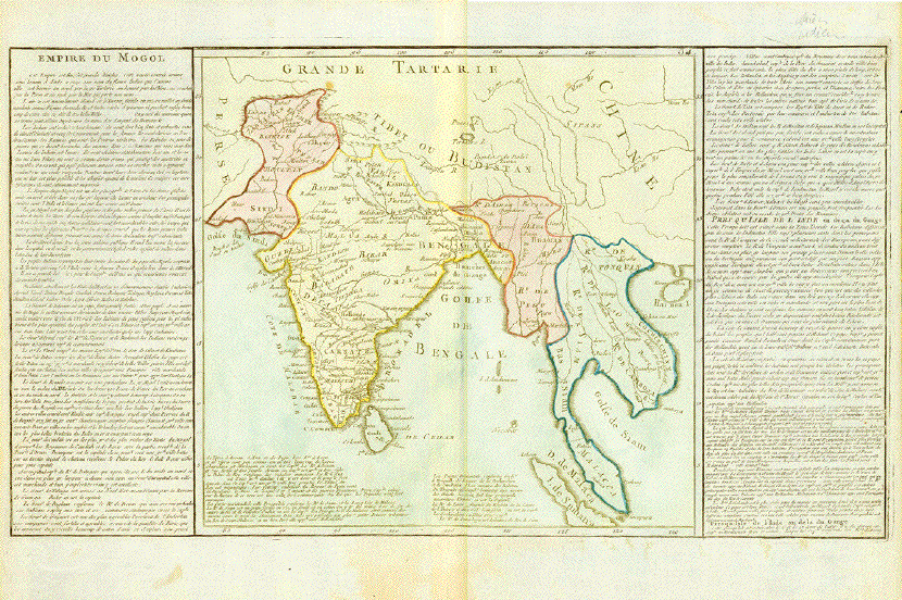
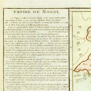
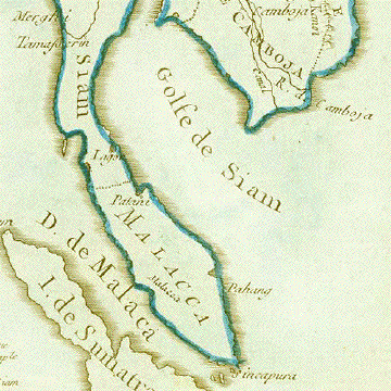
"Empire Du Mogol" Copper engraving map of Asia by
Jean Baptise Louis Clouet. On both side of the map is detailed information about the many ports and geography of Asia. Original hand coloring. Map has a vertical centerfold
that was reinforced long ago. Map image without text: 32 x 32
cm ( 12.5 x 12.5" $ 160.00 Order Nr. ASIA253940 |
|
"L'Asia divisa nei suoi principali Stati" (Asia - its main countries) Steel engraving by Castellini for �Il nuovo Mondo diviso nelle sue principali contrade" by C.P Marmocchi. Partial original hand-coloring. Rome. 1842 Large map has several horizontal and vertical folds to fit book size. Flawless. 51.5 x 56 cm (20 x 22") $ 260.00 Order Nr. ASIAMAP235212 |
|
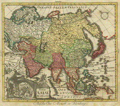
"Novae Asiae Delineatio". Copper etching by Peter Conrad Monath in Nuremberg, 1758. Original hand coloring. This map shows Asia with its various divisions in the 18th century. Notice that India reached further north and China was surrounded by Chinese Tartaria. In the lower left is a decorative scene os a parade with elephants and camels. In the lower right is a hint of Australia and in the upper right a line showing a land mass that is america. In the upper left the map reaches to Gronningen on the Dutch coast. The main problem with this map is that it is smudged, spotted and fingered in the margins. There is some light browning along centerfold. Other than that the condition is Better than Good. 23.7 x 27.5 cm ( 9.3 x 10.8 ") $ 580.00 Order Nr. ASIA2518 |
|
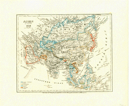
"Asien 1849" Steel etching from "Neuster Zeitungs Atlas. Alter und Neuer Erdkunde" by J. Meyer, ca 1855. Original outline coloring. Map shows the political divisions of Asia in 1849. Very good condition. 18 x 22 cm ( 7 x 8.6 ") Order Nr. ASIAMAP250124SOLD |
|
"L Asie Suivant les derniers observations de l'Academie Royale des Sciences". Copper etching ca. 1700. Recent hand coloring. This decorative little map shows very clearly the Artic Circle, Tropic of Cancer and the Equator. In the west is Scandanavia in the far north, Turkey and the Nile river in the south west. In the east is Siberia and Japan in the north and New Guinea in the southeast. Map has browning of right margin edge and almost invisible folds to fit book size. General condition is Very Good. 13.4 x 17 cm ( 5.3 x 6.7 ") Order Nr. ASIA2508SOLD |
|
"L'Asie" Copper etching by Rigoberto
Bonne for the atlas " Atlas de routes les parties cones du
globe terrestre" Map has minimal spotting in
margins. Light browning in lower margin along
centerfold. Map image: 22 x 31.5 ( 8.6 x 12.5 ")" $ 130.00 Order Nr. ASIAMAP250055 |
|
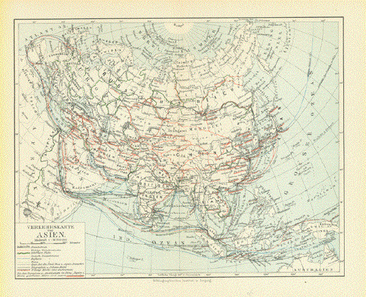
"Verkehrskarte von Asien" Map shows the roads, railroads,
telegraph lines and ship routes of Image: 20.5 x 26 cm ( 8 x 10.2") $ 35.00 minus 30% Discount = $ 24.50 Order Nr. ASIAMAP256343 |
|
"Asia" Steel engraving by Hermann
Berhaus after F. von Stuelpnagel for Stieler, dated
1854. The colored regions show the
Islamic states, the Buddhist states and the European
colonies of the time. Vertical centerfold. Map is in good condition. Very minor signs of age. 30 x 35.5 cm ( 11.8 x 13.9 ") $ 120.00 minus 30% Discount = $ 84.00 Order Nr. ASIAMAP256467 |
|
"Asia recens summa cura delineata" Copper etching with original borderline hand coloring. Author: Henricua Hondius (1597-1651) Publisher: Johann Janssonius (1588-1664) Published in Amsterdam, 1631 Image in very good condition. Two original numbers written in ink in upper right corner. Lower margin has some
well-executed repairs, one of which reaches along centerfold
into map direction India. 37,5 x 49,5 cm (ca. 14.8 x 19.5") Order Nr. ASIAMAP252894SOLD |
|
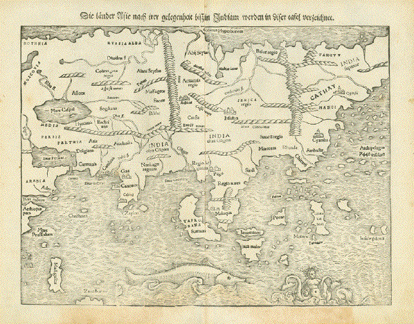
Reverse side:
"Die Länder Asie nach irer gelegenheit biss in Indiam werden in diser tafel verzeichnet" Woodcut. Published in a very early edition of "Cosmographia" by Sebastian Muenster (1488-1552) Basel, 1553 Asia as a continent in almost its entire dimension. A very early fascinating view at terra incognita. The charm of this map is the fumbling and fact-groping of huge land masses never visited nor measured nor described by geographers or travelers. Much on this map is guessing, almost nothing based on knowledge Cathay is the name Marco Polo used for China The Philippines' description is: Archipelagus 7448 insularii Siberia is India superior India itself looks like a small appendix to a huge land mass The map shows Russia, part of Arabia and Ethiopia and North Norway in the West and does not quite reach over to Kamechatka in the East. South East Asia quite prominent. Great early map to compare with reality! Light general age toning. Some little spots in margins. Lower margin has been partially reenforced. The age patina in lower margin more intense. Map: 25,8 x 34,3 cm (ca. 10.2 x 13.5") $ 1700.00 Order Nr. ASIAMAP252940 |
|
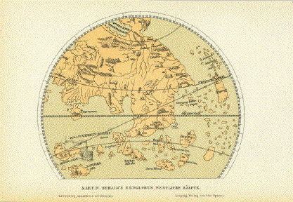
"Martin Behaim's Erdglobus, Westliche Haelfte" Interesting map made after the west side of a globe by Martin Behaim in 1492. This copy of the globe was published 1881. Image: 11 x 14 cm ( 4.3 x 5.5") $ 40.00 minus 30% Discount = $ 28.00 Order Nr. ASIAMAP253284 |
|
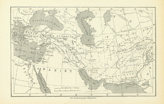
"Die Eroberungszuege Alexanders" ( the conquest route of Alexander the Great) Interesting wood engraving map
with dotted lines showing the various conquest routes of Image: 11 x 18 cm ( 4.3 x 7") $ 25.00 minus 30% Discount = $ 17.50 Order Nr. ASIAMAP252923 |
|
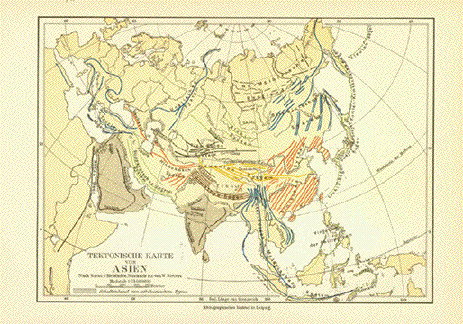
"Tektonische Karte von Asien" Published 1901. 14.5 x 20 cm ( 5.7 x 7.8 ") $ 30.00 minus 30% Discount = $ 21.00 Order Nr. ASIAMAP251958 |
|
"Asia Secondo le ultime Oservazioni dell'Accademia Reale delle Scienze". Copper etching ca. 1700. Recent hand coloring. Italian edition of the previous map. This decorative little map shows very clearly the Artic Circle, Tropic of Cancer and the Equator. In the west is Scandanavia in the far north, Turkey and the Nile river in the south west. In the east is Siberia and Japan in the north and New Guinea in the southeast. Upper and right margins have been widened. Almost invisible folds to fit book size. Repaired tear in lower right corner. General condition is Better than Good. 13.4 x 17 cm ( 5.3 x 6.7 ") $ 120.00 minus 30% Discount = $84.00 Order Nr. ASIA MAP 2155 |
|
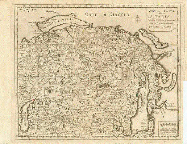
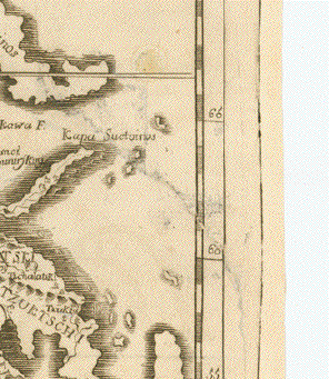
"Nuov Carta della Tartaria Secondo l'ultime Oservationi fatta in amsterdam per Isac Tirion" Very detailed copper engraving of Asia ca 1740. The map extends from the Caspian Sea in the lower left to Japan in the lower right. The map shows many topographical details such as mountains and deserts. On the right side is a repaired
tear shown in the detailed image of the map. The map has
several folds to fit the original 27.5 x 34 cm ( 10.8 x 13.3 ") $ 280.00 minus 30% Discount = $196.00 Order Nr. ASIAMAP246133 |
|
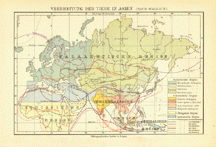
"Verbreitung der Tiere in Asien " ( nach Wallace ) Interesting map showing the
distribution of animals such as tigers, reindeer,
elephants, 13.5 x 21 cm ( 5.3 x 8.2 ) $ 35.00 minus 30% Discount = $ 24.50 Order Nr. ASIAMAP252128 |
|
"L�Asie Divisee en ses differens Etats" Copper engraving dated 1829 from:"Atlas de la Geographie ancienne, du moyen-age et moderne". By Felix Delamarche, who followed his father Charles Francois Demarche (1740-1817) in his cartographic business. Map shows the political divisions of Asia at the time. Original outline coloring. Small repair in margin above
and below centerfold. Small repaire on lower margin
edge. 27 x 36.5 cm ( 10.6 x 14.3 ") $ 85.00 minus 30% Discount = $ 59.50 Order Nr. ASIAMAP241838 |
|
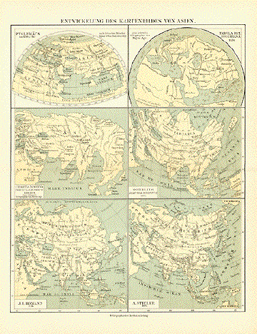
"Entwicklung des Kartenbildes von Asien" Development of Asian Maps Interesting comparison historically of famous Asian maps. Published 1895. Asian map history. Light age toning. Horizontal centerfold. Image size: 27.5 x 22 cm ( 10.8 x 8.6 ")" $ 45.00 minus 30% Discount = $ 31.50 Order Nr. ASIAMAP250113 |
|
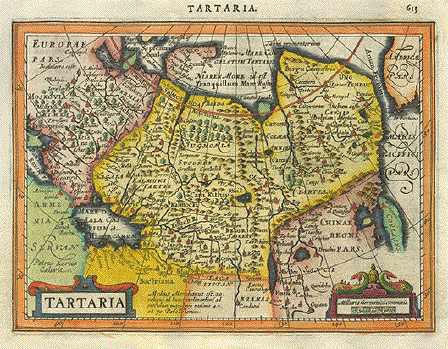
"Tartaria".
Copper etching by Peter Kaerius
(1571-1624). Amsterdam, ca 1620. Verso: Text in
Latin.Very This historical map shows the area of Tartaia from Moscow on the left to Korea on the right. In the upper right is a bit of America (Alaska) to be seen. In the lower right is much of China. The old place names and text on the backside (in Latin) give interesting information. The print has a small repaired tear in lower left margin. Condition is otherwise Almost Very Good. 13.5 x 18.3 cm ( 5.3 x 7.2 ") Order Nr. ASIAMAP2519 SOLD |
|
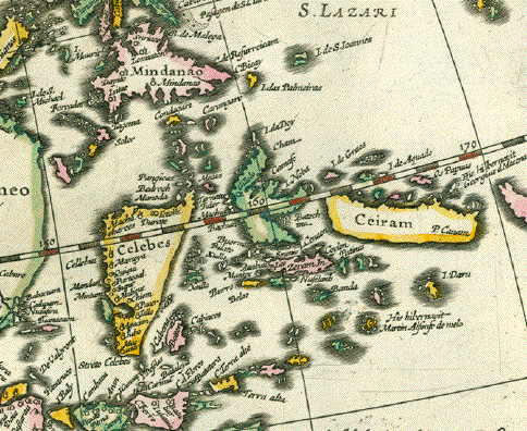
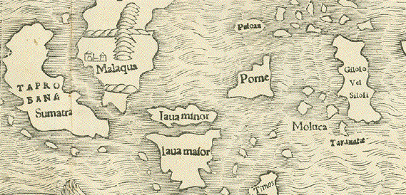
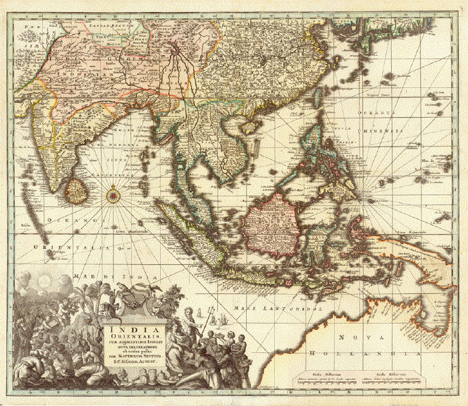
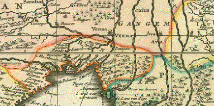
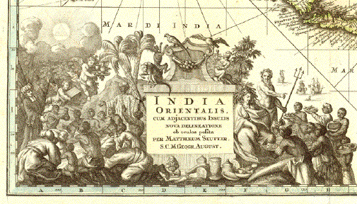
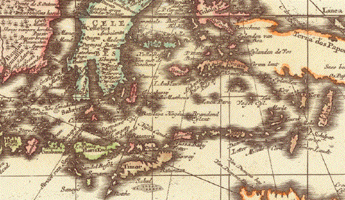
"India Orientalis cum Adjacentibus Insulis Nova Delineatione ob ocolos posita" Copper engraving map by Matthaeus Seutter. Published in Augsburg 1735. Map has fine original hand coloring. Shows Myanmar, India, Thailand. Bangladesh, Cambodia, Philippines, Indonesia and Australia. Very detailed and decorative map. Map has a few hardly visible
creases. The vertical centerfold has been reinforced. 48 x 57 cm ( 18.8 x 22.4 ") Order Nr. INDIAMAP252090 SOLD Reverse side:
|
|
Asien Wood engraving by E.
Winckelmann for Tr. Bromme, 1860. Hand colored. Printed in
Stuttgart. 29.7 x 37.5 cm ( 11.6 x 14.7 ") $ 75.00 minus 30% Discount = $ 52.50 Order Nr. ASIAMAP236819 |
|
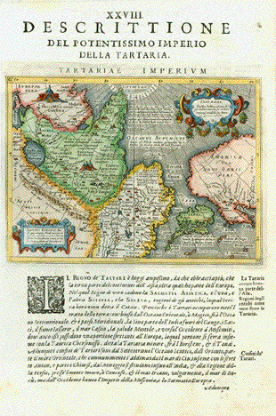
"Descrittione del Potentissimo Imperio della Tartaria - Tartariae Imperium". Plate XXVIII (28) This map shows suggestively in outlines the West Coast of North America from what later became Alaska, British Columbia, Washington (State), Oregon and California (which was already named). It also shows Japan, China, Russia, Mongolia, Central Asia. Type of print: Copper etching Artist: Girolamo Porro Published in: "Geografia cioe Descrittione Universale della Terra" Publisher: Gio. Battista & Giorgio Galignani Fratelli First published in: "Geographia" von Claudius Ptolemy Edition: Italian edition Editor: Giovanni Antonio Magini (1555-1617) Text: Italian. Complete on front and reverse side Published in: Venice Date: 1598 Measurements: Map size: Ca. 12,5 x 17 cm (ca. 4.9 x 6.7") Page size: Ca. 28,5 x 19 cm (ca. 11.2 x 7.5") Condition: Near perfect. Left margin a bit narrow. Very minor traces of age. Order Nr. ASIAMAP236461SOLD |
|
"Accuratissima totius Asiae Tabula in omnes partes devsa, de novo Correcta, ac in lucem edita........." Copper etching by Frederck de Witt. Published by Covens & Mortier, Amsterdam ca 1725. Map has been laid down on heavier paper, for reasns you do not see when looking from the front. When held against the daylight
or electric light one can see some perforations within the
map image as well as in its margins. Very pleasant original hand
coloring, but a more than moderate price because of the
mentioned shortcomings, 43.5 x 54 cm ( 17.1 x 21.3 ") Order Nr. ASIAMAP248371 SOLD |
|
"Geograph. Verbreitung Des Buddhaistischen Staaten-Systems" Lithograph published by C. Flemming in Glogau ca 1860. Some original outline coloring. Very interesting map showing the Buddhist areas and lands of Asia. In the upper right is a list of the various Buddhist states and groups. Clean map with very light browning on margin edges. 30 x 41 cm ( 11.8 x 16.1 ") $ 80.00 Order Nr. ASIAMAP2528 |
|
"Uebersichtskarte von Hedins Reisen in Tibet 1806-1908." Map was constructed and drawn by Lieutenant C. J. Otto Kjellstroem. Published 1909. Map shows many details such as special names, topography and Sven Hedins routes of travel in the area. Map has folds to fit original book size. Hardly visible repaired tear ( 13 cm - 5.1 ") from left margn into map. Light crease in lower left title corner. 32 x 46 cm ( 12.5 x 18.1 ") $ 160.00 Order Nr. ASIA248167 |
|
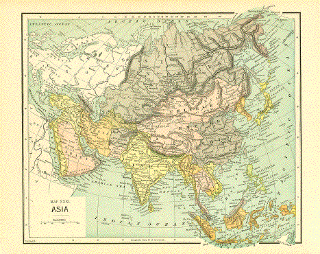
"Map XXXI Asia" Very interesting map of Asia showing the political divisions of the time. Published by Fisk & See ca 1890 in New York. Vertical centerfold. Wood engraving map. Image size: 23.5 x 28.5 cm ( 9.4 x 11.2 ") $ 40.00 Order Nr. ASIAMAP250141 |
|
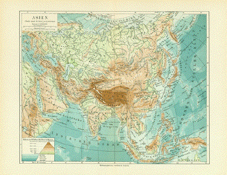
"Asien" Map published 1901 with topographicals details of Asia. Vertical centerfold. Good condition. 21 x 26 cm ( 8.2 x 10.2 ") $ 35.00 Order Nr. ASIAMAP251970 |
|
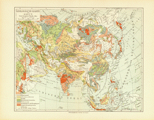
"Geologische Karte von Asien" Interesting geological map of
Asia published 1901. In the lower left is a color key to
the Good condition. 21 x 26 cm ( 8.2 x 10.2 ") $ 35.00 Order Nr. ASIAMAP251968 |
|
"Asien" Steel engraving by H. Eberhardt after Ph. Weber, ca 1850. Clean map with many historical topographical names of Asia. 20.7 x 25.7 cm ( 8.1 x 10.1") $ 50.00 Order Nr. ASIAMAP2525 |
|
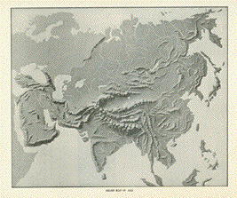
"Relief Map of Asia" Wood engraving ca 1895. Reverse side is printed. 20.5 x 24.5 cm ( 8 x 9.6 ") $ 25.00 Order Nr. ASIAMAP248007 |
|
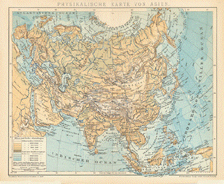
"Physikalische Karte von Asien" Wood engraving printed in color
1894 showing the topography of Asia. 22.5 x 27.5 cm ( 8.8 x 10.8 ") $ 35.00 Order Nr. ASIAMAP246822 |
|
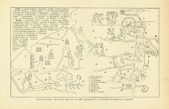
"Karte der Tartarei" ( Map of the land of the Tartars) Highly interesting wood
engraving map after the original 13th Century map in Image: 10.5 x 17.5 cm ( 4.1 x 6.8") Order Nr. ASIAMAP252954 SOLD |
|
"Asien. Politische Uebersicht" Steel engraving with original
hand outline coloring. Published ca 1850. Map has a vertical centerfold and a few signs age and use. 19 x 24 cm ( 7.4 x 9.4 ") Order Nr. ASIA250556 SOLD |
|
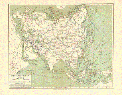
"Forschungsreisen in Asien Mittelalter und Neuzeit " ( exploration travels in Asia in the Middle Ages and in 1856 and later.) The lines on the map show the travel routes and names of the early explorers. Interesing comparison historically of exploration. Published 1895. Fine little map in good condition. Image size: 14 x 22.5 cm ( 5.5 x 8.8 ")" $ 45.00 Order Nr. ASIAMAP250114 |
|
|
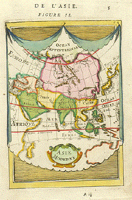
Asie Moderne Copper etching by Mallet,
1683. Map image is clean. Image
printed 14 x 10.2 cm ( 5.5 x 4 ") Order Nr. ASIA MAP 1671SOLD |
|
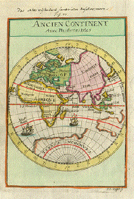
" Ancien Continent Avec plusieurs Isles Oceans et Mers ". Copper etching by Vogel after Mallet. 1685. Modern hand coloring. It is always interesting to see what is important enough to be identified at the time on these maps. In the south Atlantic St. Helena Island was already known. Further east is Madagascar, the Maldives and the Philipinnes. A spot in lower margin which does not affect the image is the only negative aspect of this map. Condition is otherwise Very Good. 13.7 x 10 cm ( 5.4 x 3.9 ") Order Nr. ASIAMAP2152.SOLD |
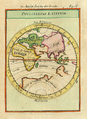
" Paralleles de Latitude ". Copper etching after Mallet. Ca 1685. Modern hand coloring.
14 x 10 cm (5.5 x 3.9 ")
$ 90.00
Order Nr. ASIAMAP2156
|
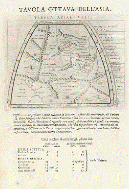
"Tavola Ottava Dell'Asia" - Tabula Asiae VIII" Plate VIII (8). Central Asia Type of print: Copper etching Artist: Girolamo Porro after Ptolemy Published in: "Geografia cioe Descrittione Universale della Terra" Publisher: Gio. Battista & Giorgio Galignani Fratelli Edition: Italian edition Editor: Giovanni Antonio Magini (1555-1617) Text: Italian. Complete. On front and reverse side Published in:Venice Date:1598 Measurements: Map size: Ca. 12,5 x 17 cm (ca. 4.9 x 6.7") Page size: Ca. 28,5 x 19 cm (ca. 11.2 x 7.5") Condition: Very minor traces of age. $ 280.00 Order Nr. ASIAMAP236716 |
|
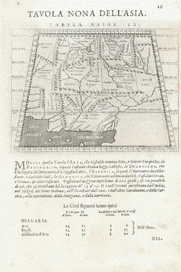
"Tavola Nona Dell'Asia" - Tabula Asiae IX" Tafel IX (9). Pakistan, Afghanistan, Iran, Cashmir, Turkmenistan to River Indus Type of print: Copper etching Artist: Girolamo Porro after Ptolemy Published in: "Geografia cioe Descrittione Universale della Terra" Publisher: Gio. Battista & Giorgio Galignani Fratelli Edition: Italian edition Editor: Giovanni Antonio Magini (1555-1617) Text: Italian. Complete on front and on reverse side Published in: Venice Date:1598 Measurements: Map size: Ca. 12,5 x 17 cm (ca. 4.9 x 6.7") Page size: Ca. 28,5 x 19 cm (ca. 11.2 x 7.5") Condition: Very minor traces of age. $ 280.00 Order Nr. ASIAMAP236719 |
|
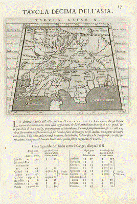
"Tavola Decima Dell'Asia" - Tabula Asiae X" Plate X (10). Pakistan, Cashmir, Bangla Desh, North-India between Indus and Ganges Type of print: Copper etching Artist: Girolamo Porro after Ptolemy Published in: "Geografia cioe Descrittione Universale della Terra" Publisher: Gio. Battista & Giorgio Galignani Fratelli Edition: Italian edition Editor: Giovanni Antonio Magini (1555-1617) Text: Italian. Complete on front and on reverse side: Tavola Undecicima Asiae (11) Published in: Venice Date: 1598 Measurements: Map size: Ca. 12,5 x 17 cm (ca. 4.9 x 6.7") Page size: Ca. 28,5 x 19 cm (ca. 11.2 x 7.5") Condition: Very minor traces of age. Reverse side:
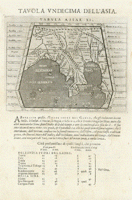
"Tavola Undecima Dell'Asia" - Tabula Asiae XI" Plate XI (11). Bangla Desh, Northeast-India, Myanmar (Birma), Laos, Thailand, Southwest-China, Singapore Type of print: Copper etching Artist: Girolamo Porro after Ptolemy Published in:"Geografia cioe Descrittione Universale della Terra" Publisher: Gio. Battista & Giorgio Galignani Fratelli Edition: Italian edition Editor: Giovanni Antonio Magini (1555-1617) Text:Italian. Complete on front and on reverse side: Tavola Decima Asiae Published in: Venice Date: 1598 Measurements: Map size: Ca. 12,5 x 17 cm (ca. 4.9 x 6.7") Page size: Ca. 28,5 x 19 cm (ca. 11.2 x 7.5") Condition: Very minor traces of age. $ 375.00 Order Nr. ASIAMAP236718 |
|
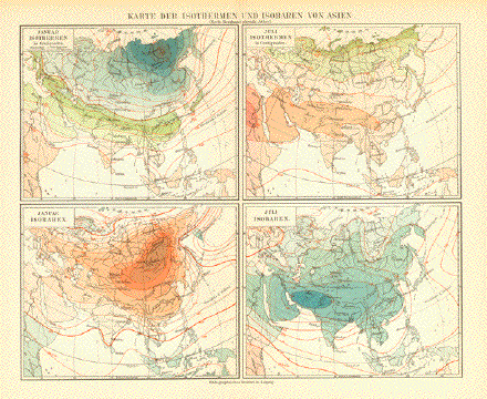
"Karte der Isothermen und Isobaren von Asien" Shows the data from January and July. Published in Leipzig 1890. Vertical centerfold to fit original book size. Light age toning in margins. Image: 21.5 x 26.5 cm ( 8.4 x 10.4 ") $ 35.00 Order Nr. ASIA252057 |
|
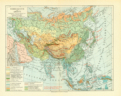
"Florenkarte von Asien" Very interesting botanical map of the various growing regions of Asia. Published in Leipzig 1890. Vetical centerfold to fit original book size. Image 21 x 26 cm ( 8.2 x 10.2 ") $ 40.00 Order Nr. ASIA252055 |
|
"Asien" Copper engraving by Champion ca 1780. Modern hand coloring. Vertical centerfold. A few light spots in margins. 20.5 x 24.8 cm ( 8 x 9.7 ") Order Nr. ASIA2526SOLD |
|
"Asia". Copper etching by Jodocus Hondius (1563-1611) and edited by Johann Janssonius. Published in Amsterdam, 1632. Fine original coloring. The continent Asia is the theme of this beautiful map. In the west is Moscow, Turkey and the Nile. In the east is Japan, the Philipinnes and Indonesia. At the top are 6 city views (Famagusta, Rhodos, Damascus, Jerusalem, Aden and Hormus). On each side are 5 pairs of Asian inhabitants in their traditional clothing. The title cartouche is in the upper left corner and the cartouche in the upper right gives the name Janssonius as editor. The margins have been widened and restored. Map has been reinforced. Light creasing on centerfold. 41.4 x 57.4 cm ( 16.3 x 22.6 ") Order Nr. ASIA 237154SOLD |
|
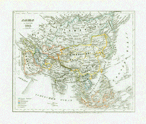
"Asien 1845" Steel etching from "Neuster Zeitungs Atlas. Alter und Neuer Erdkunde" by J. Meyer, ca 1855. Original outline coloring. Map shows the political divisions of Asia in 1845. Map is clean. Hardly visible vertical centerfold. 18 x 22 cm ( 7 x 8.6 ") Order Nr. ASIAMAP2530 SOLD |
|
|
"Asien" Copper etching, ca 1700. Modern hand coloring. Left margin is frayed from
binding. Right margin edge 16.1 x 16.8 cm ( 6.3 x 6.6 ") $ 70.00 Order Nr. ASIAMAP2516
|
|
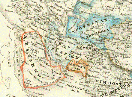
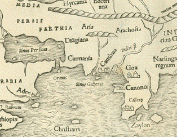
"Carte de la Partie Superieure de L'Inde en de Çàdu Gange...." Copper etching by Rigobert Bonne (1729-1795) for "Atlas de toutes les parties connues du globe terrestre" by Guillaume Thomas Francois Raynal (1713-1796). Published 1780 in Geneva. Modern hand coloring. This map shows northern India and the surrounding countries. In the northwest is part of Afghanistan with Kandahar, part of the province of Kabul and towns such as Nagar, Gasna, Pokage, Jtal and others, all of which now have different names. Pakistan and Kashmir are both shown without the boundaries as known today. North of India is part of Tibet. To the east is Bangladesh. India reaches as far south as Dapoli in the west and Visakhapatnam in the east. In the upper right is an iset showing the area around the mouth of the Ganges with Calcutta in the center. Map has wider margins (ca 1.5 - 2.5 cm) than shown. In the right margin is a small ink spot from the original printing. The is an almost invisible crease parallel to the centerfold. Paper has some minimal original irregularities visible in margins. General condition is otherwise Almost Very Good. 21 x 31.8 cm ( 8.2 x 12.5 ") $ 260.00 Order Nr. ASIA MAP 2511 |
|
"Asia wie es jetziger zeit nach den fuernemesten Herrschaften abgetheilet und beschriben ist". Woodcut by Sebastian Münster from the "Kosmographie". Basel, ca. 1590. Pleasant modern hand coloring. Part of the charm of this very old map of Asia is that it is not so exact. The map stretches from Eygpt in the west to Japan and New Guinea in the east. The northern part of the map is more "sketchy". In the location of present-day Siberia is the Scythicum Sea. Central Asia by Sebastian Münster reaches as far north as Japan and Mongolia. The area around the Caspian Sea and Black Sea are more accurate, even though the Caspian Sea lies too far south. In the lower left corner is a framed inset with information about Asia. Verso: Text in German about Asia. Corners are somewhat spotty. There is foxing along the lower half of the center fold. A repaired tear of 5 cm. in the lower margin runs parallel to the center fold and a 0.5 cm. missing piece of paper has been replaced. Inking in upper right corner. Overall age toning. Creasing on centerfold in lower margin. The overall condition of the map isgood for a map of this age. 30.7 x 36 cm ( 12.1 x 14.2 ") Order Nr. ASIAMAP2503 SOLD |
|
"Asien" Lithograph printed in color with hand outlining. Published by C. Flemming in Glogau ca 1870. Very detailed map of Asia with special information on the side with statistics, European Colonies and altitudes. Map has a narrow left margin. A few very minor spots. 33.5 x 41 cm ( 13.1 x 16.1 ") $ 75.00 Order Nr. ASIAMAP2529 |
|
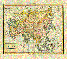
"Asia zuerst entw. u. gez. v. C.G.R. 1821. Neubearbeitet nach R. u. St. 1826." Steel engraving from Stielers Hand Atlas ca 1870. Original hand outline coloring. Map has wide margins. A few scattered spots in margins and light browning on margin edges. 30 x 35.5 cm ( 11.8 x 13.9 ") Order Nr. ASIAMAP2527SOLD |
|
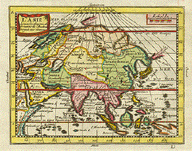
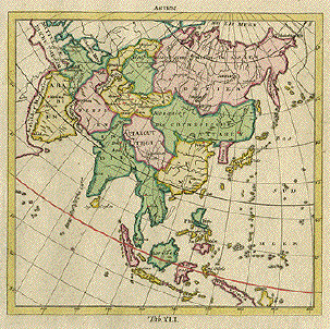
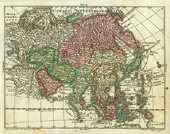
"Asia". Copper etching by Tobias Conrad Lotter ( (1717-1777) after Tobias Lobeck for the "Atlas Geographicus portabilis" (Pocket-size atlas) published 1760-1762. Original hand coloring. Map showing all of Asia with a bit of Europe and Africa on the left and a tiny bit of Alska in the upper left north of Japan! At the bottom is the northern tip of australia. Map has some light browning on right side and binding marks on left margin edge. General condition is otherwise Better than Good. 9.4 x 12.3 cm ( 3.7 x 4.8 ") $ 130.00 Order Nr. ASIAMAP2524 |
|
"Asia Antiqua et Nova". Copper etching by Philipp Clüver (1580-1622) from "Introductionis in Universam Geographicam" published in 1624. Modern hand coloring. This very early map shows Asia from the Mediterranean to the Pacific. In the lower left is part of Africa. In the upper right is a bit of America. Many original names of places and peoples are on this map. Map has folds to fit book size. Centerfold has some creasing in lower area. Crease in lower left margin corner. Side margins are narrower. Some light smuding and scatered spotting. Overall condition is Much Better than Good. 21 x 25.7 cm ( 8.2 x 10.1 ") $ 220.00 Order Nr. ASIAMAP2520 |
|
"Tabvla Asiæ IX". Copper etching from: "Geographia" by Claudio Ptolemy. Originally edited and published by Willibald Pirckheimer. This edition, which comprises all 64 maps of the "B" edition, including the "New World", was published by Josephus Meletius 1562 in Venice. For orientation one can see part of the Indian Ocean and the mouth of the Indus in the lower part of this map. In the far west is much of present-day Persia. In the northeast are the Paropamsis mountains of Afghanistan. Further south is Pakistan and a bit of India. On the backside is a location description in italian of the major towns shown on the map. The names shown are the ancient names. Map is very clean with a strong impression. Bits of text from backside visible on the front Very light browning along centerfold. Small repaired tear on upper centerfold. Overall condition is Almost Very Good. 17.8 x 24 cm ( 7 x 9.4 ") $ 450.00 Order Nr. MIDDLEEASTMAP1849 |
|
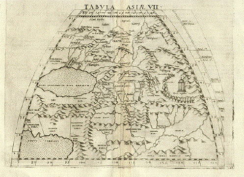
"Tabvla Asiæ VII" Copper etching from: "Geographia" by Claudio Ptolemy. Originally edited and published by Willibald Pirckheimer. This edition, which comprises all 64 maps of the "B" edition, including the "New World", was published by Josephus Meletius 1562 in Venice. Ancient names and the geography known to Ptolemy are shown on this interesting map with the Caspian Sea and Persian Gulf in the west. In the north is Scythia. Persia is shown with very old names between the Caspian Sea and Persian Gulf. In the southeast is India with the Indus river. On the back is text in italian describing this ancient area. This print has a very strong impression and is very clean. Some offsetting on edges that is from the time of printing. Bits of text from backside visible on the front. Hardly noticeable browning along centerfol. Overall condition is Very Good. 18 x 24 cm ( 7 x 9.4 ") $ 450.00 Order Nr. MIDDLEEASTMAP1848 |
|
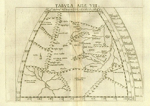
"Tabvla Asiæ VIII ". Copper etching from: "Geographia" by Claudio Ptolemy. Originally edited and published by Willibald Pirckheimer. This edition, which comprises all 64 maps of the "B" edition, including the "New World", was published by Josephus Meletius 1562 in Venice. The area to the northeast of the Ganges river is shown on this map. In several areas to the north the name Scythia is used. To the east is part of China. Italian text on the backside describes the area shown on the map. Some text shows through from backside. Except for light browning along the centerfold, this map is in Very Good condition. 17.7 x 24.1 cm ( 6.9 x 9.5 ") $ 380.00 Order Nr. ASIAMAP2514 |
|
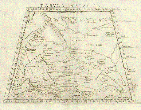
" Tabvla Asiæ II ". Copper etching from: "Geographia" by Claudio Ptolemy. Originally edited and published by Willibald Pirckheimer. This edition, which comprises all 64 maps of the "B" edition, including the "New World", was published by Josephus Meletius 1562 in Venice. This Asian map shows the countries to the north of the area between the Sea of Azov and Caspian Sea. It includes Caucasia, Sarmatia, part of Ukrania and the northeast is titled Scythia. Italian text on the backside describes the area. Bits of text from backside visible on the front. Hardly visible browning along centerfold. Overall condition is Almost Very Good. 17.5 x 24.5 cm ( 6.9 x 9.6 ") $ 380.00 Order Nr. ASIAMAP2515 |
|
|
|
"Beschreibung der Lantschafften so die Sogdianer / Margianer und Scythen bewohnen". Woodcut from the "Cosmographia" acording to Ptolomy by Sebastian Münster. Published in Basel 1574. The original map was drawn by Pomponius Mela, a Roman geographer born in Tingentera, Spain. In 43 A.D. he finished a geographical work first known as "De situ orbis" and later "De chorographia". After bookprinting became possible this work was widely known. Just looking at this map arouses interesting thoughts of this area and its history. The Caspian Sea (left middle) and the Persian Gulf (lower left) give good orientation for this map. The cartouche in the upper left describes the ancient folk known as Sogdianer while the cartouche in the upper right describes the Margianer who lived east of the Caspian Sea. The cartouche in the lower right tells about the Scythier who inhabited the northern region and supposedly spread much further west into central Europe. Notice that in the southeast is part of northern India. Condition is almost Very Good. Verso: Text in German 25 x 34.2 cm ( 9.8 x 13.5 ") $ 350.00 Order Nr. MIDDLEEASTMAP1831 |
|
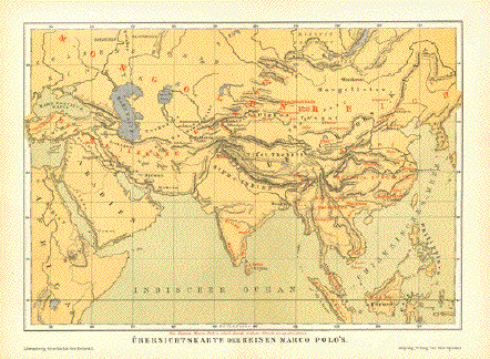
"Uebersichtskarte der Reisen Marco Polo's" Chromolithograph map published
1881. The red names are those of Marco Polo. 17.5 x 25 cm ( 6.8 x 9.8") $ 70.00 minus 30% Discount = $49-00 Order Nr. ASIAMAP255835 |
Terms of Sale - Lieferbedingungen
© Rainer Rauhut
Please visit our new sites
https://lovelyantiqueprints.com
twitter.com/philographikon2