|
Alte Landkarten von Deutschland (Seite 2) Antique Maps of Germany (Page 2) This is a selection of our historical maps of Germany. There are several pages more. Click the link at the bottom of the page to see more. If you are looking for a particular map please contact us. If you want to know if a certain town or city is on one of our maps, please ask. Sale! Discount! 30% Discount on All maps with a DEUTSCHLAND number on this page! Take 30% off the listed price. ! Visit us at the following sites: https://lovelyantiqueprints.com twitter.com/philographikon2 |
|
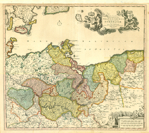
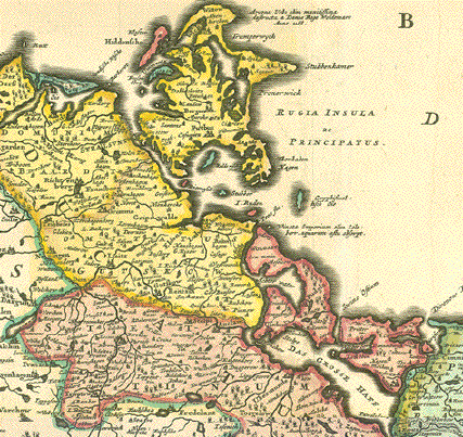
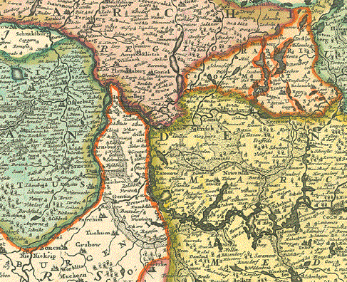
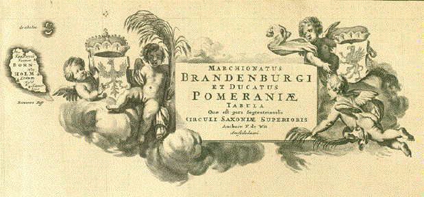
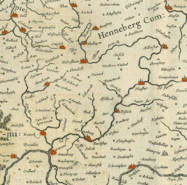
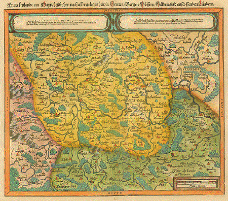
"Marchionatus Brandenburgisch et Ducatus Pomeranze Tabula qual est pars Septentrionalis, Circuli Saxoniae Superioris" Altkolorierte Kupferstichkarte von Frederik de Wit. Amsterdam, um 1680 Sehr attraktives altes Flächenkolorit. Obere Marge mit Papier des 17. Jahrhunderts angesetzt. Einige wenig auffällige Altersspuren. Leicht gebraeunt. Image: 48,5 x 55,5 cm (ca. 19 x 21.8") $ 400.00 minus 30% discount = $ 280.00 Order number DEUTSCHLAND256737 |
|
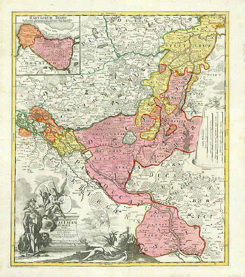
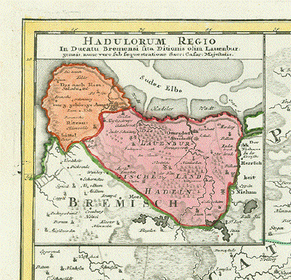
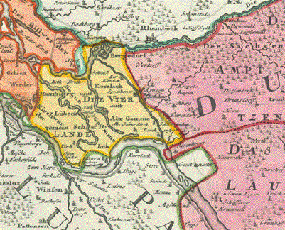
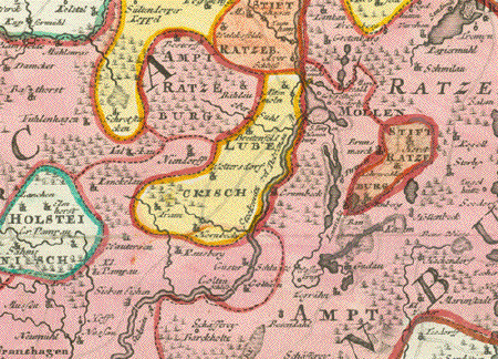
"Typus Geographiens Ducat Lauenburgici". Copper engraving by Johann Baptis Homann and son George Homann. Dated 1729. Hand coloring. For orientation Hamburg is on the left side center. Lauenburg is in the lower center of the map. At the top center of the map is Bad Segeberg. In the lower right is Hitzacker on the Elbe River. In the upper right is Travemunde. Notice the decorative cartouche showing an angel holding a coat-of-arms being shown to a soldier in armor. In the upper left is an inset of the Lauenburg region. Map has a horizontal centerfold that has been reinforced and does not "fold" anymore. A few minor scattered spots. 56.5 x 48 cm ( 22.2 x 18.9 ") $ 480.00 Order Nr. DEUTSCHLAND 1378 |
|
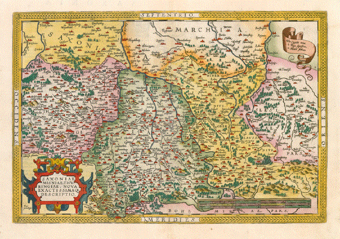
"Saxoniae Misniae, Turingae, nova exactissimaque descriptio.". Copper etching by Abraham Ortelius . Published in Antwerp 1590. Modern hand coloring. This map shows the regions of Thuringia, Saxony and Lower and Upper Lusatia. The map reaches as far south as Prague. It reaches as far west as Hameln in Lower Saxony and as far east as the Oder and Neisse rivers. Verso: Text in Latin. Map has overall light age toning and a small repaired tear in lower margin on the centerfold. General condition is Almost Very Good. 34.2 x 50.4 cm ( 13.5 x 19.8 ") $ 780.00 Order Nr. DEUTSCHLAND239157 |
|
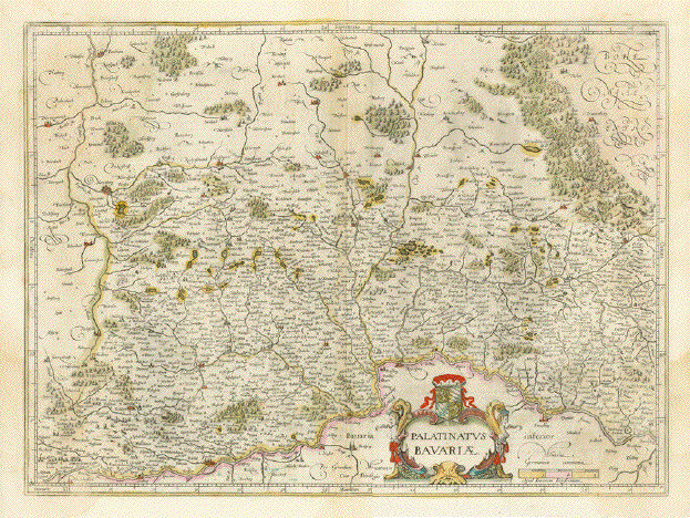
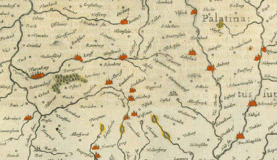
"Palatinatus Bavariae" Copper engraving by Janssonius. Published in Amsterdam ca 1640. Original hand coloring. Verso: Text in French about Bavaria. Shows the Palitanate, Lower Bavaria, and Franconia. Themap extends south to the Danube River from the mouth of the Lech River to Straubing and Naternberg. The map has light age toning. In the right and left lower areas are water stains. Along the centerfold is light browning and a parallel crease. 36.5 x 49 cm ( 14.1 x 19.2 ") $ 225.00 Order Nr. DEUTSCHLAND238215 |
|
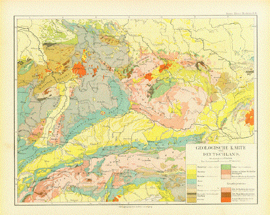
"Geologische Karte von Deutschland" This interesting geological map
extends from the Alps in the South as far north as
Hannover. Map published in Leipzig 1892. Vertical centerfold. Light browning in margins. Map image: 21 x 26.5 cm ( 8.2 x 10.4") $ 35.00 minus 30% Discount = $ 21.00 Order Nr. GEOLOGY256668 |
|
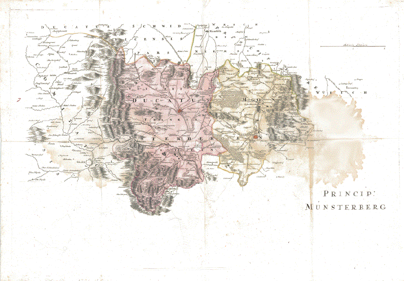
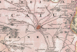
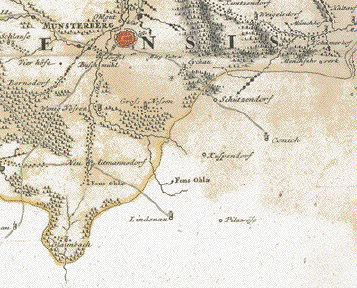
PROBEABZUG - PROOF PRINT Halbfertige Karte des Fuerstentums Muensterberg ind Frankenstein Half-finished proof print of Principality of Muensterberg and Frankenstein Noch hone Kartusche. Der Titel als Handschrift mit Tinte. No cartouche yet, just ink title Details wie vorige Karte. Details like above Handkoloriert - Hand-colored. Rechts grosser Wasserfleck - Large water staun on right side. Zusätzliche Faltungen und auf Leinen aufgezogen. Additional vertical and one horizontal folds. Mounted on linen. Abmessungen wie für die fertile Karte. Measurements like for the finished map $ 800.00 Order Nr. DEUTSCHLAND248606 |
|
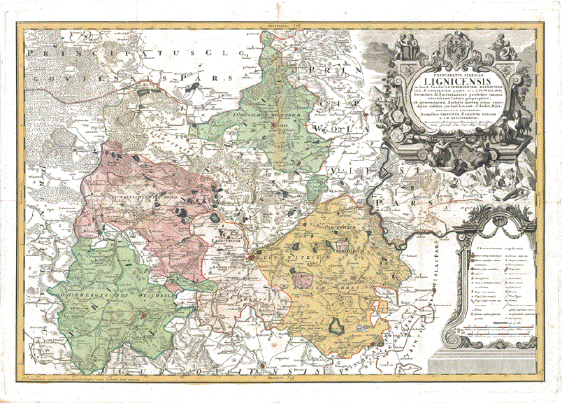
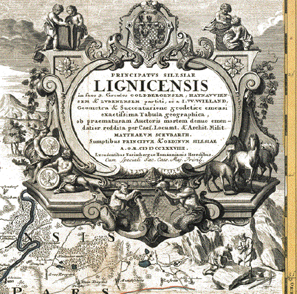
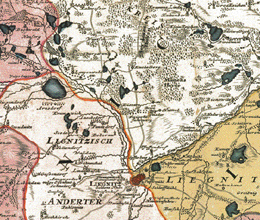
"Principatus Silesiae Lignicensis in suos 3 Circulos Goldenbergensem, Haynauviensem & Lubenensem partiti, ac I.W.Wieland Geometra et Succenturione geodetice emensi exactissima Tabula geographica ob praematuram Auctoris mortem denuo emendatior reddita per Caes. Locumt. & Archit. Milit. Mathaeum SchubarthSumptibus Pricipum & Ordinum Silesiae A.O.R. MDCCXXXVI Excudentibus Norimbergae Homannianis Heredibus�" Fuerstentum Liegnitz. Sehr detaillierte und dekorative handkolorierte Kupferstichkarte nach Zeichnung von Johann Wilhelm Wieland (? - 1736) und nach dessen Tod ueberarbeitet von Matthaeus Schubart (? - 1758). Aus dem "Atlas Silesiae". Herausgeber: Homann Erben, Nürnberg. Die Karte ist 1736 datiert und gedruckt. Der Atlas mit insgesamt 18 Kupferstichkarten ( zwei Übersichtskarten und 16 Fürstentuemer) im Gross-Folio-Format wurde insgesamt aber erst 1750 herausgegeben. Im oberen Mittelfalz ( grüner Bereich) farbliche Minderung. Kartuschen nicht koloriert. Mehrere Faltungen. Auf Leinen aufgezogen. Ansonsten kaum Alters- und Gebrauchsspuren. Principality of Liegnitz (Legnica) with coat of arms. Hand-colored copper etching after the drawing by Johann Wilhelm Wiegand (? - 1736) and, after his death, revised by Matthaeus Schubarth (ß - 1758). Published in the "Atlas Silesiae". Published by Homann Heirs in Nuremberg. The map is dated and printed in 1736, although the complete atlas with 18 grand-folio-size maps was published in its entirety in 1750. This very large map shows much detail. Even small villages are mentioned. Very detailed and very decorative. Cartouches are uncolored. Upper centegrfolg (ingrain part) minor discoloring. Extra vertical and a horizontal fold. Mounted on linen. Otherwise hardly any traces of age and use. 55 x 81 cm (ca.21.7 x 31.9") $ 1300.00 Order Nr.DEUTSCHLAND613 |
|
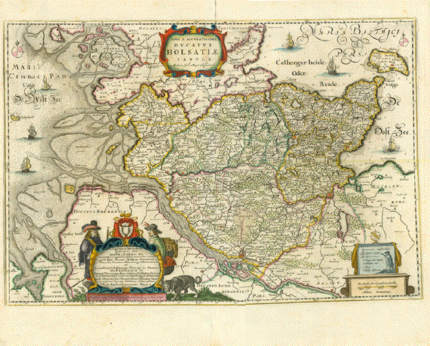
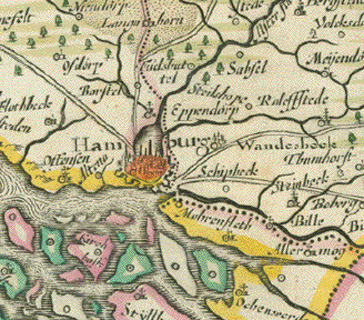
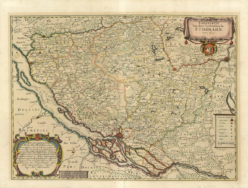
"Nova & Accuratissima Ducatus Holsatiae Tabula" Die Karte zeight die Konturen von Meeren, der Nordsee und der Ostsee. Das macht ja eine Karte immer interessanter als nur eine "Landmasse". Das Fürstentum Stormarn ist mit viel Detail im Zentrum abgebildet. Die Karte stammt auch aus dem Mejer-Atlas von Schleswig-Holstein. Husum, 1652, ist aber altkoloriert und in herausragend exzellentem Erhaltungszustand. Es ist quasi die Titel-Kupferstichkarte zu dem Atlas für "Holstein". Mit der sehr dekorativen Titelkartusche. Diese Karte hat eine "Übergrösse", was dazu führt, dass die Margen links und rechts selbstverständlich knapp sein mussten. Links ca. 1 cm, rechts ca. 1,5 cm. Eine traumhaft schöne Karte. 42,5 x 62,5 cm ( 16.7 x 24.6 ") $ 1900.00 Order Nr. DEUTSCHLAND251681 |
|
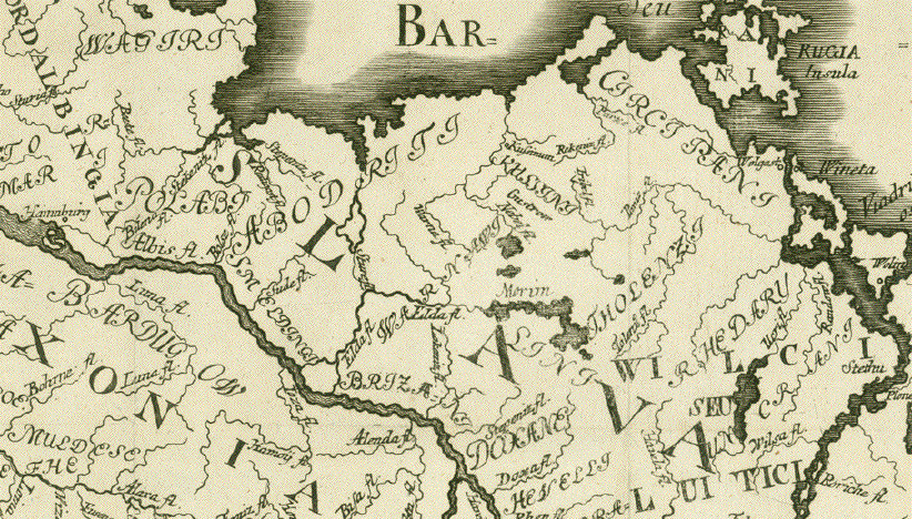
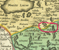
Map of North Germany ca. 1000 A.D. with attention to Slavic place names and Slavic tribal names. Slawische Besiedlung in Norddeutschland um das Jahr 1000 A.D. Slawische Ortsnamen - Slawische Völkernamen. Borders of map North: Baltic Sea coast across northern Germany to mouth of Elbe river East: Mouth of Vistula to Kracow and Tatra South: Run of the Danube from Ulm eastwards to about Bratislava West: Tuebingen - Frankfurt on the Main - run of Weser river to Bremen - mouth of Elbe river Copper etching. Printed ca. 1750/80. Unfortunately the name of the engraver is illegibly cut through the middle at bottom right. There is no cartouche, not title. Several vertical and two horizontal folds indicate, that this map was published in a small format book. The focus of this map lies on the geographical area between the Oder and the Elbe rivers. Particular attention is given to the Slavic place names in this area. Most geographical names are of Slavic origin as are the many names of Slavic population. Some old Roman names are manifest and a few names are German. Here are samples of names used on map: Chrobacia Magna Slavania Maior covering practically the entire region between Oder and Elbe and further to near the Danube. Slavania Minor (covering overridingly most of Northern Germany) Powlahi (for Poland) Lemuzi Mirikide Magna Serblia Lusici (probably meaning what in German is "Lausitz" Sorabi Magna Serblia Luitici The intention of this map is obviously show Slavic settlements in the area shown at around 1000 A.D. The Slavic names on this map are neither purely Polish nor Czech. Condition: Beyond the mentioned vertical and horizontal folds the upper and lower margins were added at a later time. Left margin narrow. Some small tears in margins. Map has light general age toning. 46,5 x 51,8 cm (ca. 18.3 x 20.4") $ 580.00 Order Nr. DEUTSCHLAND250432 |
|
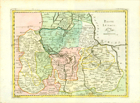
"Basse Lusace" Copper engraving map of the
Lower Lausitz. Dated 1758, Vertical centerfold. Small
light brown spot in lower image edge. Map image: 20.5 x 27.5 cm ( 8 x 10.8") $ 140.00 Order Nr. DEUTSCHLAND253829 |
|
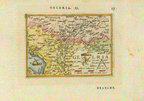
"Geldria" Hand-colored copper etching from the pocket atlas by Abraham Ortelius Antwerp, 1587 This little jewel map, east-oriented and showing areas beyond its title, is one of Abraham Ortelius' miniature maps, an attempt by the author to spread the knowledge of the world, so fabulously displayed in his large (and expensive) atlas "Theatrum Orbis Terrarum", which was the first world atlas ever produced, as I just said, to spread this knowledge further into larger groups of buyers who did not have the means to afford the large version. And just look, how pretty and educational even a miniature maps as this one can be! The River Rhine runs diagonally through this map dividing it into geographicaly right and left. On its right side, beginning at Cologne, we have the Lower Rhineland and areas well into Wesrphalia and, in the lower left corner of this map, the Zuiderzee, nowadays Ijsselmeer between Friesland and North Holland. Very good condition. Margins have light scattered spotting. . Reverse side has text print about Brabant in the French language. 7,6 x 10,7 cm (ca. 3 x 4.2") $ 90.00 Order Nr.HOLLANDMAP253367 |
|
Bavaria. - Nr.12 of the 24-piece copper etching map by Peter Weiner Hand-colored copper etching after the woodcut by Philipp Apian (1531-1589) Published in Munich, 1579 The map of Bavaria (Bayerische Landtafeln), when all 24 parts are put together, measures impressive 156 x 159 cm (ca. 61,4 x 62,6") The individual maps count Nr. 1 (top left) to Nr. 24 (bottom right). The complete map is surrounded by a decorative typical Renaissance fruit decor bordure. In the lower left corner we see just a piece of the river Danube between Winzer and Vilshofen. Along the northern edge of the map we see the river Regen and generally the beautiful area of "Bayerischer Wald" (Bavarian Forest with Grafenau in its center. On the right in Latin language a homage towards Bavaria and, bordering the map part of the decorative Renaissance fruit bordure which embraces elegantly the entire 24 piece map. Very good condition. Pleasant hand coloring. 31 x 41 cm (ca. 12.2 x 16.1") $ 1500.00 Order Nr. DEUTSCHLAND 238217 |
|
Bavaria. - Nr.10 of the 24-piece copper etching map by Peter Weiner Hand-colored copper etching after the woodcut by Philipp Apian (1531-1589) Published in Munich, 1579 The map of Bavaria (Bayerische Landtafeln), when all 24 parts are put together, measures impressive 156 x 159 cm (ca. 61,4 x 62,6") The individual maps count Nr. 1 (top left) to Nr. 24 (bottom right). The complete map is surrounded by a decorative typical Renaissance fruit decor bordure. At the time Albrecht V. was prince elector in Bavaria. He was an important patron of the arts and had originally assigned Philipp Apian with the surveying and map-making of Bavaria. Apian was the highly gifted author of the 24 piece map. He had chosen the method of woodcut for his map. However, a devoted Protestant he left Catholic Bavaria for Tuebingen, and Albrecht V. commissioned Peter Weiner to provide replacement for Apian's map. Geographically we see the river Danube running from Ingolstadt (on the left) to the confluence of the river Laber into the Danube. North and south of the stretch of Danube we see in great detail big and small places of "Niederbayern" (Lower Bavaria). Very good condition. Pleasant hand coloring. Lower margin a bit wrinkly. Map measures 31,3 x 42,5 cm $ 1500.00 Order Nr. DEUTSCHLAND 238218 |
|
Apian Weiner maps Bavaria - Peter Weiner after Apian Bavaria. - Nr. 6 of the 24-piece copper etching map by Peter Weiner Hand-colored copper etching after the woodcut by Philipp Apian (1531-1589) Published in Munich, 1579 The map of Bavaria (Bayerische Landtafeln), when all 24 parts are put together, measures impressive 156 x 159 cm (ca. 61,4 x 62,6") The individual maps count Nr. 1 (top left) to Nr. 24 (bottom right). The complete map is surrounded by a decorative typical Renaissance fruit decor bordure. At the time Albrecht V. was prince elector in Bavaria. He was an important patron of the arts and had originally assigned Philipp Apian with the surveying and map-making of Bavaria. Apian was the highly gifted author of the 24 piece map. He had chosen the method of woodcut for his map. However, a devoted Protestant he left Catholic Bavaria for Tuebingen, and Albrecht V. commissioned Peter Weiner to provide replacement for Apian's map. We are now looking at map nr. 6. In order to show the geographical layout we tell you some explanatory hints: The general area of this map is the Bavarian District "Oberpfalz". We find the district capital Regensburg at bottom right. There is near Regensburg a short stretch of the river Danube. For further orientation we are looking at contributory rivers to the Danube from the north: Altmühl, Laber, Naab and Regen. The land in between these rivers is shown in very great detail Very good condition. Pleasant hand coloring. Map measures 31 x 41 cm (ca. 12.2 x 16.1") $ 1500.00 Order Nr. DEUTSCHLAND 238219 |
|
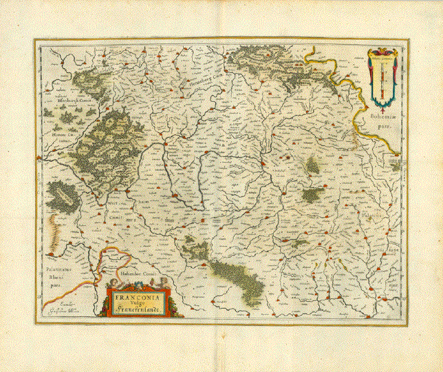
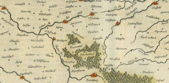
"Franconia vulgo Franckenlandt" Copper engraving map by
Guillaume Bleau ca 1635. Text on the reverse side in
German. In the upper right of the map
is the Saal River with the towns of Hof and Egra. Map is in good condition with a
few signs of age and use. Wide margins. 38 x 50 cm ( 14.9 x 19.6 ") $ 530.00 Order Nr. DEUTSCHLAND252421 |
|
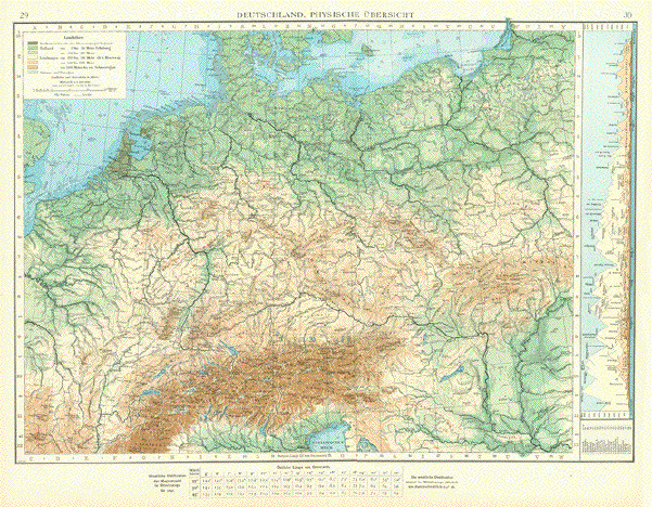
"Deutschland, Physische Uebersicht" Map published 1897 shows the
topography of Germany and surrounding countries using colors
to show altitude. Map has a vertical centerfold. Light age toning in margins. Creases in lower marging corners. 36 x 50 cm ( 14.1 x 19.6 ") $ 85.00 Order Nr. DEUTSCHLAND248851 |
|
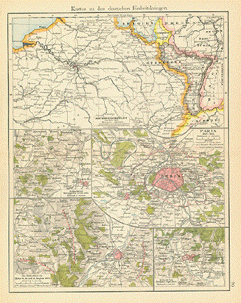
"Karten zu den deutschen Einheitskriegen" Detailed map published 1896. In
the upper left is France with Paris in the center. 29 x 22.5 cm ( 11.4 x 8.8 ") $ 55.00 MINUS 40% DISCOUNT = $ 33.00 Order Nr. MILITARY248778 |
|
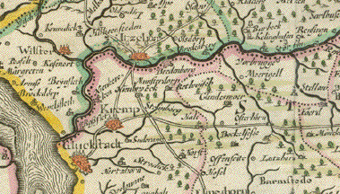
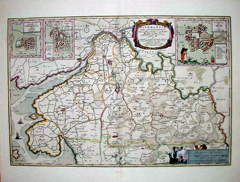
"Ditmarsiae pars Septrionalis" Copper etching by Johannes Meier (Mejer)( 1606-1674) Husum. Dated 1650. Fine original hand coloring. The mouth and course of the Eider River dominate this detailed map. The Eider River "flows out" the lower right corner. To the left of the title at the top is Friedrichstadt. In the lower center area in red is Heide (Heyde). Of special interest are the three detailed insets at the top of the map. In the upper left-hand corner is a plan of Wesselburen. To its right is a plan of Lunden. The somewhat larger plan in the upper right is Heide and surrounding area. Map has very wide margins and hardly any spotting. Vertical centerfold. Overall condition is Almost Very Good for a map this age. 39.5 x 59.5 cm ( 19.4 x 23.4 ") $ 680.00 Order Nr. DEUTSCHLAND 1375 |
|
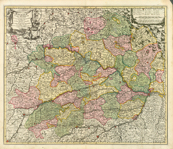
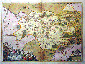
"Bavariae Pars Inferior cum insertis et adjacentibus Regionibus non solus in ejusdem Ditiones Generales sed etiam in earundem Praefecturas Particulares exactissime divisa per Nicolaum Visscher�" Type of print: Copper etching Color: Very beautiful original hand coloring Author: Nicolaes Visscher II. (1649-1702) Published: In Visscher's world atlas Published in: Amsterdam; ca. 1700 Condition: This map is in very good condition. Especially the colors are bright and pleasant. Centerfold in parts reenforced. 48 x 57 cm ( ca. 18.9 x 22.4") $ 280.00 Order Nr.DEUTSCHLAND239656 |
|
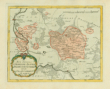
"Des Kur Kreises Noerdliche Aemter Belzig und Gomern mit der Grafschaft Barby." Copper etching in original hand coloring from the "Postal Atlas", Reilly, Vienna, 1791. The Elbe River with Magdeburg in the upper left and Witterberg lower center figures prominantly in this map. Belzig is somewhat right of center. In the lower right is Luetterbock and Goelsdorf. Map has vertical fold to fit atlas size. Wide margins. One tiny spot in map image. 24 x 30.3 cm ( 9.4 x 11.9 ") $ 120.00 Order Nr. DEUTSCHLAND1409 |
|
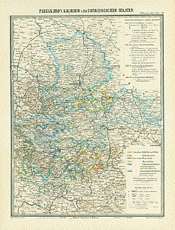
"Preuss. Prov. Sachsen u. die Thueringischen Staaten." Lithograph after C. Bauer and Tr. Bromme . Published in Stuttgart, 1862. Original outline coloring. This map reaches from Wittstock and dahlenburg in the north to Bambery and Bayreuth in the south. On the left center is Goettingen. Finsterwalde is on the right center of this detailed. Map has color-coordinated information on the right side that explains the political and royal divisions shown by various colors on the map. Map has a horizontal centerfold to fit book size. A few hardly visible spots. 37.7 x 28.7 cm (14.8 x 11.2 ") $ 40.00 Order Nr. DEUTSCHLAND1410 |
|
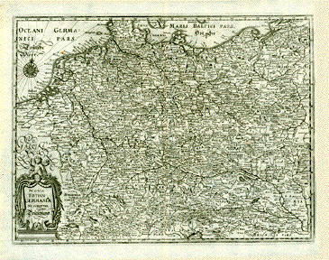
"Nova Totius Germaniae Descriptio. Teütschland". Copper engraving from " Theatrum Europaeum" ca. 1660 M. Merian. Map shows present Germany and the surrounding countries. The Danube "flows" into the lower right corner. In the lower left is part of Savoy and Burgundy by the title cartouche. At the bottom center is the northern part of the Adriactic Sea. Map has vertical fold. A few minor spots in margins. 26.5 x 35.7 cm ( 10.4 x 14 ") $ 140.00 Order Nr. DEUTSCHLAND1397 |
|
"Li Due Circoli Dell´Alto E Basso Reno secondo le Osservazione Dell'Accademia Delle Scienze" Copper engraving from an Italian source, ca 1760. Modern hand coloring. The Rhine River "flows in " at the bottom center of the map and "flows out" in the upper left where it is joined by the Moselle River. In the upper right is Northheim and Einbeck and in the lower right is Ulm on the Danube. Map is printed on heavy paper with wide margins. Three tiny worm holes in right margin. Light graying on plate mark. 17 x 13.4 cm ( 6.6 x 5.2 ") $ 95.00 Order Nr. DEUTSCHLAND1396 |
|
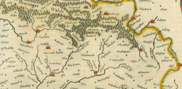
"Frankenlandt a, Mayn beschriben nach aller gelegenheit in Stetten Bergen Waessern Waeldern und anstassenden Laendern" Woodcut by Sebastian Muenster, ca 1550. Modern hand coloring. This map is south-oriented with "west" on the right side and "east" on the left side. Bamberg and Schweinfurt are near the center of the map. In the upper left are Amberg and Sulzbach. In the lower left is a bit of the Thueringerwald. In the upper right is a loup of the Neckar river by Hochhausen. Inthe lower right is Gromberg, Ortenburg and Hirtzing. Text on half of backside. Map has overall light age toning with some very minimal spotting in margins. Edges are partially frayed. Light staining on upper margin edge. Two tiny holes in upper margin near centerfold. The general condition for this 450 year-old map is Almost Very Good. 30.3 x 36.2 cm ( 11.9 x 14.2 ") $ 470.00 Order Nr. DEUTSCHLAND1293 |
|
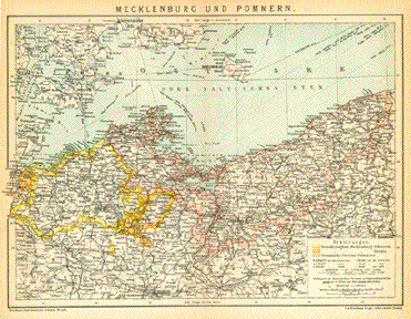
"Mecklenburg und Pommern" Detailed map of the German Prvinces on the Baltic Sea. Published 1894. Vertical centerfold to fit original atlas size. Light age toning in margins. 21 x 28 cm ( 8.2 x 11 ") $ 45.00 Order Nr. DEUTSCHLAND249032 |
|
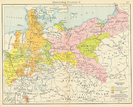
"Entwicklung Preussens II" Historical map showing the
development of Prussia since 1806. 22.2 x 29 cm ( 8.6 x 11.4 ") $ 45.00 Order Nr. DEUTSCHLAND248779 |
|
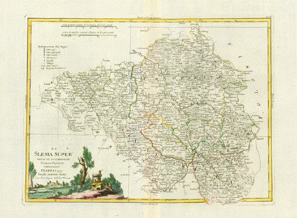
�La Silesia Suoer Divisa ne suoi Principati Di nuova Projezione" Copper etching. Original hand coloring. Published by Antonio ZattaVenice. Dated 1779 Very detailed map of the area around Oppeln (Opole), Frankenstein, Neisse and into the border area of Moravia Impeccable condition. 31 x41 cm (ca. 12.2 x 16.1") $ 250.00 Order Nr. POLANDMAP 238086 |
|
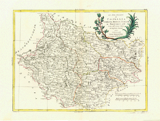
�La Palatinati di Posnania, Gniesno, Brzesc, Kalisz e Inowroclaw. Tratto dall'Atlante Polacco del Sig. Rizzi Zanoni" Copper etching G. Pitteri after G. Zuluiani for Antonio Zatta. Original hand coloring. Published by Antonio Zatta Venice. Dated 1781 Very detailed map Impeccable condition. 31,5 x40,8 cm (ca. 12.4 x 16") $ 280.00 Order Nr. POLANDMAP 238087 |
|
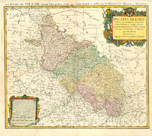
�Ducatus Silesiae Tabula geographica generalis statui hodierno, ei nempe qui post pacem Dresdensem locum obtinetl, adaptata iustaque Graduatione rectificata per Tob. Maier Norimbergae Impensis Homannianorum Heredum" Originally hand-colored copper etching. Published by the heirs of the famous Nuremberg publishing house. Ca. 1750 The title of the map indicates that this map was designed and printed after the Peace of Dresden on December 25, 1745. This peace treaty between Prussia and Austria (which was allied with Saxonia, Great Britain, and The Netherlands ended the Second Silesian War. It was Austria's decisive loss of possessing Silesia which became Prussian. Quite detailed and very acurate map of Silesia. Across the top is title in the French language. Map has some pleasant age toning patina and is in very good condition. Two decorative baroque cartouches (title cartoche topped with the Silesian Eagle and scale cartouche with explanatory text) embellish this beautiful map. 45.5 x 54 cm (17.9 x 21.3") $ 480.00 Order Nr. POLANDMAP 237904 |
|
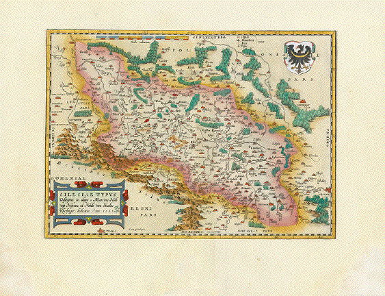
�Silisiae Typus Descriptus et editus a Martino HeilwigNeisense, et Nobili vito Nicolao Rhedinger dedicatus. Anno 1561" Hand-colored copper etching. Published in the first atlas ever printed: �Theatrum Orbis Terrarum" by Abraham Ortelius. The author, Martin Helwig (1516-1574).designed and dated his Silesia map, the oldest ever, in 1561. This map was acquired by Abraham Ortelius and used in his above named atlas in Antwerp in the year 1570. Very decorative map, handsomely hand-colored. Text verso is latin. Very wide margins. Left and right margin corner s, far awy from image, have been professionally added. A very attractive map, the oldest of Silesia 27.7 x 38.3 cm (10.9 x 15.1") $ 650.00 Order Nr. POLANDMAP 237905
|
|
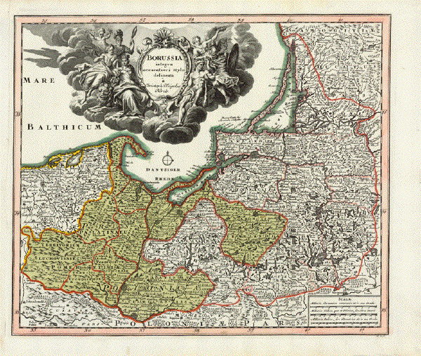
�Borussia integra accuratiori stylo delineata a Christoph Weigelio Norib" Copper etching by Christoph Weigel. Nuremberg, 1720. The original hand coloring shows a momentary area around 1720 with Polish possessions, so that this map is historically a very interesting document. Excellent condition. 32 x 37.3 cm (12.6 x 14.7") Order Nr. POLANDMAP 237906SOLD |
|
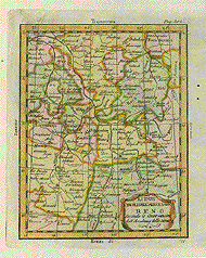
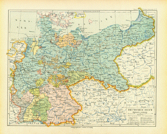
"Deutsches Reich" Historical map of Germany published 1892 in Leipzig. Map has a vertical centerfold. Light natural age browning in margins. Map image: 21 x 26.5 cm ( 8.2 x 10.4") $ 25.00 minus 30% Discount = $ 17.50 Order Nr. DEUTSCHLAND256667 |
|
"Ducatus Silesiae Grotganus cum Districtu Episcoplai Nissensi". Copper etching by Wilhelm Janzoon Blaeu. Published in Amsterdam, ca. 1635. Original coloring (royal coloring)with gold highlights! This beautifully colored map shows the region around Neisse on the Neisse river south of Breslau. The cities on the map are highlighted in gold.The map is east oriented. The two cartouches at the bottom have a marbled effect. Notice the lively scene around the title cartouche. It shows country people going about their daily work such as harvesting and spinning wool. Verso: Text in Spanish. Map has browning along the centerfold, especially at the top and bottom. Some wormholes on the right and left edges. Overall condition is Very Good. 39 x 52.8 cm ( 15.4 x 20.8 ") $ 750.00 Order Nr. DEUTSCHLAND1218 |
|
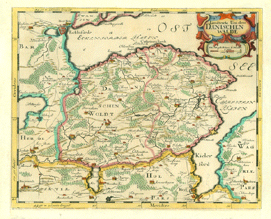
"Landtcarte Uon dem Daenischen Walde". Copper etching by Mejer-Husum, 1652. Modern hand coloring. At the top of the map is the Ecklnforder Bay and in the lower right is the Kieler Bay and at the bottom Kiel. A very detailed map of the area. All margins have been widened. Repaired tear in lower right area of map. Map image is very clean. General condition is otherwise Good. 24 x 30.2 cm ( 9.4 x 11.8 ") $ 240.00 Order Nr. DEUTSCHLAND256720 |
|
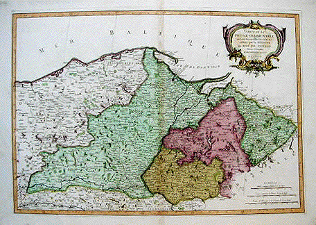
"Carte de la Prusse occidentale où sont tracés les Provinces cédées par la Pologne au roi de Prusse" Copper etching by P. Santini after a map from Homann from 1775. Published in Venice in 1766. Modern hand coloring. Western Prussia is the theme of this map that reaches from Kolberg on the Baltic Sea in the west to the Gulf of Danzig in the east. Map has overall light age toning and light browning along the centerfold. In the lower margin is a brown spot and in the lower left corner is a crease. General condition is Almost Very Good. 44.8 x 64.8 cm ( 17.6 x 25.5 ") Order Nr. DEUTSCHLAND1243SOLD |
|
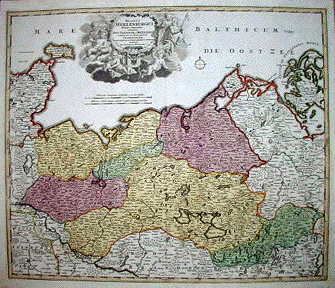
"Ducatus Meklenburgici Tabula Generalis continens Duc. Vandaliae et Meklenburg Comitatum et Episcopatum Swerinensem Rostockiense et Stargardiense Dominum." Copper etching in original hand-coloring from the atlas by Jophann Baptist Homann, Nuremberg, 1723 A rich baroque title cartouche, decorated with cherubs and Neptune as a putto and a very pleasant coloring make this map a desireable collertoprÔs item or a beautiful wall decoration. In the upper left is Eutin and a bit further down on the left side is Lauenburg. At the bottom center is Wittenberg. In the upper right is the island of Rugen and in the lower right is Strasburg and Rutenberg. The map is clean. Some minor just about invisible spotting in margins are insignificant. 43.5 x 58 cm ( 17.1 x 22.8 ") $ 540.00 Order Nr. DEUTSCHLAND1367 |
|
"Botanische Karte von Deutschland enthalten dier vornehmsten Pflanzen Familien so wie die Isotheren und Isochimen" Steel etching for J. Meyer, ca 1855. Original outline coloring. For botanists, this map is of special interest. It shows the isotheres and isochimene of Germany that influence plant life. In the lower right are the abbreviations of the plant families. Scatter all over the map - also includes part of France - Are the list of the plant families and data. Map has a vertical centerfold. Tiny worm hole in upper right corner margin. 20.4 x 24.8 cm ( 8 x 9.7 ") $ 55.00 Order Nr. DEUTSCHLAND235477 |
|
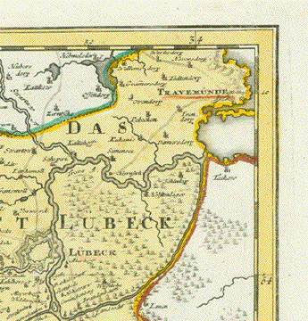
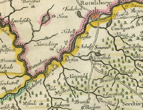
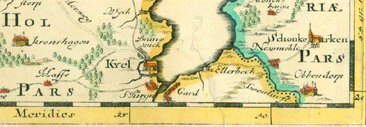
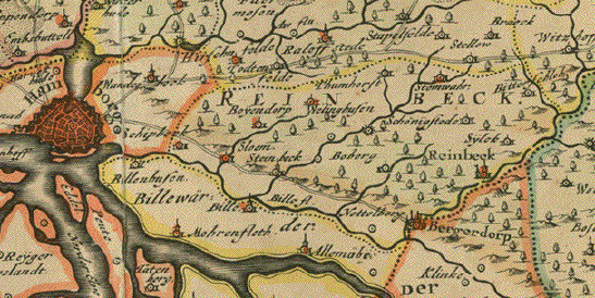
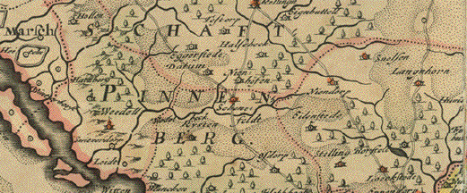
"Landtcarte von dem Furstenthumbe Stormarn.".Copper etching by Johannes Meier (Mejer)( 1606-1674) Husum. Dated 1650. Fine hand coloring. In the lower center of the map is Hamburg on the Elbe. The map reaches as far north as Neumuenster and Endorp. In the lower right corner is Lauenborg on the Stecknitz River. In the upper left is the town of Bocklenbur. Map has overall age toning and scattered spotting in margins and visible on the reverse side. The outer margins are lighter than the map, probably having been under a frame or passpartout. Map has vertical centerfold. Small repairs in left and right margins that are hardly visible. On the reverse side is a paper ( old Paper ) reinforcing the centerfold. There is a piece horizontally that has no importance. There is no tear or other problem. In the two upper corners are montage rests. 39.5 x 54.5 cm ( 15.5 x 21.4 ") $580.00 Order Nr. DEUTSCHLAND 1377
|
More Maps of Germany (Page 3) - Mehr Landkarten von Deutschland (Seite 3)
|
© Rainer Rauhut
|