|
Antique Maps of Sicily View this fine selection of historical Sicilian maps from the 16th through 19th centuries. Each map is described and illustrated. Please contact us if you are looking for a special map of Sicily. Maps where Sicily is shown with all of Italy can be seen at Maps of Italy. Also take a look at Mediterranean Maps. |
|
“Sicilia". Steel etching by Pietro Allodi after Filippi Naymiller. Published in "Atlante di Geografia Universale Cronologico, ...". Milano, 1850. Clean, very attractive and detailed map of Sicily including the Lipari Archipelago. Notice that the Island of Fernandea is shown in the lower left corner. General age toning. Some insignificant wrinkling. Wide margins. 32.2 x 41.5 cm (12.7 x 16.3") $ 420.00 Order Nr. SICILIA1448 |
|
“La Sicile". (Sicily) Originally hand-colored copper etching by Jean-Baptiste Bourguignon d'Anville. Dated 1740. Very pleasant map of Sicily. Includes part of the Tunesean coastline from Catago to just south of Hammamet. Also included: the islands of Gozo and Malta, Pantelleria (Cossyra), Aegusa, Liparic islands and parts of the Calabrian coast. Very attractive cartouche, all in original hand-coloring. Map has general age toning, several vertical and horizontal, hardly disturbing folds to fit smaller book size. There are a few foxing spots. But again: This is a very attractive map! 21.8 x 33.3 cm (8.6 x 13.1"). $ 450.00 Order Nr. SICILIA1450 |
|
"Carte Des Etats Du Roi Des Deux Sicilies". Copper engraving for "Histoire Universale" ca 1750. This map shows the "two Sicilys" ruled by the king of Naples. At the top of the map is Orvieto and Spoleto.Dotted ines show the division of the states. Map has folds to fit book size. Some cre4asing in right margin. Minor spotting in margins. 23.5 x 33 cm ( 9.2 x 12.9 ") $ 210.00 Order Nr. ITALIA1483 |
|
"Congregratio Centum Vrbinvm Ordinis Eremitarum Sancti Augustini In Regio Siciliae." Rare copper etching by F.A. Lubin for the Augustiner Chorheern (Augustin monks), 1669. Map shows the southeastern part of Sicily. The many churches and chapels of the Augustine monks are shown. Map has wide margins and is in Almost Very Good condition. 12 x 16 cm ( 4.7 x 6.3 ") $ 295.00 Order Nr. SICILIA1436 |
|
"Die Insel Sicilien" Lithograph after C. Bauer. Printed in color by Krais and Hoffmann in Stuttgart ca 1870. Map shows the topography of sicily in fine detail At the center to is the island of Ustica. In the lower left is Pantellaria. In the upper right is a bit of Calabria and the Liparian Islands. Map has a few light minor spots. Tiny crease in lower left margin corner. 17 x 25.4 cm ( 6.6 x 10 ") $ 65.00 Order Nr. SICILIA1449 |
|
"Koenigreich beider Sicilien" Lithograph published in Glogau by C.F. Flemming ca 1850. Original light green outline coloring. Very detailed map reaching as far north as Rome and Termoli. Map has crease in lower left margin. The upper margin is very narrow. a few tiny creases in lower image. 41 x 32 cm ( 16.1 x 12.5 ") $ 190.00 Order Nr. SICILIA1441 |
|
"Carte De La Sicilie". Copper engraving for "Histoire Universale" ca 1750. Interesting map with ancient names and many topographical details. In the upper left is a small inset with Sicily, Malta, Lampedusa, Costura and Carthage in Africa. Map has folds to fit book size. Small repaired tea in left margin. Light browning on margin edges. Minor spots in margins. 19 x 29.5 cm ( 7.4 x 11.6 ") $ 245.00 Order Nr. SICILIA1444 |
|
"Isle Et Royaume De Sicilie". Copper engraving by Nicolas De Fer ( 1646-1720) published ca 1700. Original hand coloring. A fine map of Sicily with many topographical details. Fine dotted lines show the major routes between major towns. Map has a few minor scattered spots and light age toning. 22.2 x 33.2 cm ( 8.7 x 13 ") $ 380.00 Order Nr. SICILIA1445 |
|
“Das Koenigreich beider Sicilien suedliche Haelfte Sicilien und Calabrien". Southern portion of the “Kingdom of the two Sicilies". Steel engraving with original outline coloring. From “Zeitungs-Atlas fuer alte und neue Erdkunde". Published by J. Meyer. Hildburghausen, Amsterdam and New York. 1849 Map shows Calabria and very clearly the island of Sicily. Inset map of Malta and Gozo. Nicely shown also the Lipari islands. Nice map! General age toning.Light browning on margin edges. 17.8 x 24.5 cm (7 x 9.6") $ 170.00 Order Nr. SICILIA1447 SOLD |
|
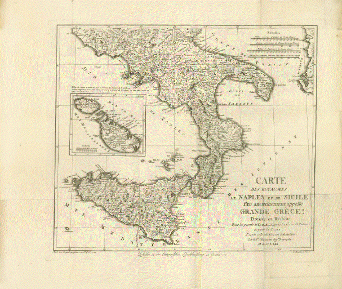
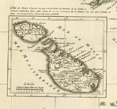
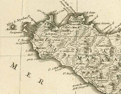
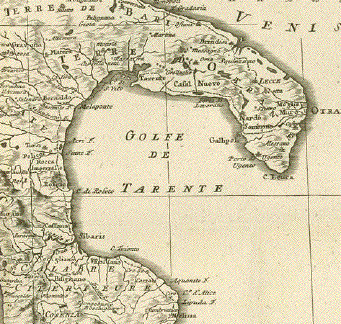
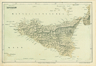
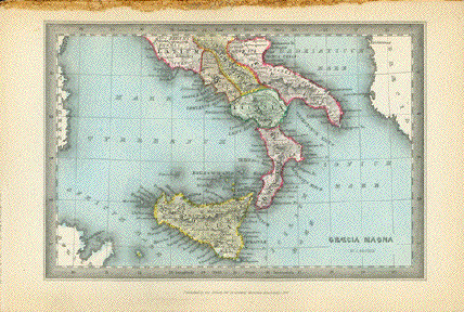
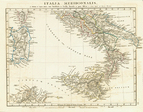
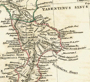
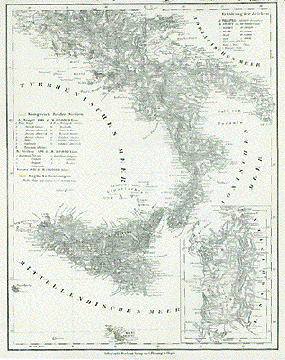
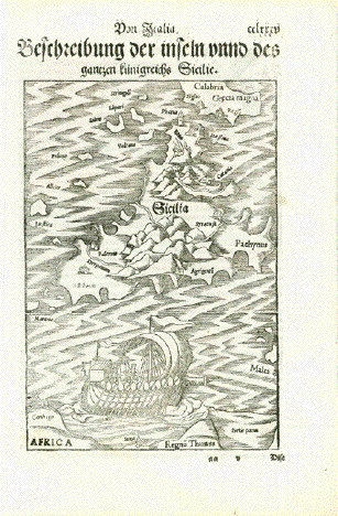
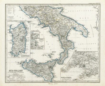
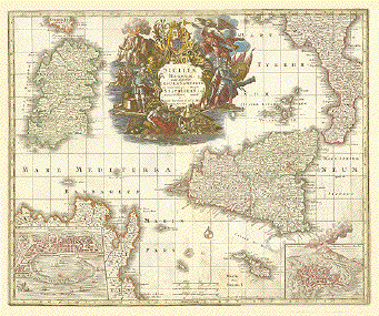
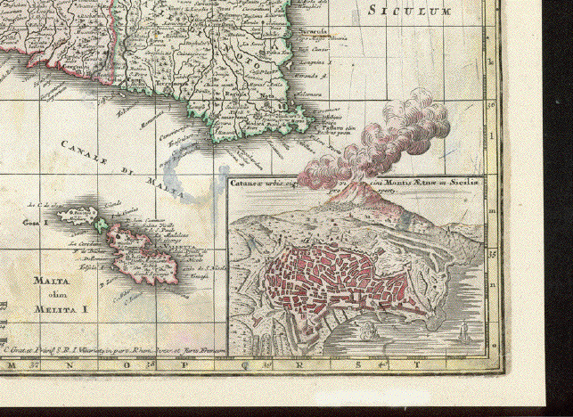
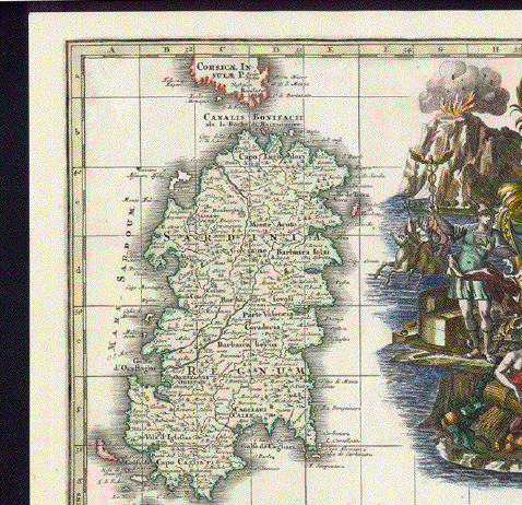
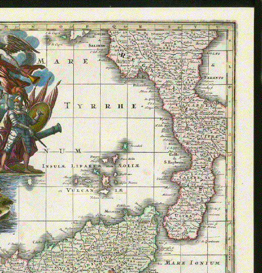
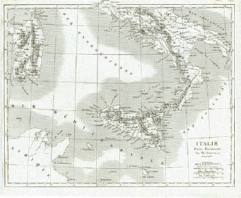
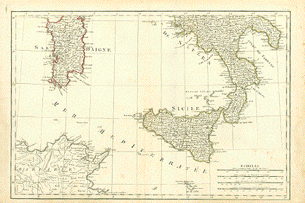
No title. Map of Southern Italy from Naples southward, including Sicilia, most of Sardinia, Malta and Northern Tunesia. Showing also Pentellaria and Linosa. Anonymous French copper etching with outline hand coloring. Mileage meter in Italian, Piemontese, Roman and French miles at bottom right. General age toning, some foxing, some spots. Lower margin narrow. Next to centerfold another fold. Vertical centerfold. Some light scattered spots, mostly in margins. Although map is showing traces of use, it is still getting favorable grades! 
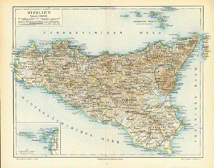
30.4 x 44.9 cm (12 x 17.7") $280.00 Order Nr. SICILIA1446 |
|
"Das Koenigreich beider Sicilien suedliche Haelfte: Sicilien un Calabrien 1849." Steel etching from "Neuster Zeitungs Atlas. Alter und Neuer Erdkunde" by J. Meyer, ca 1855. Original outline coloring. Map has light scattered spotting in lower left corner and in margins. 18 x 24.5 cm ( 7 x 9.6 ") $ 125.00 Order Nr. SICILIA1442 |
|
"Sizilien" Wood engraving printed in color. Published by the Bibliographisches Institut in Leipzig ca 1860. In the upper right are the Isole Lipari. The inset in the lower left shows the Isole Egadi. Map has vertical centerfold. Light browning on Margin edges. 20.7 x 25.7 cm ( 8.1 x 10.1 ") $ 90.00 Order Nr. SICILIA1443 |
|
"Carte De La Grande Grece Et De La Sicilie, Avec une Carte particuliere des Isles De Corse Et De Sardaigne." Copper engraving for "Histoire Universale" ca 1750. On the left is a detailed inset of Sardegna and Corsica. At the bottom middle is Malta. The names used on the map are from Classic times. Map has folds to fit book size. Lower left margin corner has been added. On the map image is some very light printing from previous page. 19.5 x 24.3 cm ( 7.6 x 9.5 ") $ 185.00 Order Nr. ITALIA1485 |
|
"Carte De L'Italie Meridionale. Copper engraving for "Histoire Universale" ca 1750. This map of southern Italy reaches as far north as Fondi and Polignano. Near the bottom is Malta. Sardegna is in the upper left corner. The names on the map are in French. Map has folds to fit book size. Right margin is narrow. A few small gray spots in the lower right. 23.5 x 33.5 cm ( 9.2 x 13.1 ") $ 190.00 Order Nr. ITALIA1486 |
|
|
"Sicilia" "Verhael Van't Koningriicke van Sicilien" Rare copper text etching with text by
Judocus Hondius II, 1621. To the north of Sicily is the island of
Volcano. Map image size: 9.5 x 13.3 cm ( 3.7 c 5.2
") $ 295.00 Order Nr. SIC1437 SOLD |
|
"Tabula noua Siciliae, Sardiniae, & Corsicae."
Woodcut from the "Geographia" by Claudios Ptolemaeus
(87-150), at This map shows the islands of Corsica, Sardinia and
Sicily in geographical position to central and southern
Italy which is only General toning, in the margins some foxing, a repaired
small tear in the lower margin near centerfold, some creases
in lower right 27.5 x 40 cm ( 10.8 x 15.7 ") $ 1000.00 Order Nr. Italy-1282 SOLD |
|